Nice Week Expected (Oct 29-Nov 2)

Nice Week Expected (Oct 29-Nov 2)

🕔13:12, 29.Oct 2018

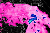
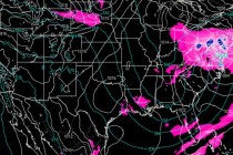
Discussion: A trough is departing the E US into the Atlantic Ocean. A week ridge will replace the trough by Wednesday-Thursday before 500mb heights fall again for the weekend. At the surface this means high pressure controlling most of the

Read Full Article
Oct 25: Coastal Storm Approaching

Oct 25: Coastal Storm Approaching

🕔22:01, 25.Oct 2018

Discussion: Model guidance and live observations continue to tighten on the approaching coastal storm. The upper-levels continue the theme of an E US trough fed by the remnant energy from Willa. The surface solution has been bouncing around but the low’s

Read Full Article
Oct 24: Coastal Storm Update

Oct 24: Coastal Storm Update

🕔22:14, 24.Oct 2018

Discussion: Willa’s remnant upper-level energy will ultimately develop into an upper-level low over the E US this weekend. This trough will be fed an upper-level shortwave from the pacific jet that will be responsible for driving our early weekend storm system

Read Full Article
Oct 23: Coastal Storm Detected

Oct 23: Coastal Storm Detected

🕔16:09, 23.Oct 2018

Discussion: The Oct 27-31 synoptic storm signal that I’ve been tracking since ~Oct 10 will likely come into fruition this weekend. The source? Hurricane Willa in the Pacific Ocean. Willa is currently located S of the Baja Peninsula and just

Read Full Article
Colder Week Expected (Oct 22-26)

Colder Week Expected (Oct 22-26)

🕔18:54, 21.Oct 2018

Discussion: A quick note about tonight (Sunday night). High pressure is set up just to our W providing N flow. The flow should subside heading into overnight hours. The combination of lighter winds and clear skies could allow for radiational

Read Full Article
Mild Start. Cold Finish (Oct 19-21)

Mild Start. Cold Finish (Oct 19-21)

🕔16:29, 18.Oct 2018

Discussion: This weekend is fairly straight-forward. High pressure dominated today and tomorrow with dry typical fall conditions. As the high drifts into the Atlantic Ocean, it’s back-side return flow will bring milder temps for Friday-Saturday. A little bit of rain moves

Read Full Article
Fall Conditions Sustain (Oct 15-19)

Fall Conditions Sustain (Oct 15-19)

🕔21:39, 14.Oct 2018

Discussion: A W US ridge pattern should continue this week with several deep but progressive troughs passing through the Mid-Atlantic and Northeast US. This should anchor a cut-off low over the SW US. At the surface this means more shots

Read Full Article
Hello Fall! (Oct 12-14)

Hello Fall! (Oct 12-14)

🕔21:42, 11.Oct 2018

Discussion: Thursday’s overnight rain, wind and thunderstorms associated with Michael’s remnants should move out by late-morning Friday. The associated energy should absorb into the upper jet and continue eastward with the mid-latitude westerlies. In the upper levels the jet stream

Read Full Article
Oct 11: Michael Remnants Approaching

Oct 11: Michael Remnants Approaching

🕔16:49, 11.Oct 2018

After delivering catastrophic damage to the Florida panhandle and many other instances of secondary damage to parts of the SE US, Michael’s remnants have weakened to tropical storm criteria. The energy should track from its current ~interior South Carolina location

Read Full Article
Oct 9: What Michael Means for New Jersey

Oct 9: What Michael Means for New Jersey

🕔22:11, 9.Oct 2018

Michael is a category 3 major hurricane heading N towards the coastline between Rosemary Beach and Mexico Beach in Florida. That would put the center of the cone in the Laguna Beach/Panama City area. This is likely where the most destructive

Read Full Article