

Aug 25: Monitoring Erika
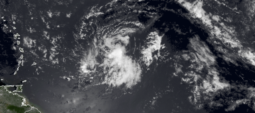
Invest 98L has evolved into Tropical Storm Erica who presents a much more realistic threat to the east coast than Danny ever did. She has less (but some) shear to deal with but once into the Bahamas, she could intensify into a Hurricane which should be approaching the SE US region. Right now she is still slightly elongated from SW to NE but slowly becoming more organized.
Short-to-mid range guidance slowly develops Tropical Storm Erika as she passes just to the north of the NE Caribbean islands. Hurricane intensity is not expected until the storm passes into the Bahamas due to a fairly neutral environment for development.
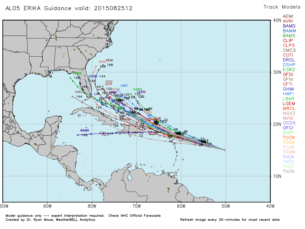
Long range model guidance has low uncertainty but currently stalls Erika out before turning out to sea SE of OBX. This scenario would mean anything from a SE US hit to something that just roughs up the SE US coast. This would bring heavy surf to the mid-Atlantic/Northeast US in the Sept 1-5 period. This is starting to get way too close for comfort though as the Euro first started indicating this solution a few days ago. Here’s the latest tropical spaghetti model plot, used with permission from WeatherBell Analytics:
New Jersey impact is too far away to call at this time but if it did happen, It wouldn’t be until Labor Day Weekend. SE US impact as a hurricane is becoming a possibility in the Sept 1-5 period. Northern Lesser Antilles (Leeward Islands) and Puerto Rico impact as a tropical storm is almost guaranteed this Thursday-Friday. I’ll be watching. Be safe! JC
Jonathan Carr (JC) is the founder and sole operator of Weather NJ, New Jersey’s largest independent weather reporting agency. Since 2010, Jonathan has provided weather safety and forecasting services for New Jersey and immediate surrounding areas through the web, social media, and app spaces. Originally branded as Severe NJ Weather (before 2014), Weather NJ is proud to bring you accurate and responsible discussions ahead of high-stakes weather scenarios that impact the garden state. All Weather. All New Jersey.™


LOCAL FORECAST | INTERACTIVE RADAR | LATEST NJ WEATHER ALERTS | WEDDING FORECAST| PRIVACY POLICY
© Copyright 2024 Weather NJ LLC. All Rights Reserved.
Some information that can be found on our website is provided by a private weather station and is not an officially recognized station for weather reporting. Though we always strive to achieve accurate reporting for our own use, it is important that you do NOT depend on the data provided here for any purpose.
