

Bertha: Close But No Cigar
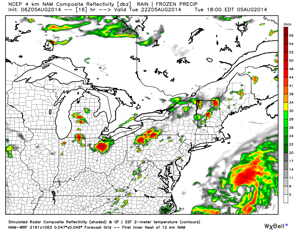
Yesterday, Bertha was upgraded to a category 1 hurricane but has since been downgraded back to a tropical storm. Today she will parallel coastal Jersey about 300 miles offshore before turning to the northeast and moving out for good. Here’s the high-res NAM showing her expected location and precipitation at 10AM (close to current obs at this point):
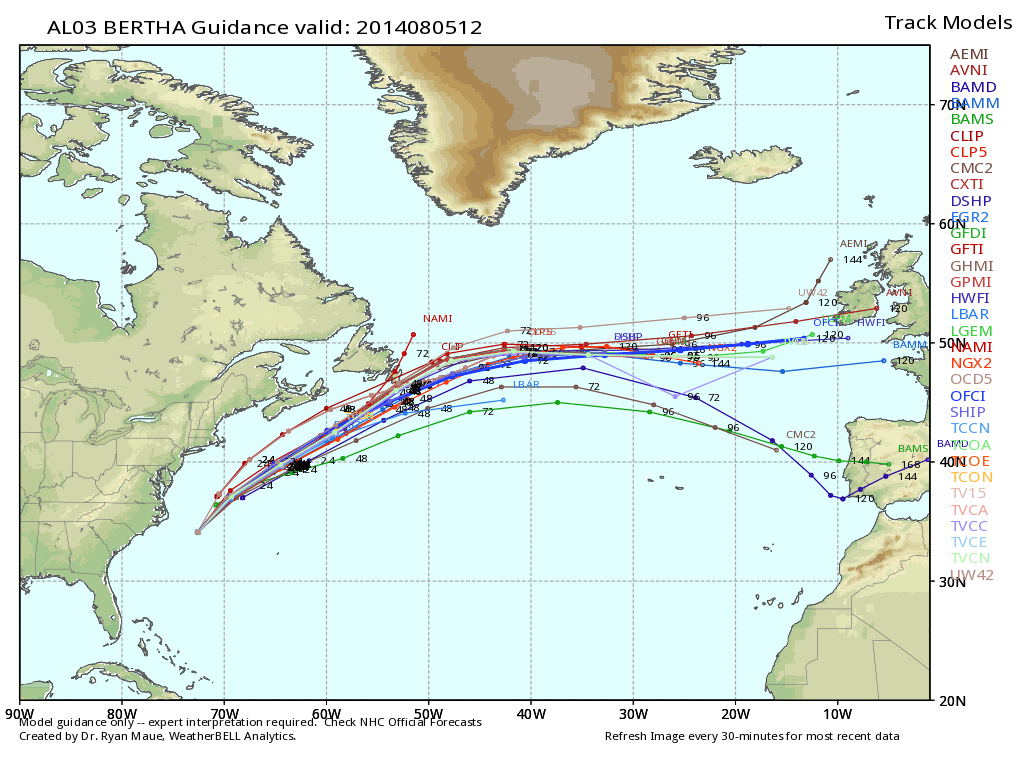
There will be zero impact for New Jersey on land. We’ll deal with a cold front and associated showers/storms approaching from the W/NW tomorrow night but that has nothing to do with Bertha. The only impact from Bertha will be intensified surf and rip currents along the immediate coast today and tomorrow. Be careful and pay attention to lifeguards. Otherwise, surf should be up with summery conditions on the beach. By tomorrow night, she will be long gone. Here’s the most recent spaghetti plot from WeatherBell Analytics:
There exists just a small chance of isolated showers and thunderstorms this afternoon-evening. There’s a much better chance for such tomorrow. Once the cold front moves through Tomorrow night, we’re in for arguably the best feeling weather of the year which should last through the weekend. Be safe and have a great day!
Model images reproduced with permission from WeatherBell Analytics.
Jonathan Carr (JC) is the founder and sole operator of Weather NJ, New Jersey’s largest independent weather reporting agency. Since 2010, Jonathan has provided weather safety and forecasting services for New Jersey and immediate surrounding areas through the web, social media, and app spaces. Originally branded as Severe NJ Weather (before 2014), Weather NJ is proud to bring you accurate and responsible discussions ahead of high-stakes weather scenarios that impact the garden state. All Weather. All New Jersey.™


LOCAL FORECAST | INTERACTIVE RADAR | LATEST NJ WEATHER ALERTS | WEDDING FORECAST| PRIVACY POLICY
© Copyright 2024 Weather NJ LLC. All Rights Reserved.
Some information that can be found on our website is provided by a private weather station and is not an officially recognized station for weather reporting. Though we always strive to achieve accurate reporting for our own use, it is important that you do NOT depend on the data provided here for any purpose.
