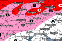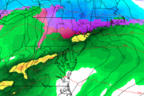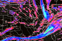
Colder Conditions Moderate (Feb 14-16)
Discussion: A positive-tilted and progressive trough is currently swinging through the region and should give way to the front side of a ridge with upper-level NW flow. This is responsible for bringing the colder conditions that started last night (Thursday)