Back to homepage

Latest NJ Weather Alerts

Unsettled and Stormy (June 17-21)

Unsettled and Stormy (June 17-21)

🕔21:23, 16.Jun 2019

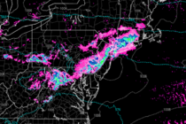
Discussion: The upper-level jet looks fairly flat and zonal through the N Mid-Atlantic and NorthEast US. Upper-level geopotential height anomalies appear neutral to slightly-below average. Basically a frontal boundary is going to drape and stall through the Mid-Atlantic US this

Read Full Article
Dry and Sunny (June 14-16)

Dry and Sunny (June 14-16)

🕔16:53, 13.Jun 2019

Discussion: After a few more isolated/scattered showers and thunderstorms this evening our E Great Lakes disturbance will then lift into Canada. High pressure, moving across N Carolina, will dominate the weekend pattern. Throughout the course of the weekend we’ll transition

Read Full Article
June 12: Rain is Approaching

June 12: Rain is Approaching

🕔15:46, 12.Jun 2019

Discussion: An area of high pressure has had control of the region for a few days now. It has provided cool, dry and sinking air mass which meant comfortable and sunny conditions. High pressure will now move offshore as low

Read Full Article
Beautiful Start (June 7-9)

Beautiful Start (June 7-9)

🕔21:36, 6.Jun 2019

Discussion: High pressure should move across New England on Friday and Saturday dominating the region with dry sinking air. This means lots of sun without the elevated humidity. It also means onshore flow for us given our S position to

Read Full Article
June 2019 Discussion with WeatherTrends360

June 2019 Discussion with WeatherTrends360

🕔15:25, 3.Jun 2019

It’s time to harness WeatherTrends360 technology and look at how the rest of June 2019 should play out. WeatherTrends360 algorithms are documented with an 84% verification rate and are based on oceanic water cycles, time table series and very complex

Read Full Article
Not Too Shabby (June 3-7)

Not Too Shabby (June 3-7)

🕔21:16, 2.Jun 2019

Discussion: Thunderstorms are just finishing up at the coast. Some held severe right to the ocean. All areas should be clear by midnight and cool dry air is on it’s way. The upper-jet will be strong out of the NW

Read Full Article
Beautiful Start. Unsettled Finish (May 31-June 2)

Beautiful Start. Unsettled Finish (May 31-June 2)

🕔23:05, 30.May 2019

Discussion: Sorry for the late-post of the weekend outlook. I got in late from a business trip (for my primary career) and it’s been challenging to keep up with this week’s severe weather outbreak. Anyhow the last remnant rain and

Read Full Article
May 29: More Thunderstorms Expected

May 29: More Thunderstorms Expected

🕔10:26, 29.May 2019

Discussion: More thunderstorms are expected today across New Jersey. It won’t be like yesterday and last night (isolated discrete supercells). It should be more of a linear segment riding a cold front. The linear thunderstorm segment looks to disrupt at

Read Full Article
Warm and Unsettled (May 28-31)

Warm and Unsettled (May 28-31)

🕔17:14, 27.May 2019

Discussion: The upper jet should basically fap NNJ this week from New England latitude. This will change Friday when brought S over NJ via cold frontal passage. In the meantime this will produce ridging for the SE US but not

Read Full Article
May 23: Thunderstorm Update

May 23: Thunderstorm Update

🕔14:55, 23.May 2019

Discussion: A few showers and thunderstorms moved through parts of CNJ and SNJ already this morning and today. It looks like we have two more main waves of storms to deal between now and tomorrow morning. The first wave is

Read Full Article