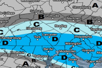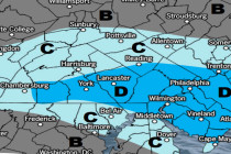
Feb 10: Snow Approaching
Click here to view full resolution map! Discussion: Our first system is approaching from the W. High pressure is sliding E out to sea from Delmarva and the back-side return flow will feed our precipitation shield with moisture and warmth. But