

Dec 1: Winter on a Break but Will it Return?
Nothing in the weather world among weather freaks, geeks and snow weenies gets them more passionate than the winter and a good old fashioned snowstorm. Now I know for most of humankind who are among the sane nothing probably gets you angrier than a snowstorm particularly when it becomes a struggle and disruptive in your daily lives.
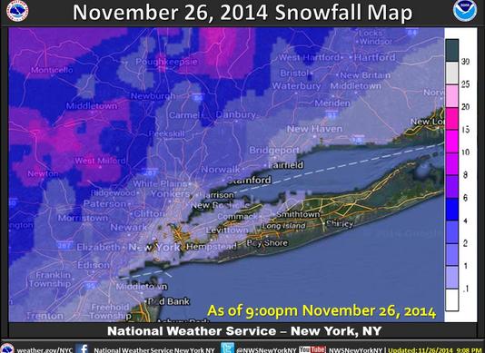
Now if you listen you may hear wailing and gnashing of teeth going on among the winter fans crowd. An early burst of winter weather which featured hundreds of record lows being shattered, a snowstorm in the interior northeast and an EPIC snowfall in Western New York would be enough for most people if it were just a one time event. But it is only the beginning of December and at least among the winter fans, wholesale panic has ensued. Winter hasn’t started yet and we hear proclamations that winter is all but over!!!!
Snow Cover September 25, 2014
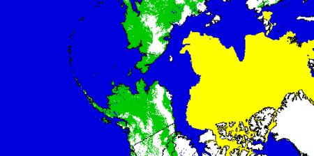
Snow Cover Loop October 2014
Let me state for the record that it not only isn’t over but it hasn’t even started yet. The early burst was thanks to a number of factors but the focus of attention fell on the snow cover in Eurasia during the month of October. It has been discovered in research work by Dr Judah Cohen that there is a link between the rate of snow cover growth on the other side of the world during the month of October and the severity of the winters here in the Eastern States especially the northeast. I have posted about this numerous times before and have left up a loop showing the snow cover growth in time lapse in Eurasia during October. Simply put the faster the snow cover grows in October, the greater the magnitude of Arctic air that can develop over that source land, which eventually finds its way to the United States especially the east. And almost on cue, November provided us with early season fireworks with cold, epic snows and other events. And after 2 weeks of this, the pattern has seemingly broken down and snow lovers are beside themselves that the winter is over before it has even statistically begun!
Let us now bring the conversation back to normal and this is the reality of winters in New Jersey especially in coastal New Jersey. Past history is clear, snowfall this early is rare. Even December during the first half at least the warm ocean continues to prevent snows from falling in most places except the north and northwest part of the state.
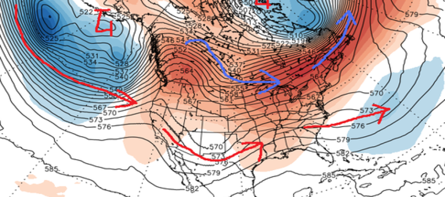
What is happening right now is that the atmosphere has reverted back to normal for this time of year which, believe it or not it does do from time to time. The atmosphere can rarely stay in an extreme position for more than a few weeks. The pattern right now as the graphic shown below shows that the flow is being controlled by pacific air. Cold Canadian/Arctic air is locked up in Canada and as the blue arrow shows, can only get so far south, giving the northern tier of states glancing blows of cold air from time to time.
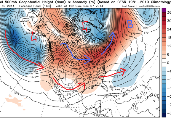
The polar vortex or the L that sits up in Northern Canada has retreated all the way to the north. And the B on the map in the Eastern Atlantic is a high pressure area aloft that is, at least for now slowing movement of the upper air weather systems and diverting the Atlantic jet to the north. All of this spells normal to above normal temperatures at least for awhile.
However there are key elements here that remain in tact. The L that sits in the Gulf of Alaska is still there and will most likely at some point move back westward which will allow stronger ridging along the west coast. And we continue to see warming in the highest layers of the atmosphere over the north pole which will eventually cause the pattern to revert back to one which delivers cold air to the US and to the east. This may take another couple of weeks to play out.
Finally we are approaching the time in December which I like to refer to as lock in time. Around the third week of December, and I have seen this happen in many winters we get a pattern shift which essentially locks in for a good part of the winter. If this breakdown holds to form, then the change will being around the middle of December setting us up for the lock in. And there lies the big question..what will we lock in to?
In the meantime enjoy the break. Cold air will bleed in from the north from time to time but not stay long. No big storms appear to be on the horizon. As for the snow freaks and snow weenies out there…relax. It hasn’t even started yet. If you don’t have snow up to the second floor yet (Western NY excluded of course) it is because you are not supposed to!
In English: Enjoy the milder first half of December because the cold pattern should reload in time for the holidays. While there will still be shorter-lived periods of cold between now and then, where smaller interior/elevation events are possible, temperatures look to stay average (maybe slightly above) with no major snow storms on the horizon.
Joe Cioffi has been a meteorologist in the New Jersey/New York area for the last 30 years on NJ 101.5 radio and WPIX TV in New York. You can follow him on facebook (facebook.com/meteorologistjoecioffi) and Twitter (@joecioffi) or visit his website at www.meteorologistjoecioffi.com.
Jonathan Carr (JC) is the founder and sole operator of Weather NJ, New Jersey’s largest independent weather reporting agency. Since 2010, Jonathan has provided weather safety and forecasting services for New Jersey and immediate surrounding areas through the web, social media, and app spaces. Originally branded as Severe NJ Weather (before 2014), Weather NJ is proud to bring you accurate and responsible discussions ahead of high-stakes weather scenarios that impact the garden state. All Weather. All New Jersey.™


LOCAL FORECAST | INTERACTIVE RADAR | LATEST NJ WEATHER ALERTS | WEDDING FORECAST| PRIVACY POLICY
© Copyright 2024 Weather NJ LLC. All Rights Reserved.
Some information that can be found on our website is provided by a private weather station and is not an officially recognized station for weather reporting. Though we always strive to achieve accurate reporting for our own use, it is important that you do NOT depend on the data provided here for any purpose.
