

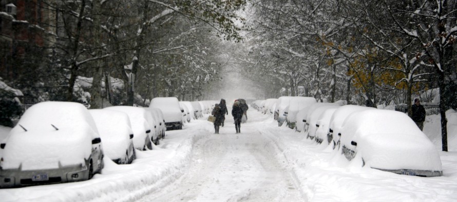
Dec 14: East Coast Snow Storm Detected!
The European model has been talking about an east coast snow storm for more than a few runs now. Historically when that happens you should listen. The timing for this system looks like the general December 19-23 period which of course will be narrowed down as we approach to probably a 10-15 hour final window. For many people in the mid-Atlantic, this could be the ticket to the possible White Christmas I spoke of last week. Lets get nerdy:
First let’s talk about the setup out west. Two teleconnection/oscillations that I pay attention to, the EPO (Eastern Pacific Oscillation) and PNA (Pacific North American), are signalling a trough over Alaska/Bering Sea/Aleutian Island region and a ridge over the west coast of North America. This traditionally opens the up the gates for much colder air to spill southward from Canada into the central and eastern US. I believe this will happen starting with the mentioned storm period and lasting through at least the rest of December.
Now lets talk about available storm energy that will be moving across the US from west to east as this cold establishes. Over the past few weeks the jet stream has been ripping across the Pacific Ocean. This has brought available storm energy with it. Over the US the jet stream is in what’s called a split flow, meaning it separates in the Pacific just before reaching the US and sends two separate jet streams across the country from west to east. When energy moves along both of these streams in parallel and get close enough together, they can reconnect the split streams in what’s called a phase. I believe this will happen for the December 19-23 storm period. It’s noteworthy that the European Ensembles (multiple runs with multiple starting variables) are screaming east coast snow storm as well.
Finally lets talk about the setup for the east coast. A low pressure system will be likely bringing rain to the region this ~Tuesday-Wednesday as it passes by to our north (from west to east). The European model has been advertising that this low will move into the eastern Canadian geographic region of 50N/50W (a 50/50 low). This would hold high pressure in place just to it’s west. Given the western side of the cyclonic 50/50 low flow coupled with the eastern side of the anti-cyclonic flow, a strong overall southerly flow will setup between. This, also advertised by the European, would prevent a storm from missing to our north—it would hold the winter storm to a southerly track. With that being said, the low responsible for the winter storm would travel across the US and eject into the Atlantic Ocean anywhere from North Carolina to Virginia. Such would mean the difference between a South Jersey Express/Special (significant accumulations to DC/BAL/PHL/CNJ/SNJ) or an I-95 snow storm (highest accumulations NW of I-95/NJTP with significant accumulations along and SE of I-95/NJTP). This represents the uncertainty in the system setup…where will the low exit the east coast?
In English: The overall weather pattern will be warmer than average through Thursday or so. Then a stormy/wintry weather pattern will begin setting up this coming weekend. The chance for significant snow accumulations exists for all of New Jersey in the December 19-23 window which will be narrowed down as I track this week. Be safe and enjoy the rest of your weekend! JC
Jonathan Carr (JC) is the founder and sole operator of Weather NJ, New Jersey’s largest independent weather reporting agency. Since 2010, Jonathan has provided weather safety and forecasting services for New Jersey and immediate surrounding areas through the web, social media, and app spaces. Originally branded as Severe NJ Weather (before 2014), Weather NJ is proud to bring you accurate and responsible discussions ahead of high-stakes weather scenarios that impact the garden state. All Weather. All New Jersey.™


LOCAL FORECAST | INTERACTIVE RADAR | LATEST NJ WEATHER ALERTS | WEDDING FORECAST| PRIVACY POLICY
© Copyright 2024 Weather NJ LLC. All Rights Reserved.
Some information that can be found on our website is provided by a private weather station and is not an officially recognized station for weather reporting. Though we always strive to achieve accurate reporting for our own use, it is important that you do NOT depend on the data provided here for any purpose.
