

Dec 22: Christmas Eve Thunderstorms Possible
I don’t think we’re looking at anything crazy. But in addition to the rain, enough convective instability/dynamics should exist on Thursday to warrant thunderstorms in the E. US ahead of the cold front. We have another strong low pressure system that will be passing over the Great Lakes into Canada. This will drag the cold front through and into the stubborn SE ridge (currently evident around the Bermuda high). We have marginal instability and decent shear. I’ve seen worse convective setups.
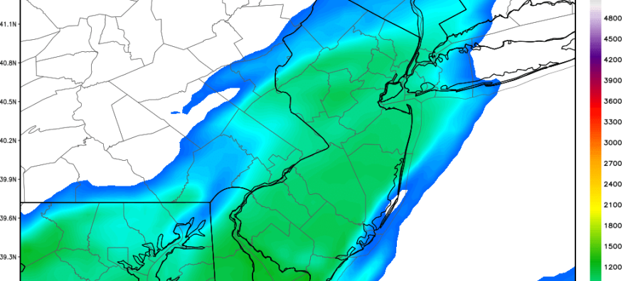
Surface based convective available potential energy (SBCAPE) is modeled at around 1000 j/kg on Thursday after peak diurnal early afternoon heating. Such heating is virtually negligible given the sun angle this time of year but worth noting, especially the higher levels near Cape May:
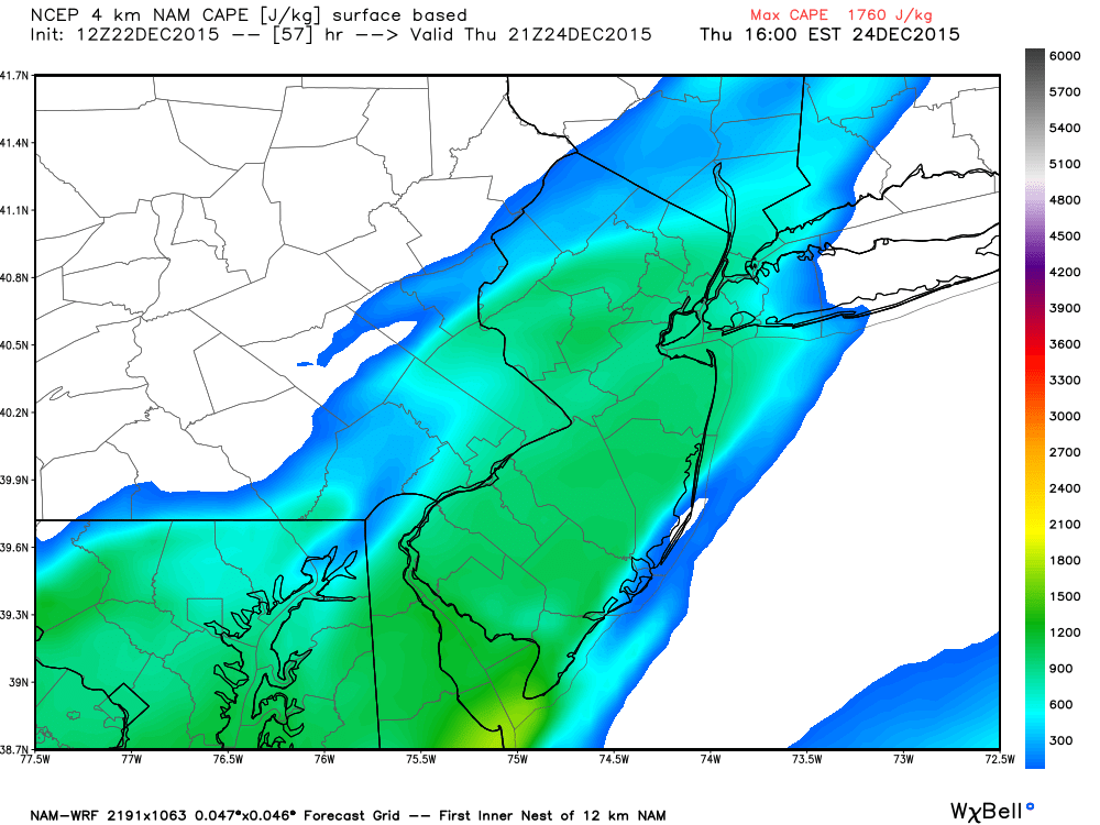
Shear however is more impressive to me. We’re looking at 40-50kts of upper level shear. When the cold front moves through this marginally unstable air mass, there’s definitely a good chance of hearing some boomers. I think the best dynamics exist to our S and W (interior SE US Appalachians) for severe potential—where the NWS SPC has a marginal risk factor. As far as New Jersey goes, I would expect anything from just rolling thunder embedded within rainfall to more frequent lightning with slightly stronger wind gusts associated with the greatest areas of convection.
In English: In addition to getting slapped in the face with a warm and rainy Christmas Eve, thunderstorms are possible in New Jersey. Nothing crazy like in the spring/summer, moreso the rolling thunder kind during periods of rainfall. Total expected rainfall is currently modeled between .25″ and .75″ but I suppose an inch is possible locally. We should clear out overnight into Christmas Day. Be safe! JC
Model images used with permission from WeatherBell Analytics.
Jonathan Carr (JC) is the founder and sole operator of Weather NJ, New Jersey’s largest independent weather reporting agency. Since 2010, Jonathan has provided weather safety and forecasting services for New Jersey and immediate surrounding areas through the web, social media, and app spaces. Originally branded as Severe NJ Weather (before 2014), Weather NJ is proud to bring you accurate and responsible discussions ahead of high-stakes weather scenarios that impact the garden state. All Weather. All New Jersey.™


LOCAL FORECAST | INTERACTIVE RADAR | LATEST NJ WEATHER ALERTS | WEDDING FORECAST| PRIVACY POLICY
© Copyright 2024 Weather NJ LLC. All Rights Reserved.
Some information that can be found on our website is provided by a private weather station and is not an officially recognized station for weather reporting. Though we always strive to achieve accurate reporting for our own use, it is important that you do NOT depend on the data provided here for any purpose.
