

Expected Tuesday Snowfall Accumulations
A clipper will track through the Great Lakes and bring negligible amounts of snow to most of New Jersey on Tuesday. It will then transfer and bomb out in the Gulf of Maine before stalling in E. Canada. Here’s how I see it playing out.
Temperatures will surge into the lower 40s by early Tuesday afternoon for the southern 2/3 of New Jersey. The northern 1/3 of New Jersey (elevations) should be held in the 30s. This surge in temperatures at the surface will be due to a brief period of southerly flow ahead of the Arctic cold front. The mid-to-upper levels will remain cold so once the front is through, winds should change to the NW—crashing temperatures at the surface.

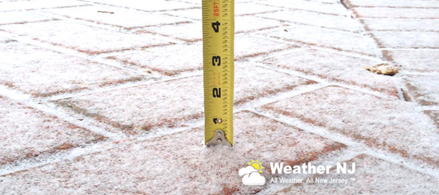
The most recent short-range model guidance suggests that precipitation will happen with the frontal passage in the form of a few short bursts. Therefore I expect a lot of snow to fall without accumulating, especially for the lower 2/3 of New Jersey. NNJ elevations should be the only region who could squeeze out an inch from this when all is said and done (maybe two locally). The rest of New Jersey might be looking at something similar to the picture above or nothing at all due to snow melting on contact.
This system really isn’t a big deal accumulation-wise. The more noticeable aspects of it IMO will be the NW wind gusts and brutal wind chills once the Arctic front is through. Once the system is through, everyone should bundle up for a frigid Tuesday night into Wednesday.
In English: Expect periods of snowfall tomorrow afternoon into early evening. Whiteout conditions (flizzards) are possible which can temporarily limit visibility so please be careful. The upper elevations of NNJ could squeeze out an inch (two would be a nice surprise). The general I-95 corridor area could end up with a dusting to an inch. Points S and E of I-95/NJTP should expect anything from white rain (snow that melts on contact) to nothing at all. Temps then crash overnight into Wednesday as New Jersey sits in an Arctic air mass.
If for some reason live observations are screaming something different tomorrow then I will update. Otherwise again, this is not a big deal. It might just time poorly with tomorrow’s PM rush hour, creating nuisance conditions. The biggest threat would then be driving mentality during snowfall. Please be safe out there! JC
Jonathan Carr (JC) is the founder and sole operator of Weather NJ, New Jersey’s largest independent weather reporting agency. Since 2010, Jonathan has provided weather safety and forecasting services for New Jersey and immediate surrounding areas through the web, social media, and app spaces. Originally branded as Severe NJ Weather (before 2014), Weather NJ is proud to bring you accurate and responsible discussions ahead of high-stakes weather scenarios that impact the garden state. All Weather. All New Jersey.™


LOCAL FORECAST | INTERACTIVE RADAR | LATEST NJ WEATHER ALERTS | WEDDING FORECAST| PRIVACY POLICY
© Copyright 2024 Weather NJ LLC. All Rights Reserved.
Some information that can be found on our website is provided by a private weather station and is not an officially recognized station for weather reporting. Though we always strive to achieve accurate reporting for our own use, it is important that you do NOT depend on the data provided here for any purpose.
