

Feb 11: Snow and Ice Impact Maps for NNJ
After review of today’s guidance, here’s our expected snow and ice totals for NNJ overnight tonight and tomorrow…
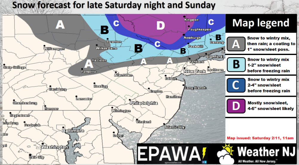
Click here for full resolution snow map.
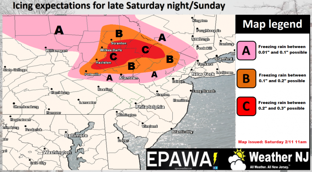
Click here for full resolution ice map.
In English: Wintry precipitation could produce dangerous conditions for parts of NNJ overnight tonight and through tomorrow morning, especially the ice component. The above maps illustrate our anticipated concerns. The snow should preceed the ice. The rest of the state (mostly lower 2/3 of NJ) should expect rainfall. All areas then become cold and gusty out of the NW tomorrow night into Monday with lake-effect snow flurries and snow showers minimal, but not off the table. Be safe! JC
Jonathan Carr (JC) is the founder and sole operator of Weather NJ, New Jersey’s largest independent weather reporting agency. Since 2010, Jonathan has provided weather safety and forecasting services for New Jersey and immediate surrounding areas through the web, social media, and app spaces. Originally branded as Severe NJ Weather (before 2014), Weather NJ is proud to bring you accurate and responsible discussions ahead of high-stakes weather scenarios that impact the garden state. All Weather. All New Jersey.™


LOCAL FORECAST | INTERACTIVE RADAR | LATEST NJ WEATHER ALERTS | WEDDING FORECAST| PRIVACY POLICY
© Copyright 2024 Weather NJ LLC. All Rights Reserved.
Some information that can be found on our website is provided by a private weather station and is not an officially recognized station for weather reporting. Though we always strive to achieve accurate reporting for our own use, it is important that you do NOT depend on the data provided here for any purpose.
