

Feb 16: Moving Forward
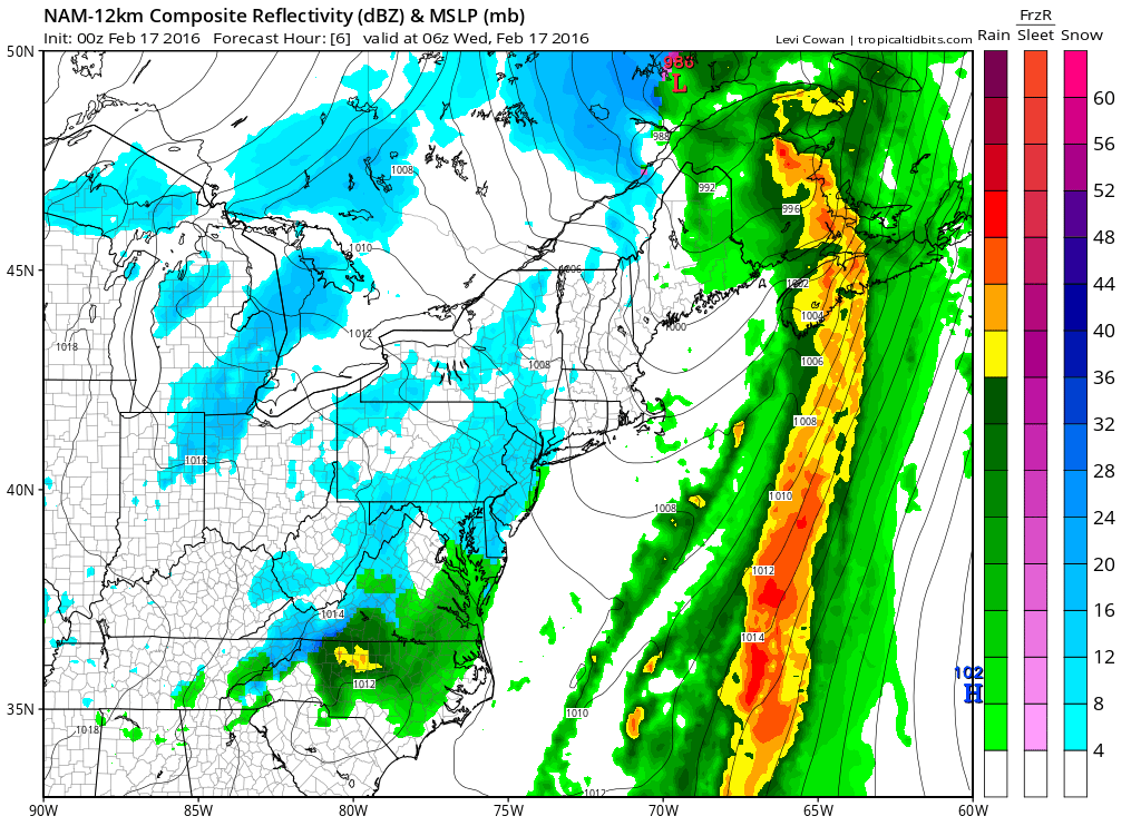
Some short-range model guidance has been hinting at a period of light snow showers overnight/early tomorrow morning but there’s just not much bite to them on live obs. Basically some weak energy is being strung out to our south but has the chance to bring just enough lifting for said snow showers over New Jersey. If they happen, expect little-to-no accumulations inland with little rain for the immediate coast. There’s a good chance they don’t happen at all. This is the latest NAM showing precipitation around 1AM:
Moving forward, Wednesday and Thursday should remain cooler but the weekend is looking dry, sunny and mild. All eyes are now focused on a long range winter storm signal for the February 23-25 period. At this point, surface solution details such as accumulations amounts and snow/rain lines are not worth the emotion.
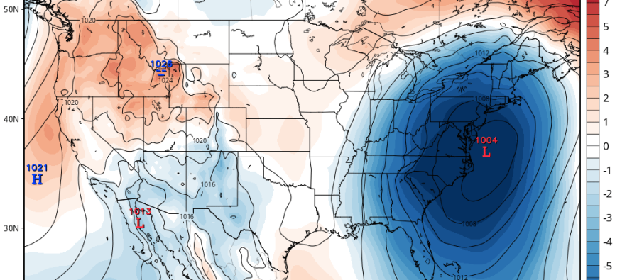
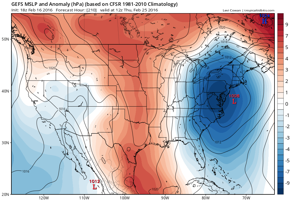
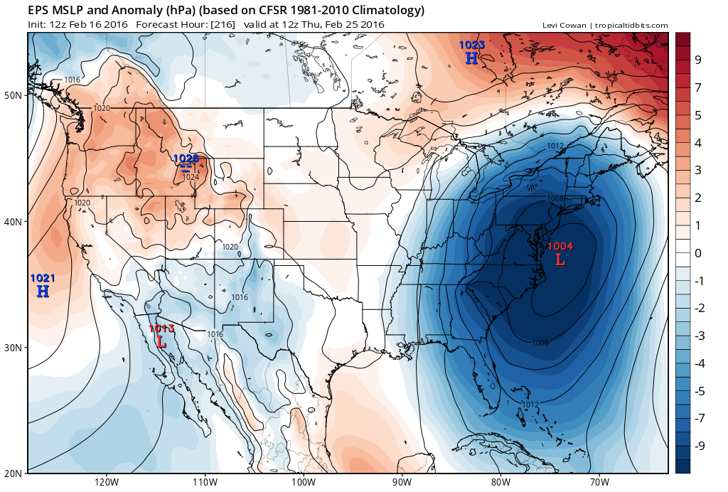
I’m primarily focusing on ensemble guidance from the GFS and Euro. Ensembles are multiple runs of the same model with slightly different starting conditions. I believe the GFS has about 20 while the European has 51. The mean, or average track plots, can tell a lot about model certainty, especially if they are group-clustered around a particular area. In the current case they are clustered around favorable location for an east coast winter storm in the February 23-25 period:
GFS Ensemble Mean:
Euro Ensemble Mean:
I’ll be looking for this signal as we transition from the long-range forecasting period to the mid-range forecasting period. That’s basically now into this weekend. If this signal is still showing on Saturday and the operational deterministic model runs are picking up on it, then it might be time to sound the alarms. It could very well drop off of model guidance by then which is why we are just discussing it for now without a forecast.
As far as relevant teleconnections go, the AO should be neutral with a slightly positive NAO. This tells me that some cold will be available to tap but the lack of Greenland blocking could mean a slightly faster moving system. The argument against that is the favorable area of high pressure modeled to the N of the low. It could provide just enough of a slow down to wind the storm up and hang around for a bit.
Further upstream, the PNA appears very positive which means a defined ridge for the W. US. This could be partially due to the greatest tropical forcing near the international dateline which concurs with the west-based greatest SSTA defining the current ENSO state. The strong ridge for the W. US should contribute dowstream to an E. US trough which could further override the less-than-ideal AO/NAO setup. The EPO is slightly negative which corresponds to the positive PNA. Overall, the teleconnections are not screaming winter storm but they aren’t saying no either.
I’d also like to point out that we are gaining sunlight by the day. This means less darker hours favorable for snowfall accumulation. During daytime hours, the sun angle is now high enough to fight accumulations (even through the clouds) on paved surfaces, especially in a marginal environment. Should the low track closer to the coast, this could become a big factor in whether snow accumulates or melts on contact for the larger highways of the coastal plain/Mid-Atlantic US.

In English: Light snow showers are possible overnight but should clear by sunrise. Conversational snow at best (if you’re even up) and might not even happen. Little to no accumulation if so with negligible travel impacts. We’re cool until Friday and mild through Monday. Another winter storm is then being discussed due to strong ensemble agreement and a somewhat favorable pattern. If it is going to happen, it would be in the February 23-25 period. I’ll be tracking this possibility through the weekend and sounding the alarms should it still appear favorable on Saturday. Have a great night and be safe! JC
Jonathan Carr (JC) is the founder and sole operator of Weather NJ, New Jersey’s largest independent weather reporting agency. Since 2010, Jonathan has provided weather safety and forecasting services for New Jersey and immediate surrounding areas through the web, social media, and app spaces. Originally branded as Severe NJ Weather (before 2014), Weather NJ is proud to bring you accurate and responsible discussions ahead of high-stakes weather scenarios that impact the garden state. All Weather. All New Jersey.™


LOCAL FORECAST | INTERACTIVE RADAR | LATEST NJ WEATHER ALERTS | WEDDING FORECAST| PRIVACY POLICY
© Copyright 2024 Weather NJ LLC. All Rights Reserved.
Some information that can be found on our website is provided by a private weather station and is not an officially recognized station for weather reporting. Though we always strive to achieve accurate reporting for our own use, it is important that you do NOT depend on the data provided here for any purpose.
