

Feb 2: Flash Freeze Situation Developing
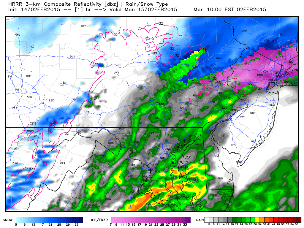
Low pressure is currently transferring from EPA to the southern Jersey coast. As the entire systems pulls away to the E/NE, temperatures are going to rapidly crash from NW to SE between now and this evening. This will present a flash freeze situation for surfaces that are still wet from rainfall. Please keep this in mind for travel this afternoon-evening. Coastal/SENJ will be last to freeze but it’s already beginning in NWNJ and even points south. In my AM commute from southern to northern Ocean county this morning, the temperature dropped 11 degrees. Precipitation could go over to snow for a bit but the main threat is the freeze. Here’s the best timeline I can give based on the latest ultra short-range HRRR model.
I find these mesoscale models to run about 2-3 hours earlier than the time-stamp. So this represents 7AM-8AM this morning despite being stamped with 10:00 EST. The pink line represents the surface line of freezing…the last layer to drop below freezing.
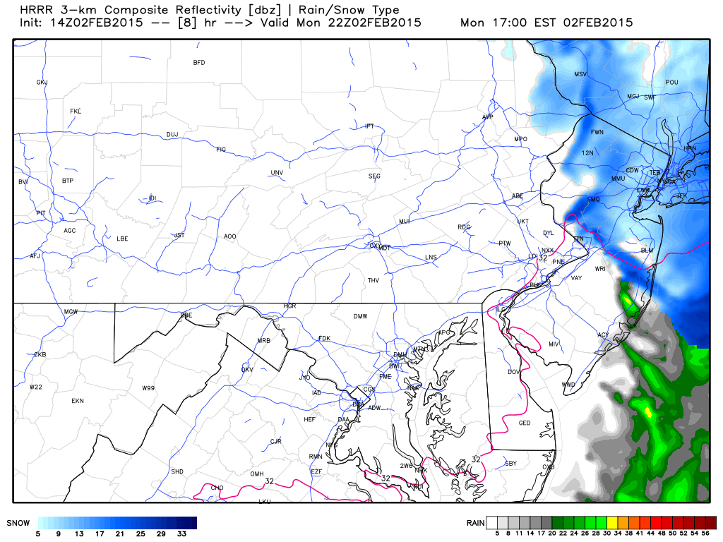
This next slide represents about 2PM-3PM this afternoon. Notice how far the surface line of freezing has crashed through EPA?
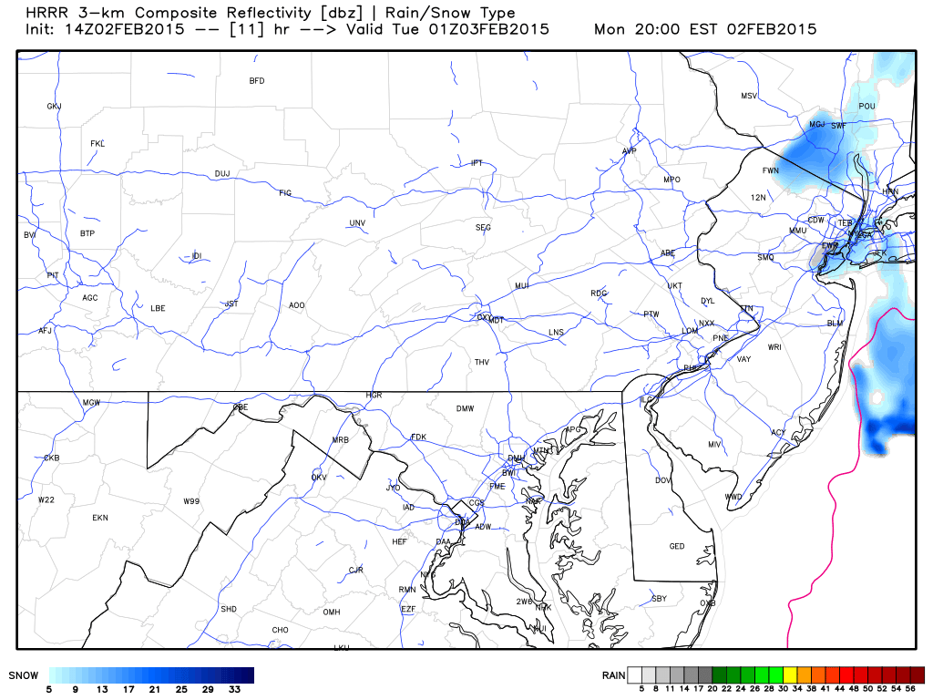
This final slide indicates that the surface line of freezing will be through all of NJ by 5PM-6PM this afternoon-evening as precipitation tapers off to the E/NE.
In English: As the storm ends, temperatures will rapidly drop between now and this afternoon/evening—creating a potential horrific ice setup for PM rush hour. Please use caution and stay off the roads if you can. Be safe! JC

Jonathan Carr (JC) is the founder and sole operator of Weather NJ, New Jersey’s largest independent weather reporting agency. Since 2010, Jonathan has provided weather safety and forecasting services for New Jersey and immediate surrounding areas through the web, social media, and app spaces. Originally branded as Severe NJ Weather (before 2014), Weather NJ is proud to bring you accurate and responsible discussions ahead of high-stakes weather scenarios that impact the garden state. All Weather. All New Jersey.™


LOCAL FORECAST | INTERACTIVE RADAR | LATEST NJ WEATHER ALERTS | WEDDING FORECAST| PRIVACY POLICY
© Copyright 2024 Weather NJ LLC. All Rights Reserved.
Some information that can be found on our website is provided by a private weather station and is not an officially recognized station for weather reporting. Though we always strive to achieve accurate reporting for our own use, it is important that you do NOT depend on the data provided here for any purpose.
