

Feb 2: Heavy Rainfall Detected
First, Happy Groundhog’s Day to all. Second, the groundhog is going to bust as the Arctic gates are expected to open for mid-February. Now let’s get down to business…
The energy responsible for the current N Midwest US snow storm will also drag a cold front through our region during Wednesday afternoon-evening. Temperatures should soar into the 60s ahead of the frontal passage as we become warm-sectored by southerly flow. Moderate-to-heavy precipitation in the form of rainfall should fall just ahead and along the frontal passage. If convective enough, then isolated embedded thunderstorms could occur. Once through, temperatures should return to seasonably cold as the favorable winter pattern finishes its reloading process. Then we’ll be watching the possible light snowfall for the coast this Friday followed by the February 8-10 potential for a much larger event. My video tonight will cover this. For now, lets focus on tomorrow.

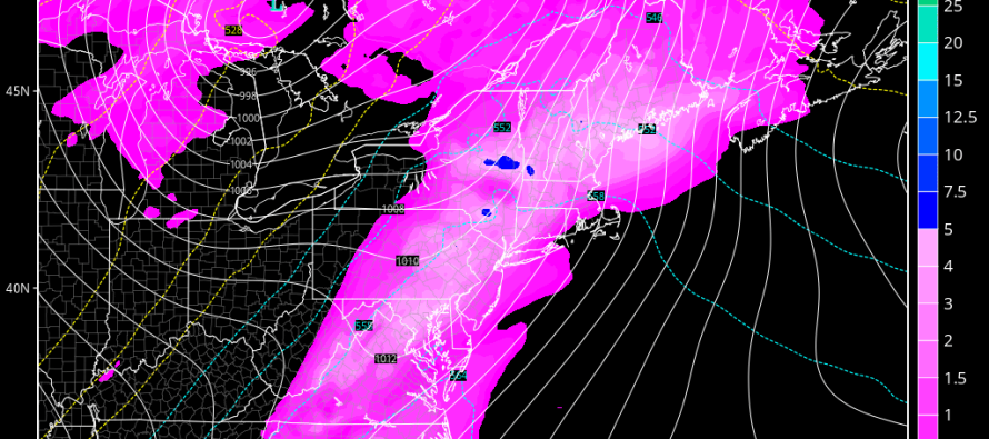
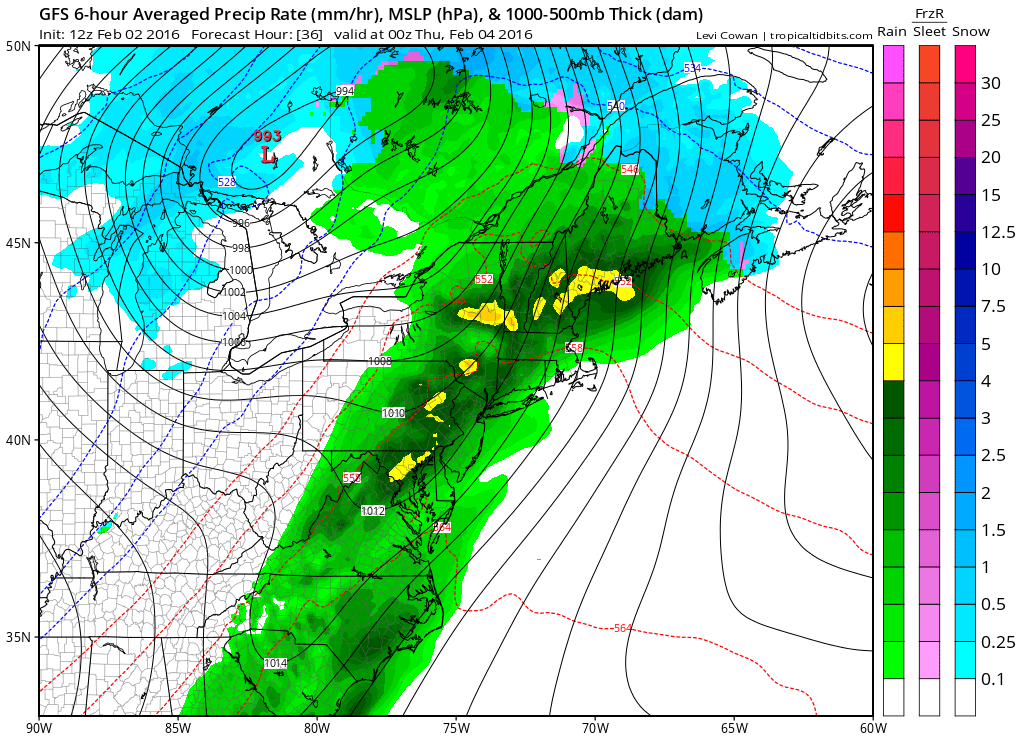
Here’s the latest GFS showing the basic principals at work. You can see the center of the system just N of the Great Lakes bringing snow to its NW and a precipitation-loaded frontal passage to its S. This model slide shows precipitation, pressure and temperatures at 850mb between 2PM and 8PM on Wednesday (tomorrow):
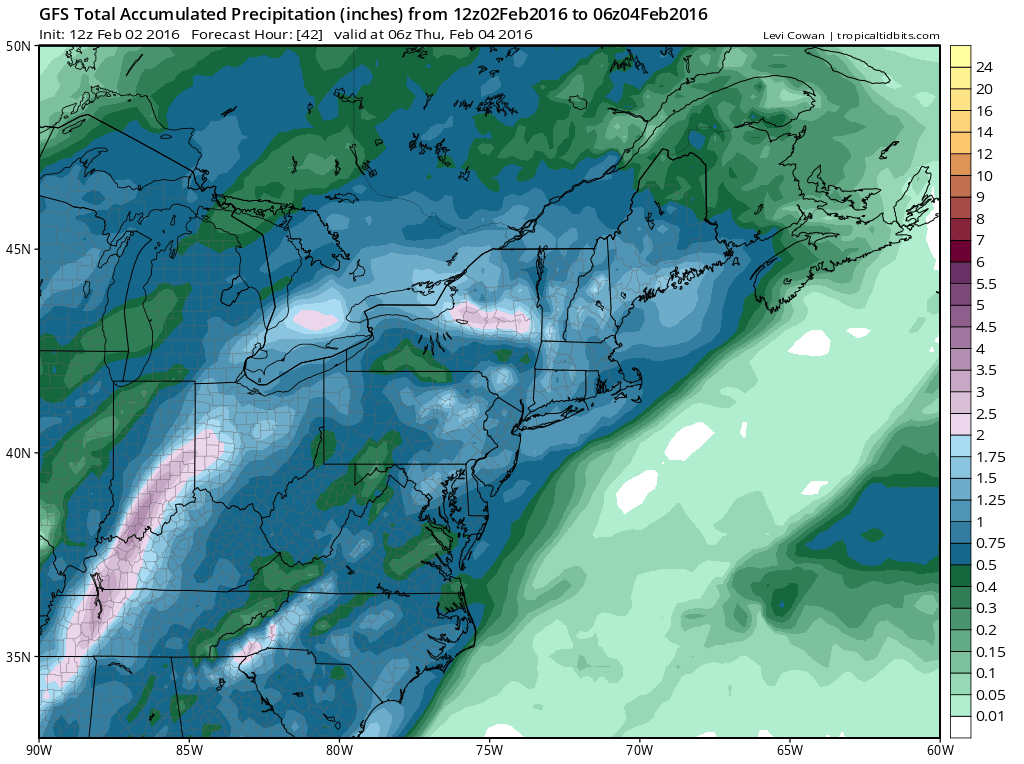
As far as total expected precipitation, this is nothing we haven’t seen before. This next slide represents total rainfall through 2AM Thursday morning. As shown, about .5 to 1.75 inches of rainfall are expected:
Additional concern: This next satellite image represents areas with decent snow pack still on the ground. Hat tip to Eric Fisher on Twitter for this image. These areas present additional flooding risk as the remaining snow is expected to melt and drain in addition to the expected rainfall. Also, tomorrow’s temperatures should be well into the 60s. I’d say the primary concern here is for areas near creeks, streams, lakes, etc., especially if you still have snow on the ground. This is why you are seeing additional flooding concern in said areas from the National Weather Service:
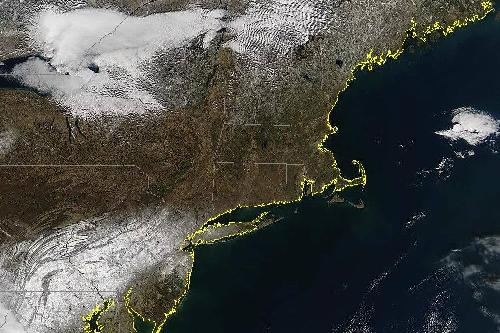
In English: Expect an unusually mild day tomorrow with warm southerly flow to start. Clouds should gradually increase throughout the day. Moderate-to-heavy rainfall is expected to start any time after noon and taper off by midnight. The actual period of rainfall should not be 12 hours but should fit within that window. Basically afternoon into evening. Watch out for an additional flooding concern if you still have snow on the ground (see above satellite image).
Anything from a half-inch to 1.75 inches of rainfall are possible along with isolated embedded thunderstorms. Winds could become gusty during the heaviest rainfall (just ahead and right along the front). Once through, winds will switch to the NW and temperatures will drop for Thursday-forward. We then look forward to some possible light snow along the coast on Friday followed by the February 8-9 possible major event. Again, my video tonight will cover that. Be safe! JC
Jonathan Carr (JC) is the founder and sole operator of Weather NJ, New Jersey’s largest independent weather reporting agency. Since 2010, Jonathan has provided weather safety and forecasting services for New Jersey and immediate surrounding areas through the web, social media, and app spaces. Originally branded as Severe NJ Weather (before 2014), Weather NJ is proud to bring you accurate and responsible discussions ahead of high-stakes weather scenarios that impact the garden state. All Weather. All New Jersey.™


LOCAL FORECAST | INTERACTIVE RADAR | LATEST NJ WEATHER ALERTS | WEDDING FORECAST| PRIVACY POLICY
© Copyright 2024 Weather NJ LLC. All Rights Reserved.
Some information that can be found on our website is provided by a private weather station and is not an officially recognized station for weather reporting. Though we always strive to achieve accurate reporting for our own use, it is important that you do NOT depend on the data provided here for any purpose.
