

Feb 25: SENJ Snow Likely Thursday AM
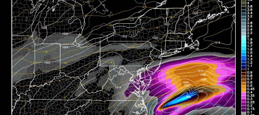
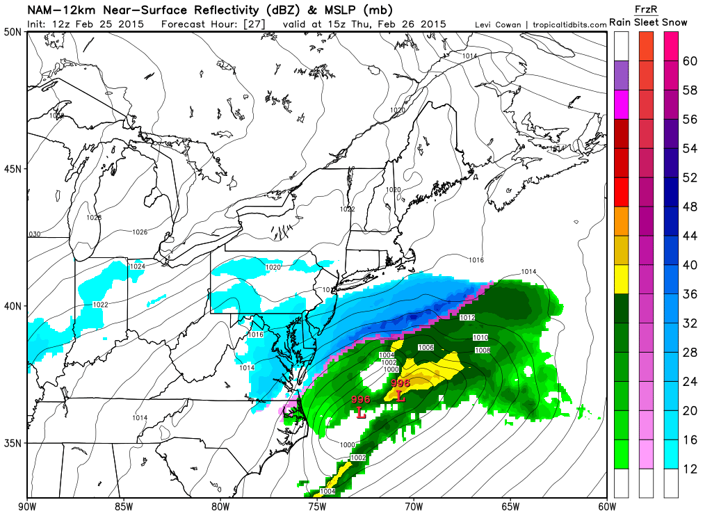
Model guidance has continued to nudge precipitation northwestward into SENJ. Cumberland, Cape May, Atlantic, and SE parts of Ocean and Burlington Counties have the best chance to see light to moderate snowfall between 4AM and 10AM tomorrow. Snow showers are now reaching as far northwestward as the I-95 corridor as seen here on the latest NAM and RGEM.
12Z NAM between 7AM and 10AM tomorrow morning:
06Z RGEM between 7AM and 10AM tomorrow morning:
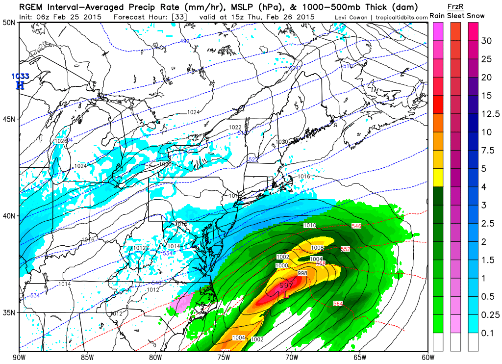
In English: My best guess is anything from a coating to an inch or so along 95—up to 4-6 inches for extreme SENJ. These SENJ jackpot zones are sometimes known to surprise despite having extremely sharp cutoffs to the NW. I’ll put a map out tonight which will probably reflect the same but with more detail. It should start after midnight tonight and wrap up just before noon tomorrow. Be safe! JC
Jonathan Carr (JC) is the founder and sole operator of Weather NJ, New Jersey’s largest independent weather reporting agency. Since 2010, Jonathan has provided weather safety and forecasting services for New Jersey and immediate surrounding areas through the web, social media, and app spaces. Originally branded as Severe NJ Weather (before 2014), Weather NJ is proud to bring you accurate and responsible discussions ahead of high-stakes weather scenarios that impact the garden state. All Weather. All New Jersey.™


LOCAL FORECAST | INTERACTIVE RADAR | LATEST NJ WEATHER ALERTS | WEDDING FORECAST| PRIVACY POLICY
© Copyright 2024 Weather NJ LLC. All Rights Reserved.
Some information that can be found on our website is provided by a private weather station and is not an officially recognized station for weather reporting. Though we always strive to achieve accurate reporting for our own use, it is important that you do NOT depend on the data provided here for any purpose.
