

Feb 8: Monday Night Observations
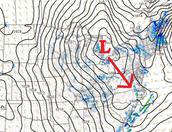
The clipper has reached the end of its road near the Great Lakes. Over the next 6 hours, I expect it to transfer to the Mid-Atlantic coast as indicated below. It will then strengthen as it moves NE and help set up the inverted trough for later in the day tomorrow.
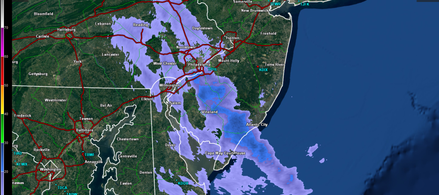
The snow that is moving through SNJ right now is just an initial band. This is not the main event by any means. I’m not sure how far that band is going to make it NE-ward to be honest. It’s heading into some drier air should it survive Burlington and Ocean Counties. There is also a feed of very fine snow off the ocean from the NW. The radar is having a hard time picking it up. Anyway, the main event is tomorrow once the low is transferred to the coast and on it’s way NE. Then we will see where the inverted trough will finally set up.
With that said, I don’t expect tomorrow morning to be too much of a travel concern as only light scattered pockets of snow should fall overnight and through tomorrow morning. The interesting dynamics come into play tomorrow during the day and into the evening/overnight hours. Just don’t want anyone getting too excited about these current SNJ bands.

In English: Pockets of snowfall could continue to fall overnight as they work from SW to NE. I think we are looking okay re: cancellations and delays in the morning but when the primary dynamics take shape in the afternoon-evening-overnight hours, that’s when conditions could become disruptive for travel. Have a great night and be safe! JC
Jonathan Carr (JC) is the founder and sole operator of Weather NJ, New Jersey’s largest independent weather reporting agency. Since 2010, Jonathan has provided weather safety and forecasting services for New Jersey and immediate surrounding areas through the web, social media, and app spaces. Originally branded as Severe NJ Weather (before 2014), Weather NJ is proud to bring you accurate and responsible discussions ahead of high-stakes weather scenarios that impact the garden state. All Weather. All New Jersey.™


LOCAL FORECAST | INTERACTIVE RADAR | LATEST NJ WEATHER ALERTS | WEDDING FORECAST| PRIVACY POLICY
© Copyright 2024 Weather NJ LLC. All Rights Reserved.
Some information that can be found on our website is provided by a private weather station and is not an officially recognized station for weather reporting. Though we always strive to achieve accurate reporting for our own use, it is important that you do NOT depend on the data provided here for any purpose.
