

Feb 9: Winter Storm Recap
Some are happy. Some are sad. That is the way of New Jersey snow. Let’s break it down…
Official accumulations from NWS Mt. Holly NJ
Official accumulations from NWS Upton NY
The storm rapidly intensified from Virginia through its Atlantic Ocean ejection overnight. However temperatures crashed from NW to SE a bit slower than expected starting late last night. This helped drape a baroclinic zone through southern PA, Delaware and most of SNJ. In this zone, the critical layers of 850-925mb remained warm enough to force heavy rain longer before the transition to sleet and ultimately snow. I’d say everyone S of I-195 lost 4 inches of snow due to this mesoscale occurrence. The upper levels (700mb and above) were cold enough and the surface would have responded quicker if those lower-mid levels crashed to the coast faster. A decent amount of lightning occurred just off the Jersey shore. That’s where the strongest precipitation fell along the intense thermal gradient.
According to a few well-trusted report sources, 3-4 inches made is as far S as Burlington/NW Ocean County and 4-6 inches fell across parts of Monmouth County. From there southward (Brick-southward through let’s say Marlton-southward), I don’t think I saw a measurement more than a coating to an inch or two. From there and northward, I’ve seen many 6-8 inch reports and even a few 10-11 inch reports out of Sussex County. NENJ and parts of Monmouth County are actually still tapering off due to the pivoting-nature of the coastal storm. A nice little event for areas that have seen little-to-no snow this season. I’m glad I did not call for a Kaboom in hindsight. We’ve got a few opportunities left in February according to long-range model guidance so I wouldn’t go pulling out the Spring gear just yet. I’ll take a fresh look at that later tonight when I release the weekend outlook.
In English: Most of NNJ and CNJ went about as planned from this quick moving yet dynamic system. Most of SNJ however fell short of expected totals. Please feel free to post your snow pics from the areas that verified in the comments. Today we’re cold and temperatures will continue to fall with breezy-to-gusty NW winds. We still have a rapidly deepening coastal storm out there and we’re within its reach of high winds. Therefore ENJ in general should be windier than WNJ but all areas should feel the wind chills today. I’ll have the Weekend outlook posted this evening. Have a great day and please be safe! JC
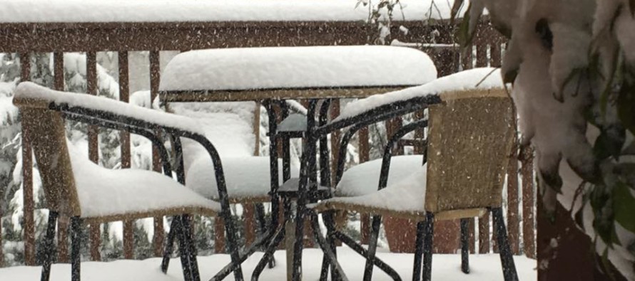
Photo Credit: Kristina Degenhardt Brusco (Taken today in Berkely Heights, NJ)
Jonathan Carr (JC) is the founder and sole operator of Weather NJ, New Jersey’s largest independent weather reporting agency. Since 2010, Jonathan has provided weather safety and forecasting services for New Jersey and immediate surrounding areas through the web, social media, and app spaces. Originally branded as Severe NJ Weather (before 2014), Weather NJ is proud to bring you accurate and responsible discussions ahead of high-stakes weather scenarios that impact the garden state. All Weather. All New Jersey.™


LOCAL FORECAST | INTERACTIVE RADAR | LATEST NJ WEATHER ALERTS | WEDDING FORECAST| PRIVACY POLICY
© Copyright 2024 Weather NJ LLC. All Rights Reserved.
Some information that can be found on our website is provided by a private weather station and is not an officially recognized station for weather reporting. Though we always strive to achieve accurate reporting for our own use, it is important that you do NOT depend on the data provided here for any purpose.
