

Heat Wave Continues (July 21-23)
Another hot and unsettled weekend is expected. Let’s break it down…
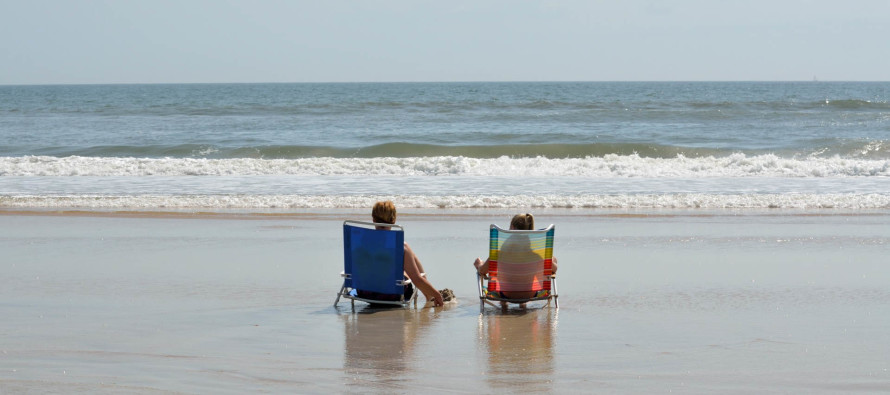
Discussion: The 250mb jet and 500mb dynamics are rather boring. A very zonal look for the weekend with the strongest streak to our N and average heights. What will happen this weekend is lateral fluctuation of a frontal boundary. Today through tonight the frontal boundary pushes just to our S. On Saturday, it returns N over NJ. With such frontal boundary movement, isolated-to-scattered showers and thunderstorms are possible. Don’t expect much relief from the passing cold front either as excessive heat warnings will likely continue for areas away from the ocean. We’re only talking about a slight reduction in humidity and a few degree difference. While no day looks like a washout, most should experience more hazy, hot and humid conditions between unsettled periods. The inshore waters of the ocean are incredibly warm for this time of year (close to 80). I imagine the beach rush this weekend will be for real. Just keep an eye to the sky and know when to leave before it’s too late.
Friday (July 21) high temperatures should at least reach the mid-90s away from the ocean. Coastal regions might hang near 90 or maybe top out in upper-80s. Skies should be partly-to-mostly sunny and humid. Winds should be light out of the W/SW. Overnight lows should fall into the lower-70s for most with NNJ elevations likely dipping into the 60s.
Saturday (July 22) high temperatures should break 90 inland and hang in the 80s for everyone else. With the cold front through, there should be a very small decrease in temperature (a few degrees) and slight decrease in humidity (mostly for NNJ). SNJ could still hang in the tropical air mass should the frontal boundary stall across the S half of NJ. Here’s to hoping it pushes as far S as possible. Saturday daylight hours look like the best part of the weekend for outdoor stuff. By late-afternoon/early evening hours, clouds are expected to increase with more rain and thunderstorms possible evening through overnight hours. Winds should be light out of the SE. Overnight lows should have trouble falling below 70 statewide.
Sunday (July 23) high temperatures should max out in the 80s statewide. Skies should be partly-to-mostly cloudy with rain and thunderstorms possible. Winds should be light out of the W/SW. Overnight lows should fall into the upper-60s/lower-70s.
An early look at next week indicates a break from the heat as temperatures return to near-average values for July (mid-80s). No major storms systems or hurricanes to worry about as of now. Everyone have a great weekend and please be safe! JC
Jonathan Carr (JC) is the founder and sole operator of Weather NJ, New Jersey’s largest independent weather reporting agency. Since 2010, Jonathan has provided weather safety and forecasting services for New Jersey and immediate surrounding areas through the web, social media, and app spaces. Originally branded as Severe NJ Weather (before 2014), Weather NJ is proud to bring you accurate and responsible discussions ahead of high-stakes weather scenarios that impact the garden state. All Weather. All New Jersey.™


LOCAL FORECAST | INTERACTIVE RADAR | LATEST NJ WEATHER ALERTS | WEDDING FORECAST| PRIVACY POLICY
© Copyright 2024 Weather NJ LLC. All Rights Reserved.
Some information that can be found on our website is provided by a private weather station and is not an officially recognized station for weather reporting. Though we always strive to achieve accurate reporting for our own use, it is important that you do NOT depend on the data provided here for any purpose.

)