

Jan 13: Initial Weekend Thoughts
Two systems could impact New Jersey this weekend. Here’s how it breaks down.
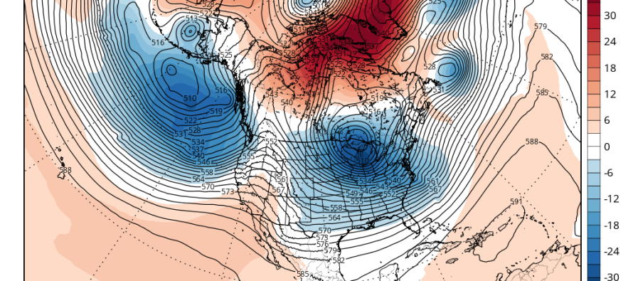
The first event is eyeing up the Friday-Saturday period. A low pressure system will track into the Great Lakes from the NW US. It will then transfer it’s energy to a coastal low in the mid-Atlantic US that will eventually bomb out while passing by the Jersey Shore and through the benchmark. The first low (primary) will draw up warmth and moisture ahead of it which will set a very warm stage for the secondary low (coastal). With that said, the Friday-Saturday event should be mostly rain for all of New Jersey.
The modeled strength (sub-990 possibly sub-980) of the coastal could present some interesting dynamics, however. First and most important, strong onshore winds and tidal surge could lead to moderate flooding along coastal regions. This will be worst when the low is directly to our S. Once the low gets to our W then winds should switch from onshore to northerly and the coastal flooding will subside. Here’s where it gets interesting. If we find ourselves on the W side of a rapidly deepening coastal low…then vertical precipitation drag and adiabatic expansion of the synoptic system’s column could cool the warmer/lower-mid levels of the atmosphere, especially with a little help from nearby weak high pressure to the N. If this can happen before precipitation lifts away then rain can change to snow for the tail-end of it.
Next is the Sunday-Monday possible event. Whether or not this low can turn up the coast or not will be determined by how strong the W US ridge is coupled with how much the polar vortex crushes the formation. So we’re dealing with another powerful (sub-990mb) low but further out to sea. The reason I am monitoring this system is because it could come close enough to the east coast to bring a surprise snow storm to New Jersey in that Sunday-Monday period.

So that no one’s hopes and dreams are crushed, the most likely outcome is rain and wind Friday-Saturday and a miss out to sea for Sunday-Monday. I’ll be watching should the first event try and change over to snow towards the end and/or should the Sunday-Monday coastal present a greater threat of snow.
In English: Two nor’easter-like possibilities exist. Friday-Saturday (likely just rain and wind but could end as snow) and Sunday-Monday (likely too far offshore but could surprise coastal regions with snow). That’s the best I can do for now but I’ll be watching these dynamics closely heading into the weekend. I’ll likely update daily from this point in as models come into focus. Have a great night and be safe! JC
Jonathan Carr (JC) is the founder and sole operator of Weather NJ, New Jersey’s largest independent weather reporting agency. Since 2010, Jonathan has provided weather safety and forecasting services for New Jersey and immediate surrounding areas through the web, social media, and app spaces. Originally branded as Severe NJ Weather (before 2014), Weather NJ is proud to bring you accurate and responsible discussions ahead of high-stakes weather scenarios that impact the garden state. All Weather. All New Jersey.™


LOCAL FORECAST | INTERACTIVE RADAR | LATEST NJ WEATHER ALERTS | WEDDING FORECAST| PRIVACY POLICY
© Copyright 2024 Weather NJ LLC. All Rights Reserved.
Some information that can be found on our website is provided by a private weather station and is not an officially recognized station for weather reporting. Though we always strive to achieve accurate reporting for our own use, it is important that you do NOT depend on the data provided here for any purpose.
