

Jan 18: Clipper Snow Detected

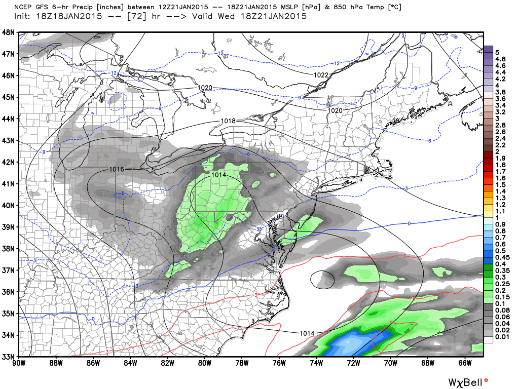
Temperatures will stay cold for the next several days as a weak low pressure disturbance dives into the region from the W/NW…aka a clipper. Clippers traditionally surprise people with a few quick inches. Snow ratios tend to be higher from cold/dry air which results in fluffy/powdery snow despite a moisture starved environment. Sometimes they can connect with coastal energy which enhances snowfall amounts. That’s what I’ll be watching over the next few days as we transition into short-range guidance. Right now, a swath of light accumulating snow is being painted through the general region on model guidance. Let’s look at the 850mb pressure, temps, and precip map from the GFS.
Precipitation between 7AM and 1PM Wednesday:
Precipitation between 1PM and 7PM Wednesday:
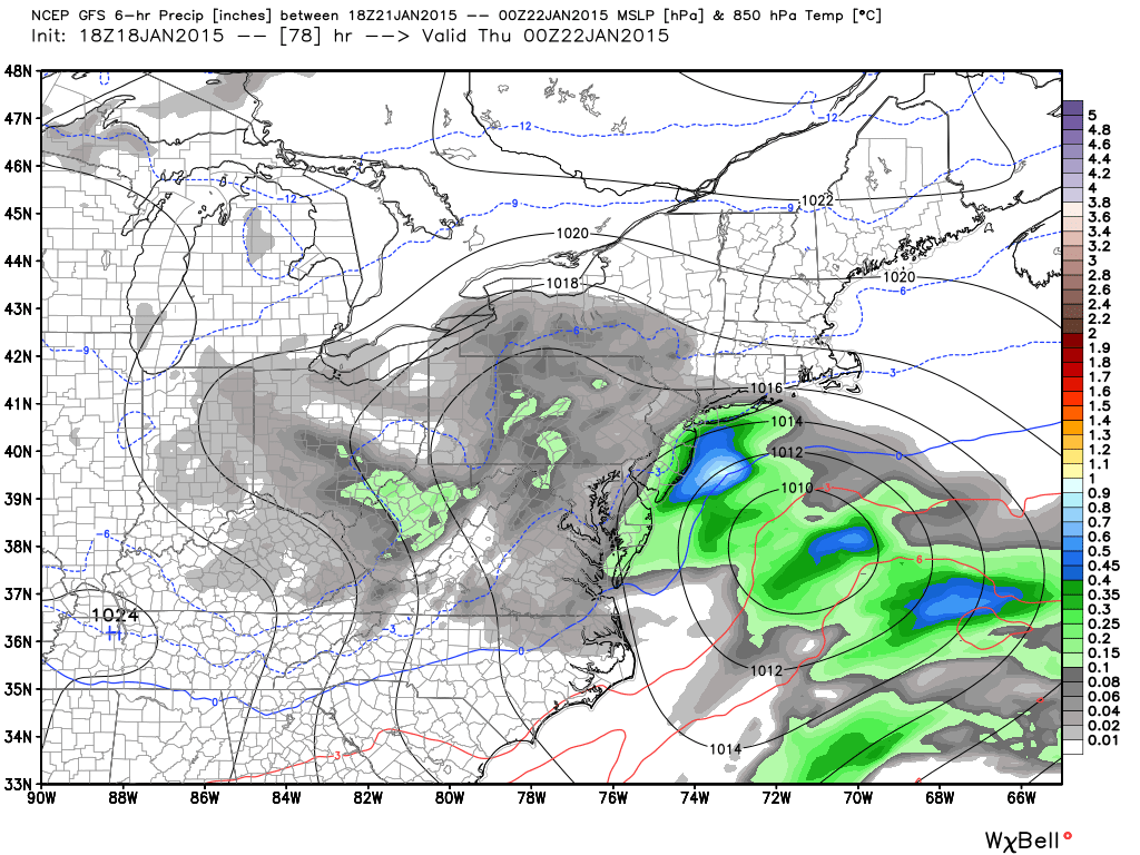
While the upper levels will be cold enough to support snowfall, the surface could be warmed slightly above freezing—especially for extreme SENJ. This would be more of an issue if there is coastal development kicking in warmer Atlantic Ocean air. With a spray of model solutions now, the jackpot accumulation zone should be anywhere between CNJ and SNJ with NNJ seeing at least light snow. So we’re talking about either a light disorganized coastal connection producing light snow accumulations or a stronger coastal connection resulting in a 3-6″/4-8″ type event. I’ll continue to review guidance and put an initial snow map out tomorrow afternoon.
In English: Light to significant snow is possible on Wednesday from sunrise to sunset. Uncertainty exists whether it will be a nuisance or significant event. Be safe! JC
Model image used with permission from WeatherBell Analytics.

Jonathan Carr (JC) is the founder and sole operator of Weather NJ, New Jersey’s largest independent weather reporting agency. Since 2010, Jonathan has provided weather safety and forecasting services for New Jersey and immediate surrounding areas through the web, social media, and app spaces. Originally branded as Severe NJ Weather (before 2014), Weather NJ is proud to bring you accurate and responsible discussions ahead of high-stakes weather scenarios that impact the garden state. All Weather. All New Jersey.™


LOCAL FORECAST | INTERACTIVE RADAR | LATEST NJ WEATHER ALERTS | WEDDING FORECAST| PRIVACY POLICY
© Copyright 2024 Weather NJ LLC. All Rights Reserved.
Some information that can be found on our website is provided by a private weather station and is not an officially recognized station for weather reporting. Though we always strive to achieve accurate reporting for our own use, it is important that you do NOT depend on the data provided here for any purpose.
