

Jan 18: Initial Thoughts on Jan 23-24
A mature low pressure system is expected to impact our region in the January 23-24 period. Right now it looks like rain and wind for New Jersey.
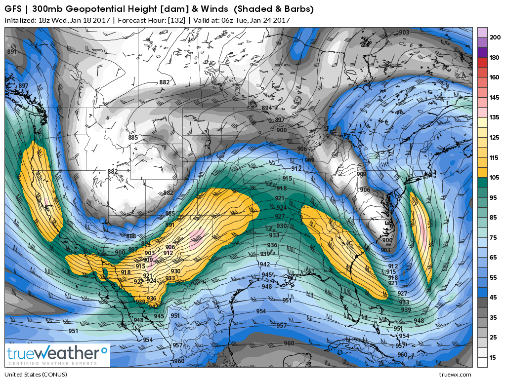
Disco: A negatively-tilted trough at the jet stream level is quite evident in this time-frame. This allows the back-leaning frontward jet streak to enhance the surface energy below:
At 500mb a closed-off low, nested within the upper-level trough, barrels through from Texas to OBX:
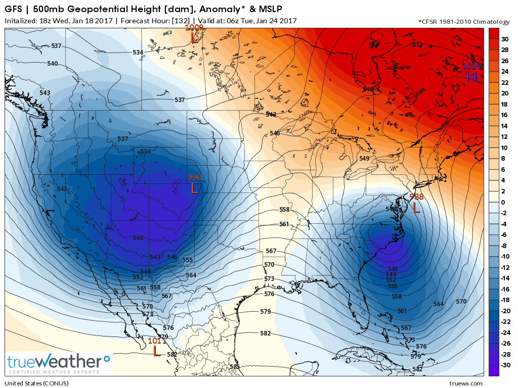
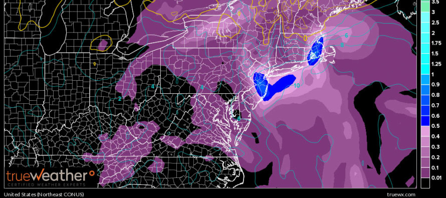
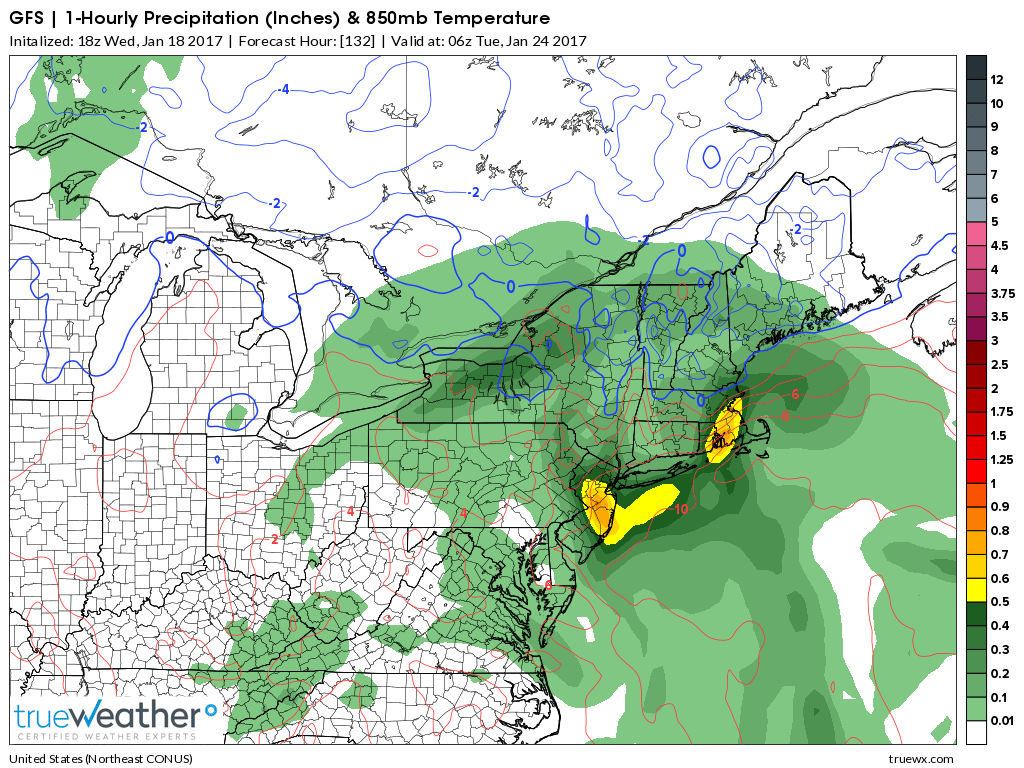
Another upper-level low briefly closes off over PA. This yanks the surface low N towards our area and under the greatest jet streak lifting. The end result at the surface is a significant rain event with gusty winds wrapped around a sub-990mb low…that tracks pretty darn close to the Jersey shore. This could potentially mean coastal flooding and beach erosion. It could also mean flash flooding under areas of heavy rainfall, as indicated in the below 3-hour surface frame:
There is a lot of room for trending through the weekend. I’m currently real skeptical of the upper-level and surface low displacement. With so much uncertainty, surface solutions should vary over the next few days. Regardless, at least some level of impact is supported by dynamics at all layers. Again, right now it looks like a rain and wind event.
In English: Significant guidance agrees on a mature low pressure system impacting the region in the January 23-24 period. As currently modeled, our general EPA/NJ/MD/DE region would see moderate-to-heavy rainfall and gusty winds. We’ll continue monitor and discuss for now. Be safe! JC
Jonathan Carr (JC) is the founder and sole operator of Weather NJ, New Jersey’s largest independent weather reporting agency. Since 2010, Jonathan has provided weather safety and forecasting services for New Jersey and immediate surrounding areas through the web, social media, and app spaces. Originally branded as Severe NJ Weather (before 2014), Weather NJ is proud to bring you accurate and responsible discussions ahead of high-stakes weather scenarios that impact the garden state. All Weather. All New Jersey.™


LOCAL FORECAST | INTERACTIVE RADAR | LATEST NJ WEATHER ALERTS | WEDDING FORECAST| PRIVACY POLICY
© Copyright 2024 Weather NJ LLC. All Rights Reserved.
Some information that can be found on our website is provided by a private weather station and is not an officially recognized station for weather reporting. Though we always strive to achieve accurate reporting for our own use, it is important that you do NOT depend on the data provided here for any purpose.
