

Jan 20: Major Storm Threats for the Northeast
If it winds up that we have not one but 2 major storms to deal with only a couple of days apart it would be the first time that I can remember ever seeing something like this. In fact I had to really give the European a double take today because it just didn’t seem right to me. But the model does what the model does. It has been telegraphing 2 storms (not including Wednesday’s clipper) but as we talked about yesterday the first one for the weekend looked like it was going to get shoved out to sea, though it was not impossible that it would shift to the left..which it has now for 2 runs in a row. My attention was more on the second event for Tuesday. Now both events seem square on the table. And if they turn out to be correct, those areas that have been crying for snow, might instead be crying for it to stop!
Okay so before we lose it here completely lets take a look and see what is happening with both weather systems
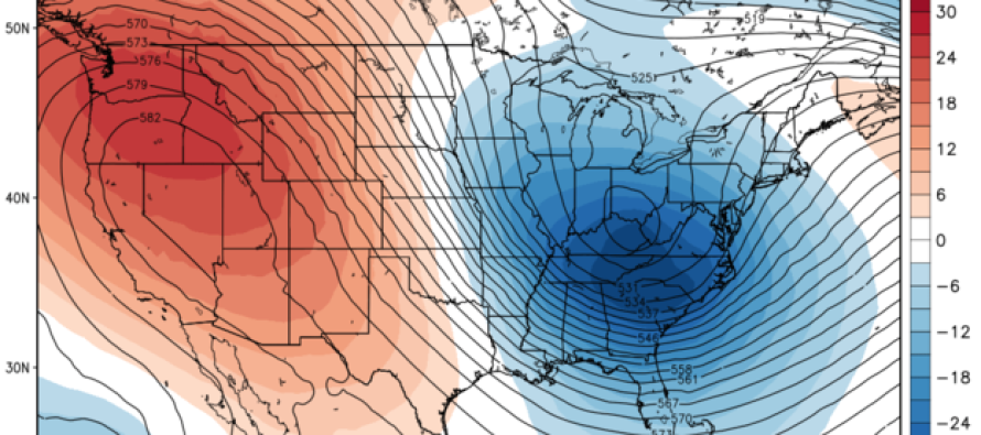
The big change from yesterday is that with the first system there is suddenly “room”. The northern stream is much more consolidated and less suppressive which allows the southern stream feature to lift up and intensity. The result is a storm that moves up the coast and tracks from North Carolina straight to just east of Cape Cod and deepens to less than a 980mb. It is pretty much the same as the Gfs model from today as described in my earlier post.
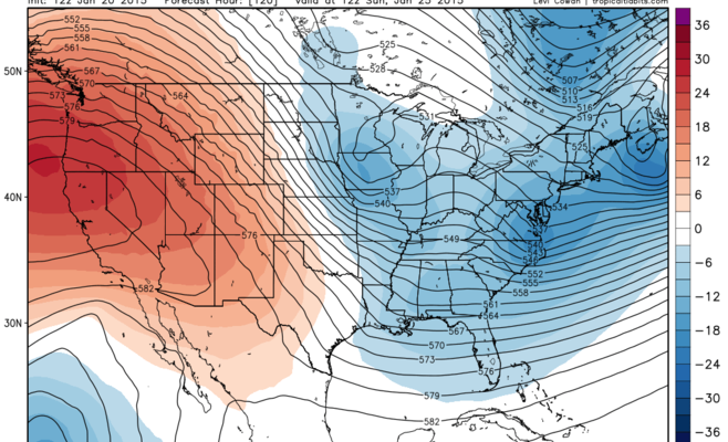
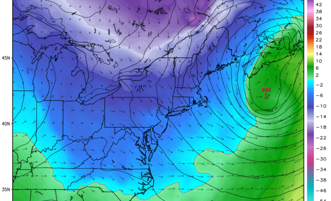
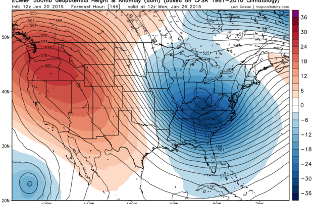
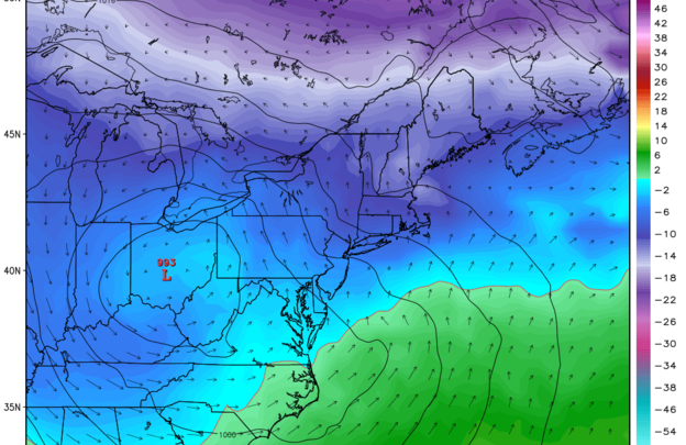
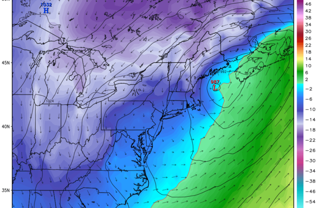
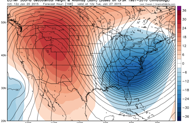
Now look behind all this and you see a ridge that is still gaining strength in the west. This forces an evens stronger upper air disturbance to drive southward. Yesterday’s maps showed the trough on the coast. Look at how much further west it is now as it digs into the Ohio Valley. Those maps are shown below at 144 hrs which is Monday morning 7am and 168 hrs which is Tuesday morning 7am. The low redevelpes and intensifies tracking east of Atlantic City to the Gulf of Maine. AMAZING!!!
Now that we have seen all this and tried to digest it..remember that it is really really really unusual to see 2 back to back events like this especially since the winter from the standpoint of storms so far has been relatively quiet. However obviously the atmosphere and the pattern has shifted into a stormier mode. Im not sure whether I totally believe this yet however I would not want to think we would make up for all of the last month and do it in 72 hrs!
Here are the bottom lines…odds of first storm for Saturday are increased to HIGH..SPECIFIC DETAILS TO BE WORKED OUT OVER THE COMING DAYS.
POSSIBILITY of a second event Monday into Monday night...with even more details to follow..after we deal with the clipper tomorrow..and then the Saturday event..and then maybe Monday..and then maybe a vacation!
At this point comes the shameless plug to like and share my facebook page! Thank you
In English: In addition to a potential snow storm this weekend, another possibility exists for early next week.
Jonathan Carr (JC) is the founder and sole operator of Weather NJ, New Jersey’s largest independent weather reporting agency. Since 2010, Jonathan has provided weather safety and forecasting services for New Jersey and immediate surrounding areas through the web, social media, and app spaces. Originally branded as Severe NJ Weather (before 2014), Weather NJ is proud to bring you accurate and responsible discussions ahead of high-stakes weather scenarios that impact the garden state. All Weather. All New Jersey.™


LOCAL FORECAST | INTERACTIVE RADAR | LATEST NJ WEATHER ALERTS | WEDDING FORECAST| PRIVACY POLICY
© Copyright 2024 Weather NJ LLC. All Rights Reserved.
Some information that can be found on our website is provided by a private weather station and is not an officially recognized station for weather reporting. Though we always strive to achieve accurate reporting for our own use, it is important that you do NOT depend on the data provided here for any purpose.
