

Jan 23: PM Coastal Storm Update
Here’s how the rest of tonight should play out from here…
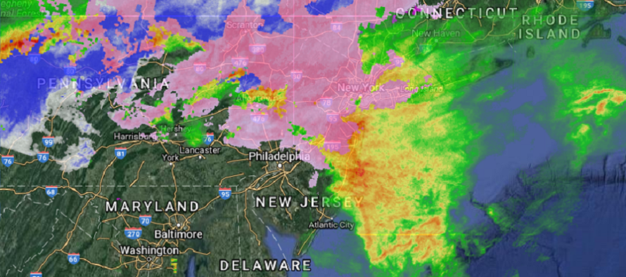
The current radar is detecting sleet (pink) in NNJ and parts of CNJ due to a cold 925mb layer beneath a marginal 850-700mb. This is what’s preventing an all snow/heavy accumulations event for NWNJ. Sleet and/or a wet snow is the more probable precipitation type. Light accumulations of either sleet and/or wet snow are still possible for points NW so please use extra caution.
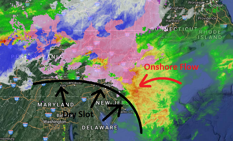
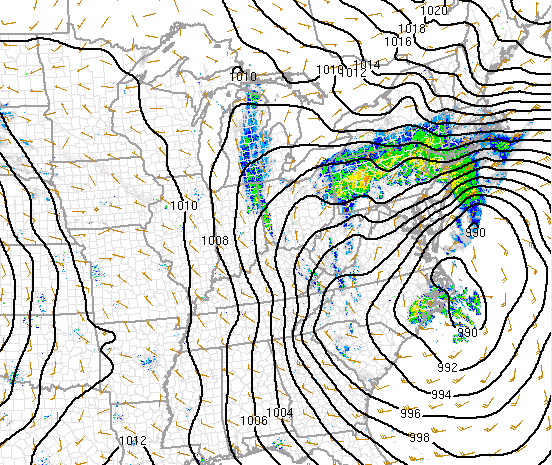
The strong lower-level jet (850mb) is kicking off the ocean and will stay that way until about midnight (give or take a few hours). This is the heaviest rain band off the ocean I’ve seen today but rain has been shut off for SWNJ/SNJ due to a dry slot. The dry slot opened up due to the transfer of low pressure from W NC to the OBX area over the last few hours. Now the system is loosely closed off at the surface and will retrograde in track towards the SENJ coast. Once winds switch to the N instead of off the ocean (midnight-ish), conditions will noticeably subside through tomorrow morning.
In English: SWNJ has been shut off from rain due to a dry slot. Rain and wind are still pumping onto the N Jersey coast (AC/LBI and northward) and extending NW into CNJ/NNJ. We’re now in the time period where sleet and wet snow could impact points NW. This should continue until midnight-ish (as the cut-off line continues to inch northward). Conditions should improve during the AM hours of tomorrow. The low will still be just to our E tomorrow so still some wind out of the N but nowhere near as bad as today’s onshore flow. We have one last high tide to worry about tomorrow morning and then the coast is home free of flooding risk. Have a great night and please be safe! JC
Jonathan Carr (JC) is the founder and sole operator of Weather NJ, New Jersey’s largest independent weather reporting agency. Since 2010, Jonathan has provided weather safety and forecasting services for New Jersey and immediate surrounding areas through the web, social media, and app spaces. Originally branded as Severe NJ Weather (before 2014), Weather NJ is proud to bring you accurate and responsible discussions ahead of high-stakes weather scenarios that impact the garden state. All Weather. All New Jersey.™


LOCAL FORECAST | INTERACTIVE RADAR | LATEST NJ WEATHER ALERTS | WEDDING FORECAST| PRIVACY POLICY
© Copyright 2024 Weather NJ LLC. All Rights Reserved.
Some information that can be found on our website is provided by a private weather station and is not an officially recognized station for weather reporting. Though we always strive to achieve accurate reporting for our own use, it is important that you do NOT depend on the data provided here for any purpose.
