

July 27: Evening Storms Approaching!
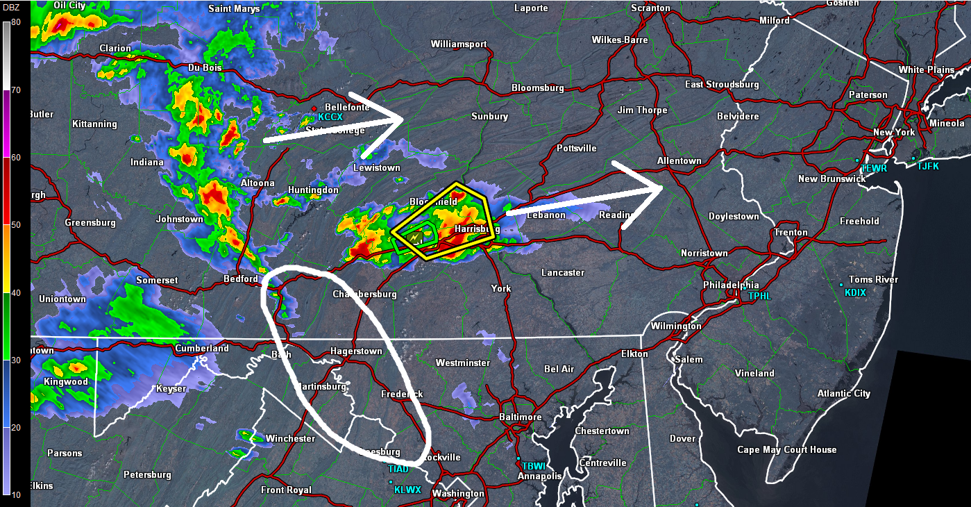
Thunderstorms continue to push ENE across Pennsylvania towards New Jersey. They’re not moving very fast so estimated impact is still at least a few hours away. Given the current setup and radar observations, it appears that NNJ has a better chance than SNJ. I’m watching the area that I’ve circled below for near-future development. It seems like that line of moisture wants to stream southeastward towards the DC/Baltimore area. If that happens then more of SNJ will likely get in on tonight’s storms. Here’s the playbook diagram:
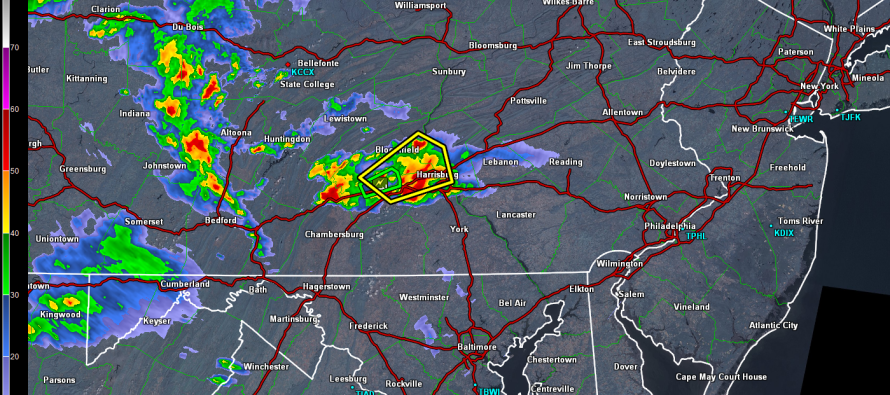
Harrisburg, PA is currently seeing a decent storm cell. As with any system like this, coastal regions of New Jersey, especially SENJ, have a lesser chance of holding intensity due to marine influence. Dew point temperatures are holding pretty high though and there’s plenty of instability + shear to work with overnight. With that being said, no guards are being let down anywhere in the state of New Jersey. As I always say for the coast, 9 times out of 10 these storms fizzle for you but there’s always that 1 time. Best to be ready for it. The best timing window for NJ impact I can give is 8PM through sunrise. Obviously WNJ will see impacts before ENJ…about 2-3 hours beforehand. I’ll be tracking all night. Be safe! JC
Jonathan Carr (JC) is the founder and sole operator of Weather NJ, New Jersey’s largest independent weather reporting agency. Since 2010, Jonathan has provided weather safety and forecasting services for New Jersey and immediate surrounding areas through the web, social media, and app spaces. Originally branded as Severe NJ Weather (before 2014), Weather NJ is proud to bring you accurate and responsible discussions ahead of high-stakes weather scenarios that impact the garden state. All Weather. All New Jersey.™


LOCAL FORECAST | INTERACTIVE RADAR | LATEST NJ WEATHER ALERTS | WEDDING FORECAST| PRIVACY POLICY
© Copyright 2024 Weather NJ LLC. All Rights Reserved.
Some information that can be found on our website is provided by a private weather station and is not an officially recognized station for weather reporting. Though we always strive to achieve accurate reporting for our own use, it is important that you do NOT depend on the data provided here for any purpose.
