

June 25: Widespread Rainfall Expected!
First we have rain and storms moving through later today-evening but then a series of low pressure disturbances will impact the weekend.
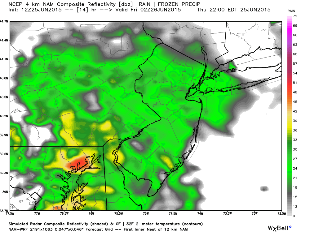
Lets talk about today first. Short range guidance indicates that most of New Jersey should see rainfall this afternoon-overnight with embedded thunderstorms possible in SNJ. Here is the latest high-res NAM showing expected precipitation intensity:
Between 9-10PM this evening:
Between 3-4AM overnight:
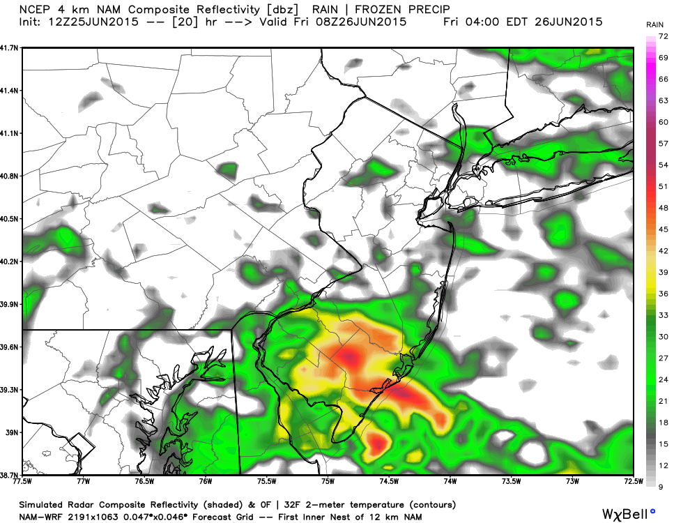
I would expect rain to move in from the WNW anytime after 4PM today and then persist overnight into tomorrow. Should any thunderstorms embed within the rainfall, they will likely be for SNJ only and probably overnight.
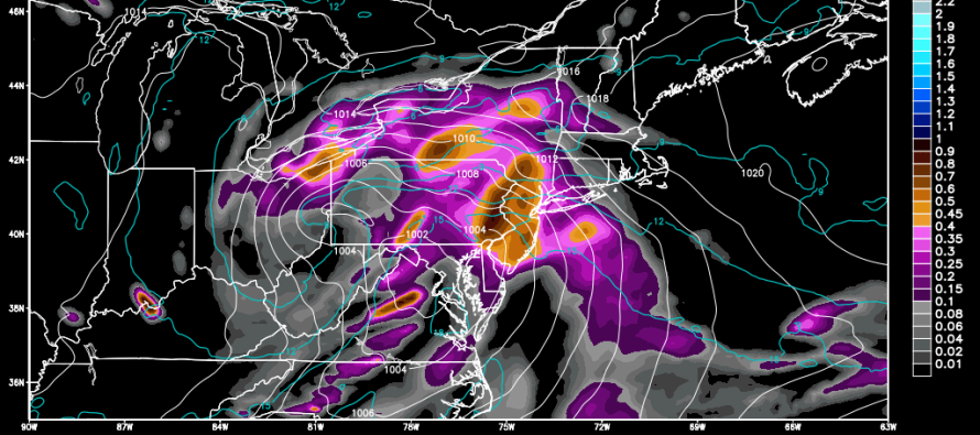
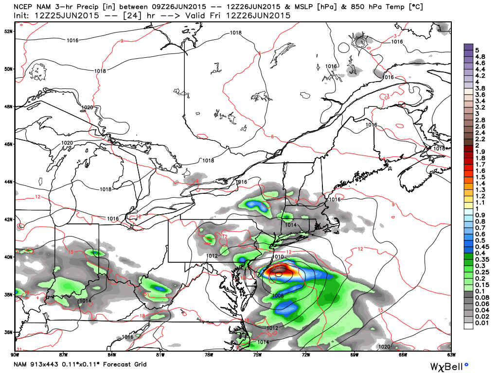
Now let’s talk about the weekend. Here’s the latest NAM showing 850mb pressure, temperature, and precipitation:
Friday Morning:
Saturday Evening:
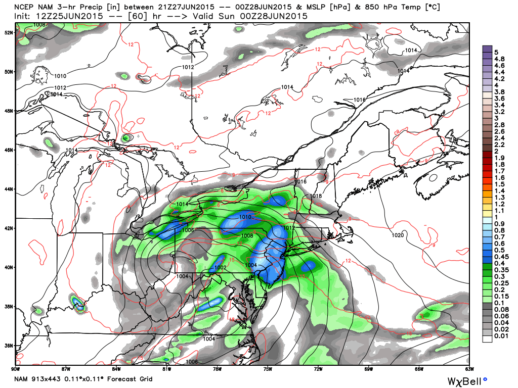
As you can see, we’ll have organized low pressure off the SENJ coast Friday morning. Once it clears out to sea, we might see a small break until rain associated with another low pressure disturbance cuts through to our west on Saturday afternoon. Sunday should gradually dry out after a wet start. Hard to call it a nice day as clouds and showers could linger.
In English: The overall theme setting up is that most rainfall should occur Friday and Saturday overnight. Daytime hours on Saturday and Sunday however, could still present nuisance conditions for outdoor activities. While random periods of clearing are possible during the day, I wouldn’t expect any duration of sunny skies. I’ll have a fully detailed weekend outlook posted tomorrow morning but this is how it looks for now. Be safe! JC
Jonathan Carr (JC) is the founder and sole operator of Weather NJ, New Jersey’s largest independent weather reporting agency. Since 2010, Jonathan has provided weather safety and forecasting services for New Jersey and immediate surrounding areas through the web, social media, and app spaces. Originally branded as Severe NJ Weather (before 2014), Weather NJ is proud to bring you accurate and responsible discussions ahead of high-stakes weather scenarios that impact the garden state. All Weather. All New Jersey.™


LOCAL FORECAST | INTERACTIVE RADAR | LATEST NJ WEATHER ALERTS | WEDDING FORECAST| PRIVACY POLICY
© Copyright 2024 Weather NJ LLC. All Rights Reserved.
Some information that can be found on our website is provided by a private weather station and is not an officially recognized station for weather reporting. Though we always strive to achieve accurate reporting for our own use, it is important that you do NOT depend on the data provided here for any purpose.
