

March 13: Final Storm Update and a Look Ahead
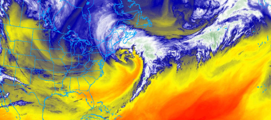
Discussion: In my opinion the Upper-Level Low (ULL) moved into the Great Lakes region a hair quicker than expected yesterday-overnight. Also, it crossed the US border with a heading a hair closer to due S rather than S/SE. This rippled through to the Pacific shortwave, allowing a slightly tighter pit and pendulum swing with open isobars to the Great Lakes ULL. Not a full phase by any means but slightly more interaction. This then ultimately rippled down to the primary coastal surface low and allowed a track closer to the 40N/70W benchmark than what was expected. Here’s the current location of the storm:
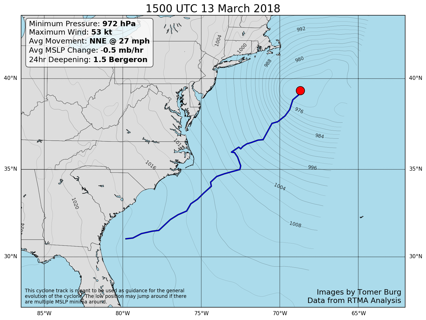
Notice the track jump to the NW around 35N? Most would argue that there was trouble plotting the exact surface low location due to multiple meso lows. However, the time of this jump was during/immediately after the ULL took the due S movement across the Canadian border (rather than S/SE movement). Either way, that’s my best post-storm analysis as to why the track ended up closer to the 40N/70W benchmark. This is why I think some of the current-monster snow bands over New England started off further to the W (over places like NNJ and the ENJ. The stronger connection with the ULL then led to stronger lifting back into NWNJ and NY State towards the ULL. At the end of the day this produced accumulations slightly higher than expected for most of NNJ and some parts of Monmouth/Ocean County. These were wildcard areas listed in my discussion. The rest of NJ performed about as expected with minimal road issues. For these areas (Most of SNJ especially SWNJ) there simply wasn’t enough lift to force heavy-enough precipitation to overcome the above-freezing surface. You might have some slushy stuff on the grass but roads are likely now just wet as we continue to warm today.
The rest of this week should be dominated by breezy, and even gusty at times, surface winds that range/rock from NW to W/NW. This will be due to the back-side of departing cyclonic flow that surrounds the storm. There are a few reasons why we can see random snow showers and squalls this week. First, we’re aligned with the NW flow over the Great Lakes. Second, the upper-level low will follow the primary coastal low and drag across New Jersey from W to E midweek. That can also enhance precipitation with convective activity. Third, some weak passing coastal energy could interact with the ULL. In any of these cases we’re likely talking about trace-to-light accumulations for any one snow shower or squall. We’re just going to have to play it by ear knowing that the Wednesday PM-Thursday AM is most favored with the ULL passage over New Jersey. Whether or not snowfall occurs during daytime or overnight will impact the ability to fall and stick. No significant-major accumulations of snow are expected this week. By the time we get to the weekend we’re looking cool, sunny and slightly milder.
The elephant in the room is the ~March 20-21 period (next Tuesday-Wednesday). Since we’re a week a way I refuse to call it anything other than a monitored storm signal. It looks like a very flat and progressive wave that will cross the US from W to E and run into blocking offshore. Whether or not it blows up for the Mid-Atlantic US is far yet TBD. There are a number of ways it could work out. We’ll be discussing it in the premium MPM forum as things evolve but until there’s a consensus in the mid-range forecasting period (by this Friday PM/Sat AM) there is no point in getting worked up about it. It could just as easily drop-off of model guidance as it could verify.
In English: The last few bands of precipitation are currently tapering off in Monmouth County/NENJ. Some of those areas are a still a slushy mess so please use caution on the roads. The sun is warming all areas up so it shouldn’t be long before the last of the slush liquefies on paved surfaces. Otherwise most other areas should be okay. The rest of this week looks cold and blustery (for mid-March). Daytime highs should range from upper-30s to upper-40s NNJ to SNJ. Overnight lows should fall below freezing for most. NNJ, especially elevations, should fall well-below freezing. Breezy-to-gusty winds out of the NW to W/NW should remain noticeable for a few days behind this departing storm. Light snowfall/rain (likely divided near I-95) is possible here and there through Thursday night with Friday-Sunday looking clearer. I’d say this Wednesday night into Thursday morning holds the best chance of the week for light snowfall. I’ll provide additional updates as needed. Moving beyond that I’ll be monitoring the potential storm signal showing for ~March 20-21. have a great rest of your Tuesday and please be safe! JC
Satellite imagery credit: NOAA GOES-16
Coastal low track image credit: Tomer Burg
Jonathan Carr (JC) is the founder and sole operator of Weather NJ, New Jersey’s largest independent weather reporting agency. Since 2010, Jonathan has provided weather safety and forecasting services for New Jersey and immediate surrounding areas through the web, social media, and app spaces. Originally branded as Severe NJ Weather (before 2014), Weather NJ is proud to bring you accurate and responsible discussions ahead of high-stakes weather scenarios that impact the garden state. All Weather. All New Jersey.™


LOCAL FORECAST | INTERACTIVE RADAR | LATEST NJ WEATHER ALERTS | WEDDING FORECAST| PRIVACY POLICY
© Copyright 2024 Weather NJ LLC. All Rights Reserved.
Some information that can be found on our website is provided by a private weather station and is not an officially recognized station for weather reporting. Though we always strive to achieve accurate reporting for our own use, it is important that you do NOT depend on the data provided here for any purpose.
