

March 7: And That’s a Wrap
As the last remnant bands finish up in NENJ, I wanted to talk a bit about this storm. Another powerful March nor’easter has had heavy impact on New Jersey. This storm was not as large-scale as last Friday’s but it had similar impacts being so close to the Jersey coast. The system evolved from two upper-level shortwaves that mimicked the Fujiwara Effect while tracking in from the W/NW under the remnant influences of last week’s ridiculous block (and near 50/50 low). Eventually the energy swung through and enhanced a transferring surface low near the North Carolina coast via negative tilt and capture. The primary low took a a track towards Atlantic City before pulling away to the E/NE towards the benchmark. This pull away dramatically reduced snowfall accumulations in the jackpot zone for PA. Instead, NNJ (especially NENJ) saw the jackpot accumulations while areas along and SE of the I-95 corridor saw a snowier solution overall. I honestly don’t know the final accumulation numbers but the NWS should have official amounts out in the near future. I only have an idea based on live reports and comments. Parts of NENJ approached “Dude where’s my car?” criteria while EPA and NWNJ fell below Kaboom criteria. This can happen with a Miller-B transfer and is something that should be considered with every instance of it.
This storm was insane dynamically. We saw coastal flooding, rain, sleet, hail, lightning, gusty winds and heavy snowfall in the same day. We had multiple layers (700/850/925/etc) each with difficult low placement. Most of New Jersey was not cold at the surface heading in. Most surface temperatures were well-above freezing to start. There was very cold air aloft however. This created the destabilized environment that assisted the convective precipitation and lightning. The other driving force was the low as a trigger itself. Areas that saw convective precipitation (extreme frontogenic forcing/lifting) were able to overcome the warmer surface by bringing cold air aloft downwards to the ground with the heavy precipitation. Parts of CNJ saw shallow low-mid layers of warmer air. This was produced by marine influence rotating inwards around the meso low parked near Atlantic City. This kept a lot of CNJ in rain/sleet mode for longer than expected. That final snow band filled the gap somewhat but at least 3-6 inches were likely lost in CNJ due to the mixing. Coastal flooding reached into the moderate flooding stage in several locations. Surge-related tides should improve over the next few days. It’s been a long week of water in the streets for barrier island residents with a few more higher-than-normal tides expected. Each high tide from this point and on should be less and less.
Now comes the final hazard of this system. For areas that saw more than a few inches of snowfall accumulation, there is a lot of heavy wet snow weight on tree branches and power lines. This goes especially for those who saw 18-24 inches in NENJ. Many of you are hearing transformers pop and branches breaking. With the departing storm still within proximity, we’re going to deal with gusty northerly winds overnight and into tomorrow. This is a recipe for widespread power outages in addition to all existing power outages. There’s not much you can do about it but I recommend keeping necessary devices charged.
We now turn our attention to yet another winter storm possibility this Sunday-Monday (March 11-12). I’ll start covering it in detail tomorrow because tonight I need a break. I feel like I’ve just gone 12 rounds with 1985 Mike Tyson and I simply need rest. A HUGE thank you to my long-time followers for your patience, understanding and support over the years and a HUGE welcome to all new followers! My name is Jonathan Carr and you can read more about me here. Have a great night and please be safe! JC
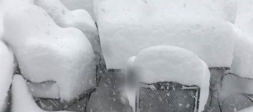
Image Credit: Weather NJ contributor Dan Salzman.
Jonathan Carr (JC) is the founder and sole operator of Weather NJ, New Jersey’s largest independent weather reporting agency. Since 2010, Jonathan has provided weather safety and forecasting services for New Jersey and immediate surrounding areas through the web, social media, and app spaces. Originally branded as Severe NJ Weather (before 2014), Weather NJ is proud to bring you accurate and responsible discussions ahead of high-stakes weather scenarios that impact the garden state. All Weather. All New Jersey.™


LOCAL FORECAST | INTERACTIVE RADAR | LATEST NJ WEATHER ALERTS | WEDDING FORECAST| PRIVACY POLICY
© Copyright 2024 Weather NJ LLC. All Rights Reserved.
Some information that can be found on our website is provided by a private weather station and is not an officially recognized station for weather reporting. Though we always strive to achieve accurate reporting for our own use, it is important that you do NOT depend on the data provided here for any purpose.
