

March 9: Overnight Snow/Rain Approaching

Discussion: A well-organized low pressure system (a mature mid-latitude cyclone) will track through the Great Lakes between now and tomorrow (Sunday) evening. A warm front, attached to the low, will push a period of precipitation through New Jersey from SW to NE between midnight tonight and late-tomorrow morning. This low is plowing into a SE Canadian high which will provide enough cold for wintry type precipitation for the interior. The best chance for wintry precipitation tonight will be N of I-80 and NW of I-287. We’re talking about N Warren, all of Sussex, N Morris, N Passaic and possibly NW Bergen Counties. While wintry precipitation can still fall slightly S and SE of such geographical boundaries, surface temperatures will likely inhibit accumulations. Here’s the latest short-range HRRR model (courtesy of truewx.com) depicting expected wintry accumulations. This map shows how much snow/sleet can fall. How much sticks will likely be less especially on paved surfaces:
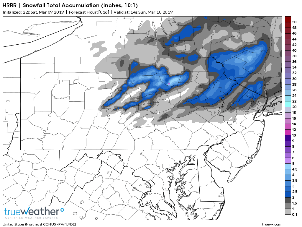
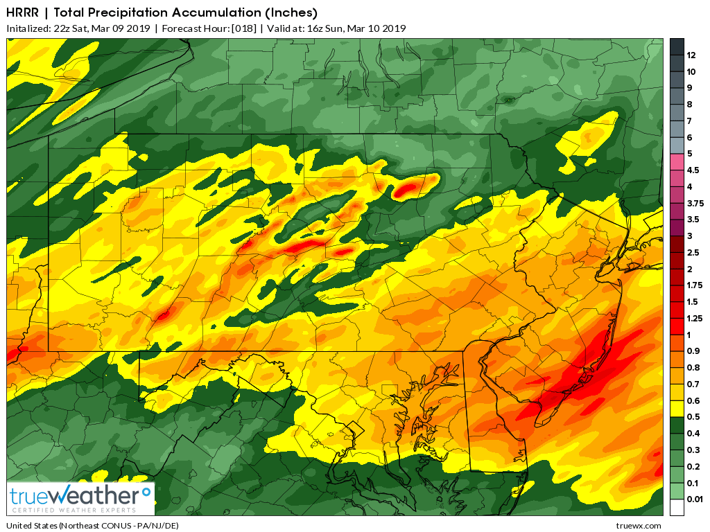
Again this is a warm front passage so most areas should at least go over to a mix of sleet/freezing rain or rain especially once the lower-mid levels warm above freezing. Therefore for safe measure let’s allow the possibility for light snow/sleet accumulations N of I-80 and NW of I-287 with the highest NNJ elevations having the best chance. I doubt anyone up that way would see more than a few inches. The rest of NJ (lower 2/3) should expect rain from start to end. Here’s the same short-range HRRR depicting expected precipitation (in liquid inches). As you can see SENJ is favored for the most amount of overnight rainfall:
Winds should be stiff off the ocean tonight through noon tomorrow. This will be the period that the Great Lakes low pulls air in along the warm front. Tomorrow should feature much milder temperatures as most of NJ (at least the lower 2/3) is warm-sectored. Conditions should improve from late-morning through evening tomorrow. Winds should then switch to the W by Monday AM hours and bring some colder air through the region for Tuesday and Wednesday. Milder temperatures are expected beyond that.
In English: Snow is possible for parts of NNJ tonight mainly N of I-80 and NW of I-287 between midnight and late-tomorrow morning (Sunday). NNJ snow should change over to a mix of sleet, freezing rain or rain by sunrise tomorrow morning as a warm front pushes through from the S/SW. The rest of NJ (S of I-80/SE of I-287) should start and stay all rain from midnight through late-tomorrow morning. Rainfall could be heavy at times and we can’t rule out a few embedded boomers. Winds should pick up later this evening, off the ocean, and persist through most of tomorrow morning. Tomorrow we’re mild as conditions improve through PM hours. AM hours should be mostly cloudy as precipitation tapers off. I’ll have the Monday-Friday outlook posted tomorrow evening to cover the chilly start/mild finish to next week. Everyone have a great Saturday night and please be safe! JC
Download the new free Weather NJ mobile app on Apple and/or Android. It’s the easiest way to never miss Weather NJ content. Our premium services go even further above and beyond at the hyperlocal level.
Jonathan Carr (JC) is the founder and sole operator of Weather NJ, New Jersey’s largest independent weather reporting agency. Since 2010, Jonathan has provided weather safety and forecasting services for New Jersey and immediate surrounding areas through the web, social media, and app spaces. Originally branded as Severe NJ Weather (before 2014), Weather NJ is proud to bring you accurate and responsible discussions ahead of high-stakes weather scenarios that impact the garden state. All Weather. All New Jersey.™


LOCAL FORECAST | INTERACTIVE RADAR | LATEST NJ WEATHER ALERTS | WEDDING FORECAST| PRIVACY POLICY
© Copyright 2024 Weather NJ LLC. All Rights Reserved.
Some information that can be found on our website is provided by a private weather station and is not an officially recognized station for weather reporting. Though we always strive to achieve accurate reporting for our own use, it is important that you do NOT depend on the data provided here for any purpose.
