

May 11: Friday Thunderstorms Expected
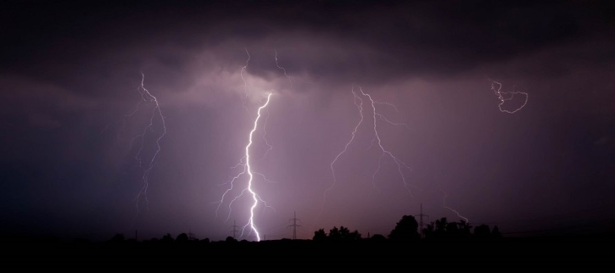
A cold front attached to a low moving through Canada will pass through the region Friday evening into Saturday morning from W to E. At the very least, linear segments of rainfall are expected just ahead of the front between Friday afternoon and evening hours. Should instability, shear and a few other factors cooperate then we could be looking at thunderstorms with severe potential (high wind gusts and/or hail).
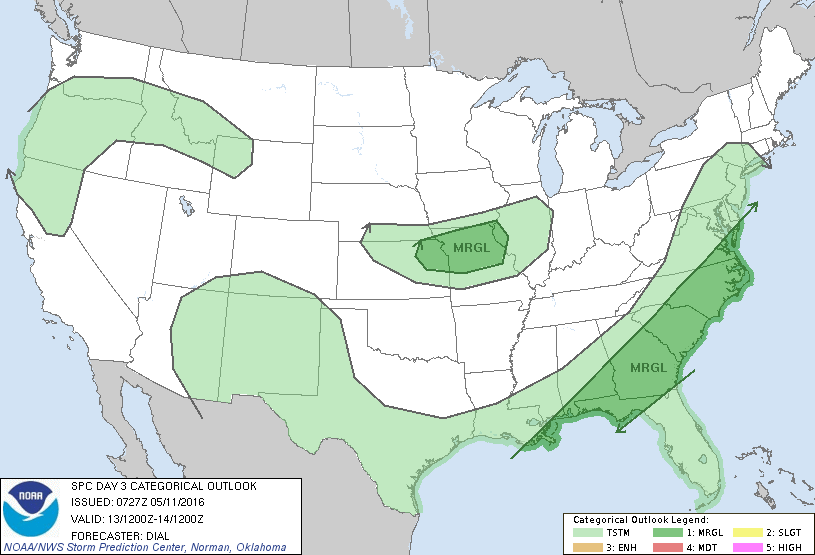
The National Weather Service Storm Prediction Center in Norman, Oklahoma has issued the following severe potential outlook for Friday. The entire state of New Jersey is in the TSTM area right now. This is the lowest risk category but suggests that there will at least be some action. I wouldn’t be surprised to see parts of NJ and surrounding areas elevated to the MRGL category (marginal) tomorrow or the day of on Friday. That’s the NWS SPC’s call though and they have not yet done so.
Another cold front should move through between Saturday night into Sunday. This should chill the area down well-below average between Sunday and Tuesday morning. Tuesday afternoon-forward looks to feature much warmer temperatures and that looks to last as far as I can see. High pressure should finally set up near the Bermuda area which will build the east coast ridge.

In English: Expect rain and possibly thunderstorms Friday afternoon-evening. Severe criteria is on the table but not guaranteed for all areas. Such will have to be live-casted. As of right now, my best estimate of timing is from 4PM-8PM (WNJ-ENJ). I will adjust this as needed but again, that’s my best guess for now. More rain is expected Saturday night followed by a colder Sunday-Tuesday. After that, we roast. I’ll have the detailed weekend outlook posted tomorrow evening. Be safe! JC
Jonathan Carr (JC) is the founder and sole operator of Weather NJ, New Jersey’s largest independent weather reporting agency. Since 2010, Jonathan has provided weather safety and forecasting services for New Jersey and immediate surrounding areas through the web, social media, and app spaces. Originally branded as Severe NJ Weather (before 2014), Weather NJ is proud to bring you accurate and responsible discussions ahead of high-stakes weather scenarios that impact the garden state. All Weather. All New Jersey.™


LOCAL FORECAST | INTERACTIVE RADAR | LATEST NJ WEATHER ALERTS | WEDDING FORECAST| PRIVACY POLICY
© Copyright 2024 Weather NJ LLC. All Rights Reserved.
Some information that can be found on our website is provided by a private weather station and is not an officially recognized station for weather reporting. Though we always strive to achieve accurate reporting for our own use, it is important that you do NOT depend on the data provided here for any purpose.
