

May 27: Conditions to Improve
Discussion: Yesterday’s isolated thunderstorms were air mass thunderstorms, meaning they formed mostly from upward motion (diurnal instability/sea breeze front) without wind shear. This is common for the warm sector of your classic Norwegian cyclone model, especially this time of year. Such storm cells reach a maximum and choke themselves off with downward motion meeting the upward motion. The downward motion from the collapse of the cell however can send out lateral meso-fronts since air hits the ground and has nowhere to go but sideways. This is the cool air you feel during/just after a t-storm downpour. These meso-fronts can contain severe winds and spark neighboring thunderstorm development as old cells collapse nearby. I like referring to them as pulsers due to their pulsing radar nature. Since we didn’t have wind shear or a nearby synoptic trigger to assist with vorticity, I believe whatever happened in Monmouth/ECNJ yesterday evening was off a microburst-like downpour. This would explain the hail core and straight line wind damage. It’s obviously not an official conclusion, just my two cents. Many of you asked about it this morning.
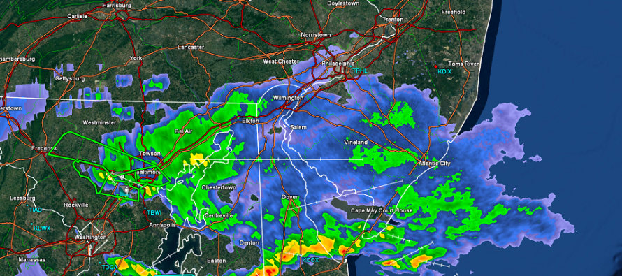
The flash flooding that occurred in CNJ this morning was due to the frontal boundary sinking. It’s currently running from Baltimore to just S of Cape May. This is where the lightning and heaviest precipitation is due to the additional frontal dynamics. NJ is just to the N of this frontal boundary. Therefore SNJ should finish out tonight with additional rainfall while NNJ just finishes out raw.
As we head into the week, it looks like Alberto’s tropical remnants will track into the central US as high pressure drops southward, out of Canada, to our E. Sounds like a few days of cooler marine flow to me, especially if the high pressure holds tropical remnant moisture to our W. Eventually everything should push through to the E so rainfall heading into next weekend makes theoretical sense to me. I’ll put out a Tuesday-Friday outlook tomorrow evening which will take a closer look at everything.
In English: Yesterday featured a strong thunderstorm cell in ECNJ. The wind damage, flash flooding and hail reports were impressive through this morning. My unofficial opinion is a microburst-like gust front, not a tornado for those who asked this morning. I’m not sure if the National Weather Service at Mt. Holly will investigate for tornadic wind patterns. If they do then their conclusion obviously would be official.
Moving forward, today was the crappiest day of the weekend. We knew that going in and tonight looks to end wet (wetter for SNJ as above radar image shows). Memorial Day (tomorrow) is going to gradually improve after a cloudy raw start. Whether it’s a mist, drizzle or light rainfall, it should clear out by late-morning tomorrow. We should eventually see the sun by afternoon-forward, hopefully sooner, with high temperatures limited to the 70s statewide. That should make for a refreshing feeling heading through PM hours tomorrow. Tomorrow night’s outlook will cover Tuesday-Friday with an early look at Saturday-Sunday. I hope everyone is having a great holiday weekend so far. Have a great night and please be safe! JC
Who’s coming to our music dinner party for cancer assistance this year?
Jonathan Carr (JC) is the founder and sole operator of Weather NJ, New Jersey’s largest independent weather reporting agency. Since 2010, Jonathan has provided weather safety and forecasting services for New Jersey and immediate surrounding areas through the web, social media, and app spaces. Originally branded as Severe NJ Weather (before 2014), Weather NJ is proud to bring you accurate and responsible discussions ahead of high-stakes weather scenarios that impact the garden state. All Weather. All New Jersey.™


LOCAL FORECAST | INTERACTIVE RADAR | LATEST NJ WEATHER ALERTS | WEDDING FORECAST| PRIVACY POLICY
© Copyright 2024 Weather NJ LLC. All Rights Reserved.
Some information that can be found on our website is provided by a private weather station and is not an officially recognized station for weather reporting. Though we always strive to achieve accurate reporting for our own use, it is important that you do NOT depend on the data provided here for any purpose.
