

May 8: What you need to know about Ana

Right now, Ana is classified as a sub-tropical storm, not a tropical storm. This means that instead of the strongest convection and winds being located around the immediate center of a warmer circulation, they are spread out throughout the entire cyclone with an overall cooler center. Ana is showing continued signs of tropical intensification so in theory, subtropical storm Ana should become tropical storm Ana before making landfall in the coastal NC/SC border (likely just to the south of that) on ~Sunday. It could actually convert from subtropical to tropical later today or this evening. As far as US land-falling impacts from a tropical cyclone go, that’s it!
Once Ana passes over land (eastern NC/VA) on Sunday PM-Monday AM, she should lose her tropical characteristics and fizzle into a remnant low pressure disturbance. This disturbance should then be lifted to the NW by an approaching cold front, passing to the SE of New Jersey in the Monday-Tuesday time period. The combination of tropical remnants and energy associated with the front should at least increase humidity for New Jersey but could also bring rainfall and possibly thunderstorms. The jury is out whether Monday-Tuesday rainfall will be widespread or of an isolated/scattered nature. By Wednesday, the front should be through—leaving dry and comfortable weather in it’s wake. Hopefully this will be after some much needed rainfall.
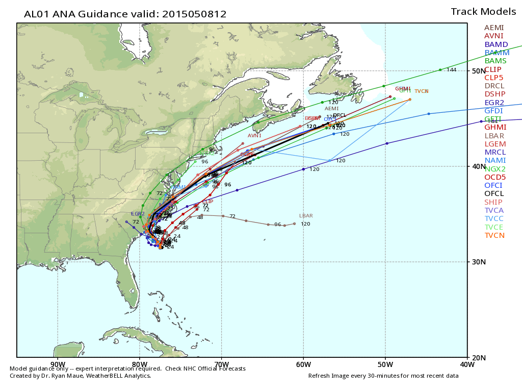
Here’s the latest spaghetti plot (all tropical model paths) from WeatherBell Analytics. Keep in mind that although the track gets pretty close to the Jersey Shore, it will be a weakening low pressure disturbance at that point without high winds. Tropical storm characteristics will disappear shortly after landfall in the Carolinas (likely northern coast of SC):
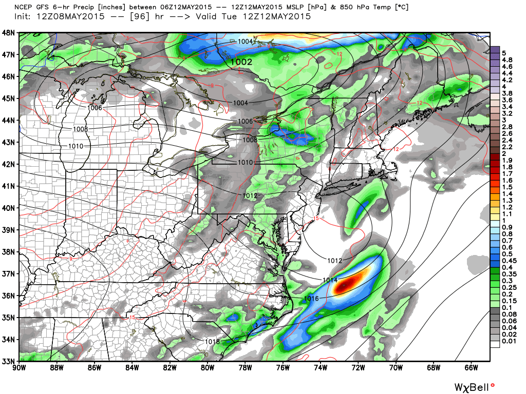
Here’s the latest GFS model showing the position of the low pressure remnants Tuesday AM. 1012mb is considered weak sauce for a low and as you can see, it should be absorbing into the passing frontal energy associated with the upper low in Canada:
In English: Ana will not make direct landfall on the Jersey Shore. Instead, she will make landfall somewhere near the northern coast of South Carolina on ~Sunday. Ana will weaken to just remnants by the time she passes New Jersey and absorbs into a passing cold front—bringing humidity and possibly showers/storms to New Jersey in the Monday-Tuesday period. By Wednesday everything should be cleared out as gorgeous weather moves in behind. The only aspect of Ana that I would pay attention to is surf conditions. Rip currents are possible from now through Tuesday evening so be careful if/when swimming in the “still pretty cold” Atlantic Ocean. Be safe! JC
Satellite image courtesy of NOAA. Model images courtesy of WeatherBell Analytics.
Jonathan Carr (JC) is the founder and sole operator of Weather NJ, New Jersey’s largest independent weather reporting agency. Since 2010, Jonathan has provided weather safety and forecasting services for New Jersey and immediate surrounding areas through the web, social media, and app spaces. Originally branded as Severe NJ Weather (before 2014), Weather NJ is proud to bring you accurate and responsible discussions ahead of high-stakes weather scenarios that impact the garden state. All Weather. All New Jersey.™


LOCAL FORECAST | INTERACTIVE RADAR | LATEST NJ WEATHER ALERTS | WEDDING FORECAST| PRIVACY POLICY
© Copyright 2024 Weather NJ LLC. All Rights Reserved.
Some information that can be found on our website is provided by a private weather station and is not an officially recognized station for weather reporting. Though we always strive to achieve accurate reporting for our own use, it is important that you do NOT depend on the data provided here for any purpose.
