

Oct 3: East Coast Monitors Hurricane Matthew
Model guidance is swinging back and forth between US East Coast impact and a solution that stays just off shore. Let’s break it down..
We’re going to break the future forecasting period into three phases of forecasting uncertainty. First is the immediate phase which is between Matthew’s current location in the N Caribbean Sea and the 25N latitude which has high condifence. The second phase is between 25N and 35N which affects the SE US coast and has moderate confidence. The last phase is from the 35N latitude and northward which still has low confidence. The areas are broken up this way on the following video map:
Scenario A: The would be the furthest W track possible at this time with landfall possible anywhere on the SE US coast as well as higher impact for the Mid-Atlantic and Northeast US. For this to happen the system needs to maintain speed, the ridge needs to stay strong and the US trough needs to time perfectly while swinging across and tilting negative. Such impacts for New Jersey would be in the Sunday time frame give or take a day.
Scenario B: This would be the furthest E track possible at this point in time. There is less variance in the track through the first two phases of latitude than there is N of 35N. This scenario would mean a slower solution (which is a trend we are seeing about half of current model guidance). The ridge would have less influence and the US trough would swing through and bump Matthew out to sea instead of capturing him in…do to a slower solution.

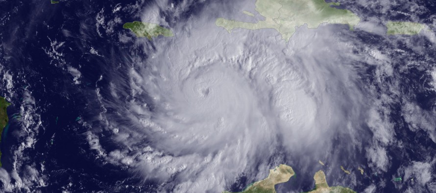
Regardless, the immediate phase (short-term forecast) through the windward passage has high confidence in bringing historical impact to E Jamaica, E Cuba, Haiti and the Bahamas. Rainfall amounts should easily be into the double-digits which could result in life-threatening flooding and mudslides. Winds will be extremely damaging to these island areas as Matthew will likely remain a major hurricane. Coastal flooding will be very bad as well.
The second phase (25N to 35N) represents the mid-range forecasting period. During this phase, which should be between Wednesday and Friday, Matthew will either come very close to SE US landfall or just miss it. Either way, coastal conditions should rapidly deteriorate between E Florida and OBX.
The last phase (N of 35N) represents the long-range forecasting period for Matthew and holds the highest level of uncertainty. A W track (A) here would mean the US trough captures Matthew with a strong ridge to the NE. An E track (B) would mean the US trough swings through beforehand and bumps Matthew out-to-sea.

In English: Matthew is still a major hurricane and will devastate Haiti and surrounding islands, especially the Bahamas. He will then curl around the SE US coast with a landfall possible between E Florida and OBX. After that, he will either come N our way or shoot out to sea. It might be Wednesday before we have a confident handle on Matthew’s behavior after moving N of the 35N parallel. Either way, US East Coast impact is becoming more likely with New Jersey carefully watching the end of this weekend as possible impact time. Nightly updates will continue for tracking and educational purposes. It is still too early to sound alarms but models have trended W today. Have a great night and please be safe! JC
Image of Major Hurricane Matthew by NOAA
Jonathan Carr (JC) is the founder and sole operator of Weather NJ, New Jersey’s largest independent weather reporting agency. Since 2010, Jonathan has provided weather safety and forecasting services for New Jersey and immediate surrounding areas through the web, social media, and app spaces. Originally branded as Severe NJ Weather (before 2014), Weather NJ is proud to bring you accurate and responsible discussions ahead of high-stakes weather scenarios that impact the garden state. All Weather. All New Jersey.™


LOCAL FORECAST | INTERACTIVE RADAR | LATEST NJ WEATHER ALERTS | WEDDING FORECAST| PRIVACY POLICY
© Copyright 2024 Weather NJ LLC. All Rights Reserved.
Some information that can be found on our website is provided by a private weather station and is not an officially recognized station for weather reporting. Though we always strive to achieve accurate reporting for our own use, it is important that you do NOT depend on the data provided here for any purpose.
