

Rain Storm Detected (July 20-22)
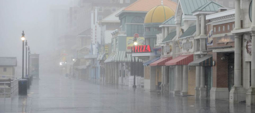
Discussion: An upper level low will track from the northern plains to the KY/TN area over the weekend. This upper level energy will interact with a coastal low pressure system, currently forming over coastal GA. The surface low should track into the Cape May area and then get tugged by the ULL inland towards Philadelphia. This is a hybrid type of storm. It’s not a full-blown tropical cyclone nor a nor’easter. It is a mid-summer disturbance with slight characteristics of both. The warmer waters off the E US will aid in latent heat exchange/evaporational development while the ULL will enhance the extra-tropical air mass clashing. It’s not a catastrophic event but it could generate some flooding problems, especially for barrier islands that drain slower. This hybrid system should produce wet and windy conditions off the ocean extending all the way into E PA. The timing of peak impact looks to be between noon and midnight on Saturday. Expect a mid-to-late Saturday morning build and an early Sunday morning taper. Winds will be the caliber we’ve seen many times before. Unswimmable/Unboatable beaches and inshore/offshore waters obviously but a run-of mill coastal synoptic rain system. Today and tonight (Friday) looks pretty good. Sunday doesn’t look anywhere near as bad as Saturday. You might even see the sun poke through in a few spots. Widely scattered rainfall is still expected Sunday however so I would play it safe and plan for more rain. Just note that some spots may luck out as a small probability.
Friday (July 20) high temperatures should reach the low-to-mid 80s for most. Skies should range from mostly sunny to partly sunny NNJ to SNJ. Winds should be light out of the SE. Overnight lows should range from mid-50s to mid-60s NNJ to SNJ.
Saturday (July 21) high temperatures should reach the mid-70s for most. Skies should be mostly cloudy. Periods of heavy rainfall, possibly with embedded thunderstorms, are likely between noon and midnight (builds up mid-to-late Saturday AM and tapers off by early Sunday AM). ENJ is expected to see more total rainfall than WNJ. I would generally expect 1-2 inches for WNJ and 2-3 inches+ for ENJ, especially the coast (worst case scenario 3-5 inches). Onshore flow conditions should peak between afternoon and evening hours with sustained winds of 15-30mph and gusts up to 40-45mph. Wind direction should rock from SE to S during the peak storm period. Overnight lows should range from lower-60s to upper-60s NNJ to SNJ.
Sunday (July 22) high temperatures should reach the low-to-mid 80s for most. Skies should vary with a mixed bag of sun, clouds and scattered rain. There might be some areas that luck out and stay dry but most areas should plan for rainfall. Winds should be light out of the S/SE. Overnight lows should stay just above 70 for most.
An early look at next week indicates very unsettled conditions. While a few sunny periods are expected (likely earlier in the weekdays), a long-term wet general pattern is also expected (mostly from afternoon-evening rain and thunderstorms). Rainfall is always welcomed given our typical ability to drought in the August-September period. But unfortunately the wet pattern looks to last for at least a week or so. Let’s have another look on Sunday. Have a great weekend and please be safe! JC
Jonathan Carr (JC) is the founder and sole operator of Weather NJ, New Jersey’s largest independent weather reporting agency. Since 2010, Jonathan has provided weather safety and forecasting services for New Jersey and immediate surrounding areas through the web, social media, and app spaces. Originally branded as Severe NJ Weather (before 2014), Weather NJ is proud to bring you accurate and responsible discussions ahead of high-stakes weather scenarios that impact the garden state. All Weather. All New Jersey.™


LOCAL FORECAST | INTERACTIVE RADAR | LATEST NJ WEATHER ALERTS | WEDDING FORECAST| PRIVACY POLICY
© Copyright 2024 Weather NJ LLC. All Rights Reserved.
Some information that can be found on our website is provided by a private weather station and is not an officially recognized station for weather reporting. Though we always strive to achieve accurate reporting for our own use, it is important that you do NOT depend on the data provided here for any purpose.

)