

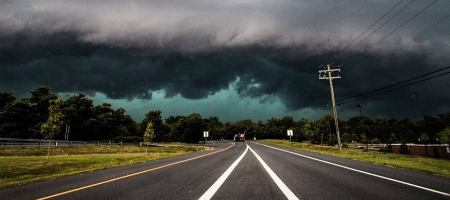
Storms expected tomorrow (July 23)
Today and most of tomorrow will feature increased humidity as temperatures inch closer to 90F. That should allow heat indices to reach the mid-90s if not higher. Diurnal surface heating will destabilize the region through tomorrow afternoon before thunderstorms move into the region. The best I can do on timing right now is between 8PM and 2AM tomorrow night. I’ll try to narrow that if I can by tomorrow morning.
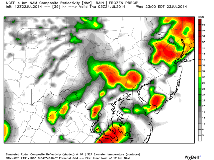
Isolated cases of high winds are possible directly under storm cells but no damaging wind outbreak. There’s not enough projected wind shear for that to happen. Given decent instability however, I think we’re looking at pulsating thunder-cells containing frequent lightning and heavy downpours. A pre-frontal trough will be moving through the region off the tail of weak low pressure. This will be our storm trigger tomorrow afternoon-evening. As it pushes through it will lift the swampy surface air mass into destabilized skies. Once air parcels become saturated at cooler and higher altitudes, nature will do its thing . Here’s some recent short-range guidance (12Z NAM) showing estimated precipitation intensity tomorrow night at 11PM. Most of New Jersey should see impacts within the specified timing window…before the storms move out to sea:
In English: Expect warm and humid conditions today and tomorrow followed by rain and a possible light show tomorrow night. I expect storms to be of a scattered nature rather than widespread (pulsating cells – hit or miss). Some storms could reach severe status (winds > 58mph and/or hail > 1 inch) but strong storms are more likely for the region. Thursday could feature some lingering showers and storms in the morning/day hours but once the cold front it through we’ll dry out and return to below-average July temperatures. That should set up a nice Friday and Saturday. Be safe! JC
Jonathan Carr (JC) is the founder and sole operator of Weather NJ, New Jersey’s largest independent weather reporting agency. Since 2010, Jonathan has provided weather safety and forecasting services for New Jersey and immediate surrounding areas through the web, social media, and app spaces. Originally branded as Severe NJ Weather (before 2014), Weather NJ is proud to bring you accurate and responsible discussions ahead of high-stakes weather scenarios that impact the garden state. All Weather. All New Jersey.™


LOCAL FORECAST | INTERACTIVE RADAR | LATEST NJ WEATHER ALERTS | WEDDING FORECAST| PRIVACY POLICY
© Copyright 2024 Weather NJ LLC. All Rights Reserved.
Some information that can be found on our website is provided by a private weather station and is not an officially recognized station for weather reporting. Though we always strive to achieve accurate reporting for our own use, it is important that you do NOT depend on the data provided here for any purpose.

)