

Tuesday Morning Observations
It’s KABOOMING in NWNJ, KABUSTING in NENJ/CNJ/SWNJ and flooding as expected along the Jersey Coast…
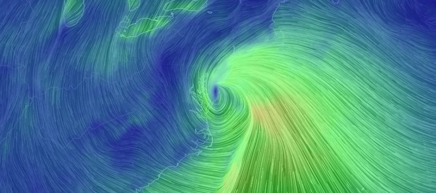
The overall trough that is swinging through the E US has tilted negative a bit faster that what model guidance and live observations suggested heading into the storm. This was listed as a wildcard in our forecasts and it has certainly come into fruition. As a result, the surface low has tracked closer to the east coast and has brought warmer air further into the lower-mid levels of the atmosphere than many were expecting.
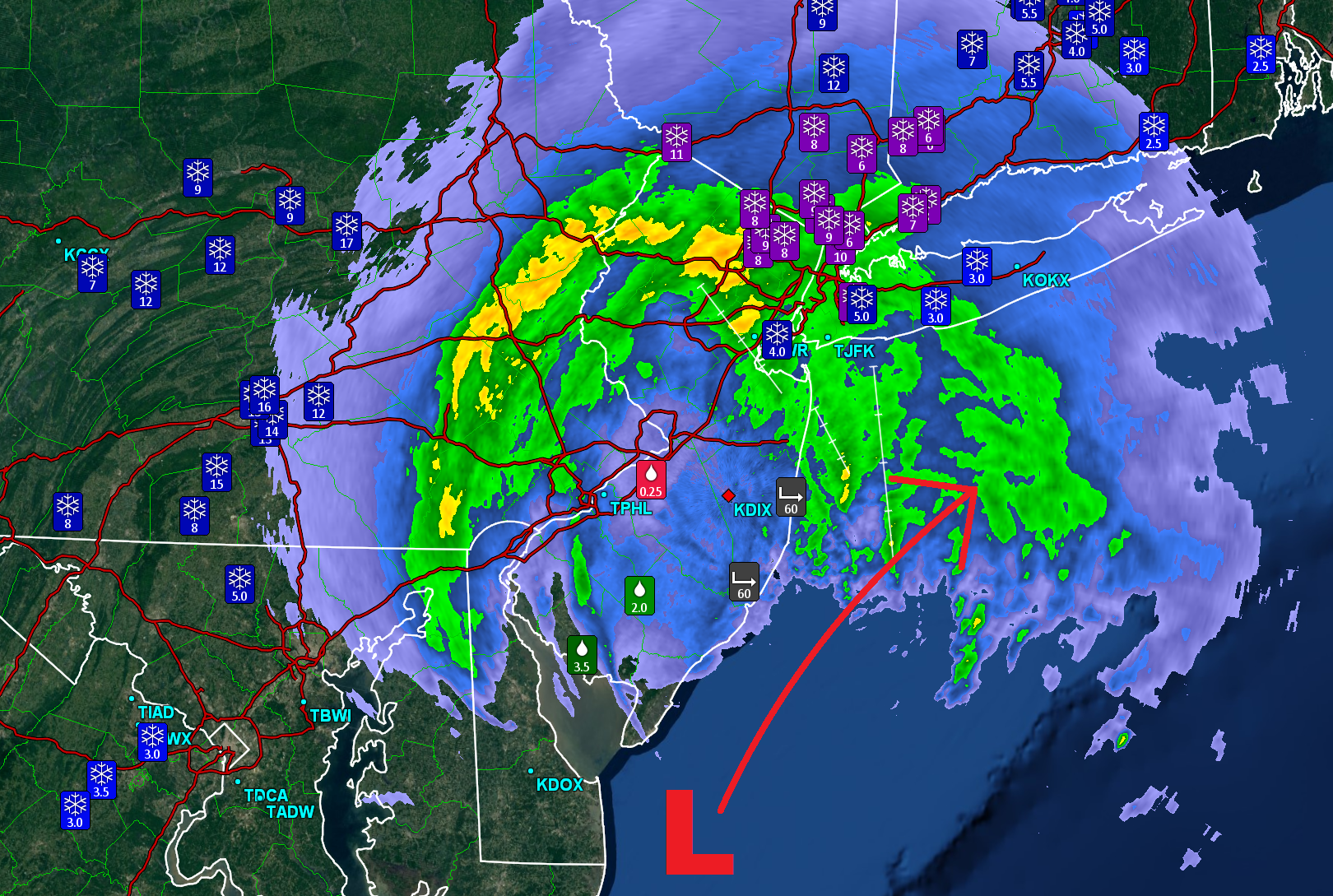
The I-95 corridor and points SE have suffered the greatest snow accumulation loss from this. This was expected for SENJ but not as far NW as it actually panned out. Many points even N and W of the I-95 corridor have seen periods of sleet and rain mix in…even into extreme NNJ. Some areas have inches of sleet with lightning! Here’s the latest radar showing very high rates of precipitation across our region. Note the tucked-in low position:
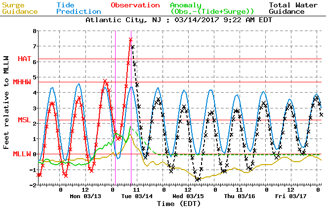
Coastal region forecasts are verifying regarding winds and flooding. I’ve seen a few wind gusts clocked near 60mph along the immediate coast and a few pictures of water in the streets. Here’s the latest tidal guidance which suggests the next immediate tide will possibly reach into major flooding category. Moderate at the very least. Back bays are delayed a bit so from now through noon should be the highest that water levels get. Here’s the latest tidal guidance for Atlantic City:
What to expect moving forward: It will continue to snow hard in NWNJ and PA. Any areas currently still seeing sleet in those areas should change to all snow as the low moves E of NJ resulting in northerly winds. Philly through NYC (the I-95 corridor including SWNJ and NENJ) might go back to all snow but the damage is done on higher accumulations. SENJ should continue to rain but flooding and wind are the highest concerns along the coast. The main storm batch of precipitation should taper off between now and afternoon from SNJ to NNJ. Remnant precipitation associated with the upper-level low/trough however is possible overnight tonight and through tomorrow. It will definitely be cold enough for that to fall as snow but only light additional accumulations would be possible.
When this storm is over in it’s entirety, snow accumulations will disappoint many snow lovers in New Jersey (less NWNJ). On the contrary, this makes snow haters very happy. The flooding and winds that typically come with a nor’easter will have left their mark on the Jersey Shore and areas slightly inland. Power outages are happening and will continue to happen as many tree branches and power lines are iced over. I’ll post another observation article this evening. Everyone have a great day and please be safe! JC
Jonathan Carr (JC) is the founder and sole operator of Weather NJ, New Jersey’s largest independent weather reporting agency. Since 2010, Jonathan has provided weather safety and forecasting services for New Jersey and immediate surrounding areas through the web, social media, and app spaces. Originally branded as Severe NJ Weather (before 2014), Weather NJ is proud to bring you accurate and responsible discussions ahead of high-stakes weather scenarios that impact the garden state. All Weather. All New Jersey.™


LOCAL FORECAST | INTERACTIVE RADAR | LATEST NJ WEATHER ALERTS | WEDDING FORECAST| PRIVACY POLICY
© Copyright 2024 Weather NJ LLC. All Rights Reserved.
Some information that can be found on our website is provided by a private weather station and is not an officially recognized station for weather reporting. Though we always strive to achieve accurate reporting for our own use, it is important that you do NOT depend on the data provided here for any purpose.
