

Unsettled Conditions Expected (May 29-June 1)
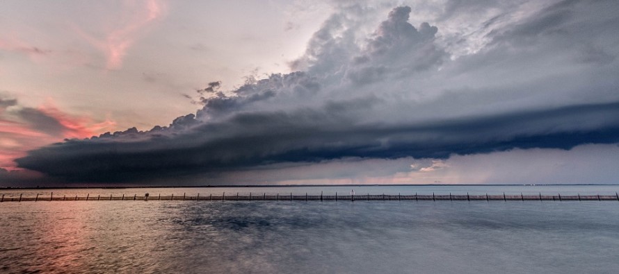
Discussion: High pressure dropping out of SE Canada (over the Atlantic Ocean to our E) will maintain an onshore flow for NJ over the next few days. By the time we get to Thursday-Friday, the high should be to our dead E, switching the general flow from E to S. This should enhance thunderstorm potential for Friday. Saturday through at least Tuesday then looks unsettled and wet as low pressure forms and stalls off Delmarva/OBX, providing a constant feed of cool/raw/wet onshore flow. Hopefully the weekend forecast improves for the official outlook this Thursday evening. I’ve seen better weekends though as of right now.
Tuesday (May 29) high temperatures should reach the mid-to-upper 80s away from the ocean, especially in NNJ. Interior CNJ/SNJ closer to 80. 70s for the immediate coast and much of SNJ. Skies should be partly sunny and humid with isolated afternoon/evening showers and thunderstorms possible. Winds should be light out of the S/SW. Overnight lows should dip into the 60s statewide.
Wednesday (May 30) high temperatures should range in the 70s statewide. Skies should feature a mixed bag of sun and clouds. Winds should be light out of the E/SE. Overnight lows should range from mid-50s to mid-60s NNJ to SNJ.
Thursday (May 31) high temperatures should range from about 70-75 NNJ to SNJ. Skies should be mostly cloudy with a few showers (maybe boomers) around. Winds should be light out of the SE. Overnight lows should fall into the 60s statewide.
Friday (June 1) high temperatures should reach well into the 80s away from the ocean. Interior CNJ/SNJ could take a run at 90. Immediate coastal areas should top out in the upper-70s/lower-80s. Skies should be partly sunny and humid with a chance of afternoon/evening showers and thunderstorms. Winds should be light out of the S. Overnight lows might struggle to dip below 70 in some locations but the entire state should stay above the low-60s.
An early look at the weekend indicates unsettled and wet conditions for both Saturday and Sunday with highs topping out in the upper-60s/lower-70s. Such conditions could last into Tuesday of next week. Let’s take another look on Thursday evening. Have a great week and please be safe! JC
Jonathan Carr (JC) is the founder and sole operator of Weather NJ, New Jersey’s largest independent weather reporting agency. Since 2010, Jonathan has provided weather safety and forecasting services for New Jersey and immediate surrounding areas through the web, social media, and app spaces. Originally branded as Severe NJ Weather (before 2014), Weather NJ is proud to bring you accurate and responsible discussions ahead of high-stakes weather scenarios that impact the garden state. All Weather. All New Jersey.™


LOCAL FORECAST | INTERACTIVE RADAR | LATEST NJ WEATHER ALERTS | WEDDING FORECAST| PRIVACY POLICY
© Copyright 2024 Weather NJ LLC. All Rights Reserved.
Some information that can be found on our website is provided by a private weather station and is not an officially recognized station for weather reporting. Though we always strive to achieve accurate reporting for our own use, it is important that you do NOT depend on the data provided here for any purpose.

)