

Unsettled Week Expected (Feb 13-17)
An active February pattern continues this week. Let’s break it down…
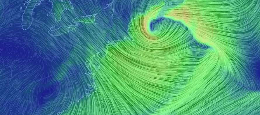
Disco: As far as the Wednesday-Thursday system, there still exists two major players on the field. This period of winter storm potential was first identified last week with a positive-phased PNA and a little bit of Greenland blocking. This traditionally supports a winter storm and trough over the E US however a favorable trough axis has yet to get its act together on model guidance. The two players are in the form of shortwaves, one on the northern stream and one on the southern stream. The northern stream has been modeled faster and therefore crushes out the later-arriving southern stream energy before it can produce for us. Therefore the two waves phase late and deliver more disruptive weather for coastal New England with very little impact to NJ just beforehand. However, there have been signs of improvements in the last few days as to timing. The southern stream has caught up to the northern stream some and in-return, the northern wave is digging a bit further SW. It’s closer to a hit but still a miss. So the general theme right now is that conditions are becoming more favorable but not fast enough to deliver for NJ this Wednesday-Thursday. I’m 90% there in throwing the towel but I’d like to see today and tonight’s model runs before fully committing.
Monday (Feb 13) high temperatures should reach the upper-30s/lower-40s. Skies should be mostly sunny. Winds should be strong and gusty out of the NW but should subside through PM hours. Lake-effect flurries cannot be ruled out, especially for NNJ. Overnight lows should drop into the 20s for most. NNJ elevations could dip into the teens. Winds should continue to subside overnight.
Tuesday (Feb 14) high temperatures should reach the low-to-mid 40s. Skies should be mostly sunny. Winds should be light-to-breezy out of the SW. Overnight lows should fall into the 20s for interior locations (especially for NNJ elevations) and 30s for everyone else/along the coast.
Wednesday (Feb 15) high temperatures should struggle to escape the 30s for NNJ. CNJ and SNJ should reach into the low-to-mid 40s. Skies should be mostly cloudy. Right now there is a 20% chance of snow region-wide for Wednesday (see above disco). Winds should be breezy-to-gusty out of the W/NW. Overnight lows should fall into the teens for NNJ elevations and 20s for the rest of NJ.
Thursday (Feb 16) high temperatures should struggle to escape the 30s statewide. Skies should start mostly cloudy but improve throughout the day. Right now there is a 10% chance of snow region-wide for Thursday (see above disco). Winds should become breezy-to-gusty out of the NW behind the system, regardless of earlier or later phase. Overnight lows should fall into the teens and 20s again.
Friday (Feb 17) high temperatures should struggle to escape the 30s for NNJ. The rest of New Jersey should reach into the low-to-mid 40s. Skies should be partly-to-mostly sunny. Winds should be breezy out of the W/NW. Overnight lows should fall into the 20s and 30s with NNJ elevations possibly dipping into the teens.
An early look at the weekend doesn’t look to bad. As of now it looks dry and sunny with temperatures moderating into the 50s for highs. Should feel nice after the colder week, especially with the increasing sun angle. Those milder conditions could very-well last into next week. Let’s revisit the weekend mid-week. I’ll watch the Wed-Thurs winter storm possibility for one more day but right now, meh… Be safe! JC
Jonathan Carr (JC) is the founder and sole operator of Weather NJ, New Jersey’s largest independent weather reporting agency. Since 2010, Jonathan has provided weather safety and forecasting services for New Jersey and immediate surrounding areas through the web, social media, and app spaces. Originally branded as Severe NJ Weather (before 2014), Weather NJ is proud to bring you accurate and responsible discussions ahead of high-stakes weather scenarios that impact the garden state. All Weather. All New Jersey.™


LOCAL FORECAST | INTERACTIVE RADAR | LATEST NJ WEATHER ALERTS | WEDDING FORECAST| PRIVACY POLICY
© Copyright 2024 Weather NJ LLC. All Rights Reserved.
Some information that can be found on our website is provided by a private weather station and is not an officially recognized station for weather reporting. Though we always strive to achieve accurate reporting for our own use, it is important that you do NOT depend on the data provided here for any purpose.

)