

Zero Tropical Activity? Learn Why
Atlantic Ocean surface temperatures are heating up. Latest buoy observations indicate a range of 68F near Long Island to 76F off the Delmarva Peninsula despite recent upwelling along the coast. We also have traditional high pressure tumbling between Bermuda and the Azorean Islands. Remember, high pressure systems are anti-cyclonic in the northern hemisphere featuring clockwise rotation. This setup creates a hurricane highway from the Cape Verde African region to the US east coast. So why no tropical activity with such a promising setup? We just dealt with an early start to the season with Arthur. What gives?
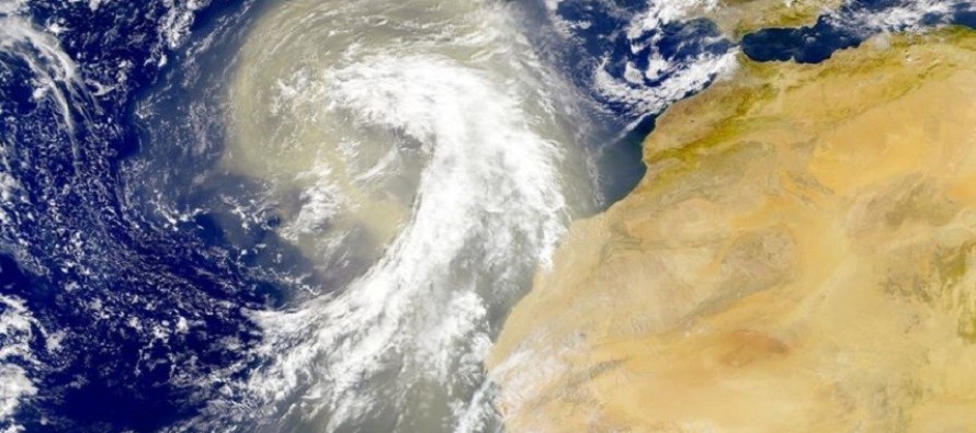
The Sahara Desert in Africa is what gives. Winds are kicking sand up which drys the atmosphere. Tropical cyclones (including tropical storms and hurricanes) prefer a moist environment for development. So even though we have an ideal temperature and track setup, we’re lacking moisture in the most crucial phase of tropical development. Lets look at some global model guidance. First we have the GFS for today, hour zero:
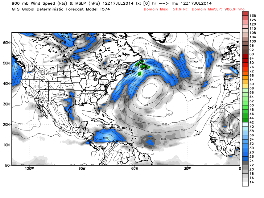
See that 1030mb high pressure system ENE of Bermuda? That helps power the entire anti-cyclonic (clockwise) flow in the northern Atlantic Ocean. That’s the track I’m talking about that places tropical systems coming off Africa onto a conveyor belt towards the US. Notice there is only a weak low pressure system in western Africa. That’s being hindered due to the dry and sandy atmospheric conditions (as seen on satellite above). When I scroll through each slide of this model for the next 7 days or so, there is very little change. Everything slowly revolves around that Bermuda/Azores high without tropical development. Again, this is due to the sandy and dry influence of the Sahara. Let’s skip to Friday, July 25 on the GFS:
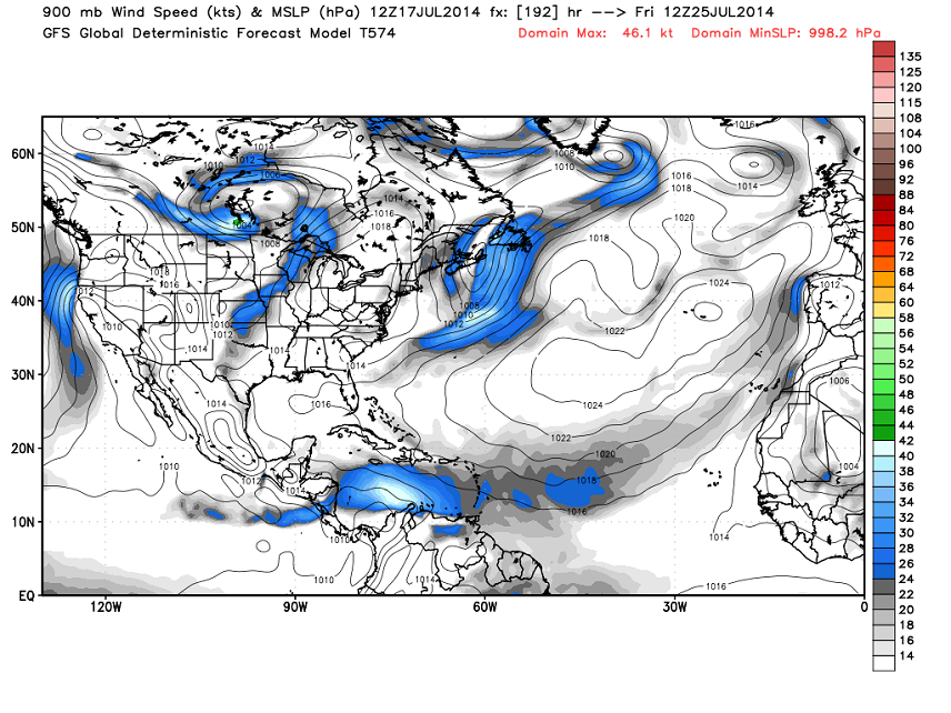
Other than the high pressure gravitating towards the Azorean Islands, there is little change at all. There still exists ideal ocean temps and track setup but hindered development off western Africa. With all of this being said, I think we’re hurricane free on the east coast as far as I can see. Gulf of Mexico/SE US development is always possible in the shorter-term but nothing is currently modeled.. Lets revisit this in about 7-10 days and see if western African development conditions have improved. In the meantime, be safe! JC
Image Sources: NASA and WeatherBell Analytics
Jonathan Carr (JC) is the founder and sole operator of Weather NJ, New Jersey’s largest independent weather reporting agency. Since 2010, Jonathan has provided weather safety and forecasting services for New Jersey and immediate surrounding areas through the web, social media, and app spaces. Originally branded as Severe NJ Weather (before 2014), Weather NJ is proud to bring you accurate and responsible discussions ahead of high-stakes weather scenarios that impact the garden state. All Weather. All New Jersey.™


LOCAL FORECAST | INTERACTIVE RADAR | LATEST NJ WEATHER ALERTS | WEDDING FORECAST| PRIVACY POLICY
© Copyright 2024 Weather NJ LLC. All Rights Reserved.
Some information that can be found on our website is provided by a private weather station and is not an officially recognized station for weather reporting. Though we always strive to achieve accurate reporting for our own use, it is important that you do NOT depend on the data provided here for any purpose.
