

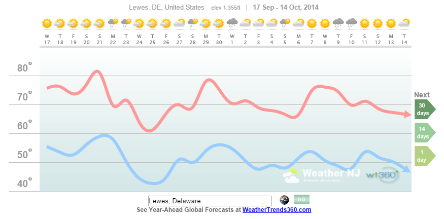
The September 21-26 period in the Delaware Bay/Lewes Yacht Club region is starting to come into focus on long range weather model guidance. The proprietary algorithms of weathertrends360 indicate just a small chance of light rain showers Monday into Tuesday but aside from that, a decent week for sailing. Temperatures should be cooler than average once the front moves through. Here’s a 30-day projected graph of temperatures and general conditions:
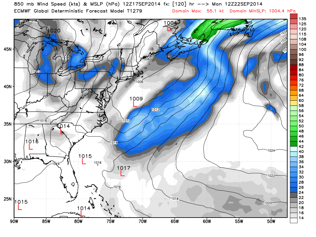
Long range global operational guidance from the ECMWF reflects the light rain idea with an almost dry frontal passage on Monday. An area of weak low pressure will be positioned a few hundred miles ESE of the Delmarva Peninsula which could aid the showers ahead of the front. That places the Delaware Bay in the NW quadrant of the low pressure systems cyclonic flow. Winds would then be 14-18 knots out of the N/NE as indicated by this WeatherBell model image:
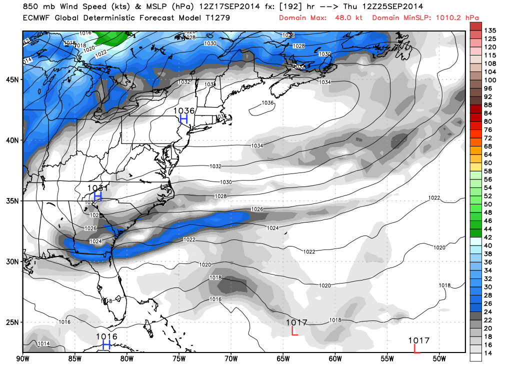
Tuesday through Friday remain dominated by anti-cyclonic high pressure flow across the region. Winds should be light at 5-10 knots off the ocean as onshore flow establishes itself to our north. Increased clouds are always a possibility with an easterly component but there should still be plenty of sun. Here’s another model image from WeatherBell showing high pressure in control for Thursday, September 25:
One thing’s for sure…we’re in for a nice stretch of beautiful weather. We should moderate in temperatures this weekend before dropping below average after the nuisance frontal passage Monday into Tuesday. There’s nothing else showing on model guidance but fair weather and light winds under the influence of more high pressure. I’ll continue to tweak this forecast as the race approaches. Be safe! JC


Jonathan Carr (JC) is the founder and sole operator of Weather NJ, New Jersey’s largest independent weather reporting agency. Since 2010, Jonathan has provided weather safety and forecasting services for New Jersey and immediate surrounding areas through the web, social media, and app spaces. Originally branded as Severe NJ Weather (before 2014), Weather NJ is proud to bring you accurate and responsible discussions ahead of high-stakes weather scenarios that impact the garden state. All Weather. All New Jersey.™