
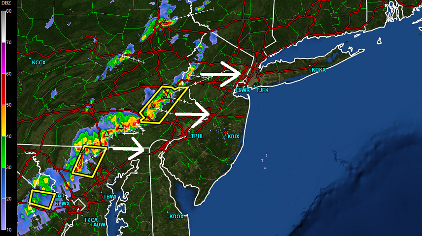
Thunderstorms have begun moving into NWNJ but are looking stronger for points south. A decent amount of storm energy is currently heading towards the Philadelphia region. The actual line of precipitation is actually quite thin. That means a short period of heavy rainfall despite frequent lightning and wind gusts. Multiple Severe Thunderstorm Warnings have been triggered by the National Weather Service in PA for this line of storms for both wind and hail so be careful! I expect this intensity to persist while crossing the Delaware River into New Jersey but weaken before reaching coastal/SENJ regions. It should all be gone by midnight or shortly after. Here’s the current high-resolution radar:
Please be safe! JC


Jonathan Carr (JC) is the founder and sole operator of Weather NJ, New Jersey’s largest independent weather reporting agency. Since 2010, Jonathan has provided weather safety and forecasting services for New Jersey and immediate surrounding areas through the web, social media, and app spaces. Originally branded as Severe NJ Weather (before 2014), Weather NJ is proud to bring you accurate and responsible discussions ahead of high-stakes weather scenarios that impact the garden state. All Weather. All New Jersey.™