

Low pressure is dragging a cold front through the region today. It is just now pushing the last of the rainfall offshore. Behind the cold front, are strong and gusty winds out of the NW in correlation with the back-side (W side) of the low’s cyclonic flow. This flow will be partially assisted by the anti-cyclonic flow of the approaching high pressure system further to the west. This is the latest NAM showing an axis of tight isobars at 2AM tomorrow (Tuesday) morning:
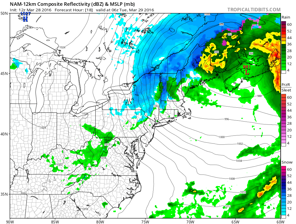
With that said, strong NW winds are possible for New Jersey between later this evening and tomorrow night. I would expect at least sustained winds of 15-25mph with gusts to 40mph+. Given the axis of the isobars along with proximity, the higher elevations of NWNJ are subject to the greatest winds while the SENJ coast is subject to the lesser winds. Don’t get be wrong though, the entire state should feel and hear noticeable winds overnight tonight.


In English: Rain is wrapping up. Winds should pick up between afternoon and evening hours. Expect strong gusts out of the NW overnight and into tomorrow. Winds should gradually subside tomorrow as afternoon hours transition into evening hours. We then start our moderation towards mild temperatures for Wednesday and even warmer temperatures for Thursday. Be safe! JC
I took the above image when I lived in Maryland. It was a windy night.


Jonathan Carr (JC) is the founder and sole operator of Weather NJ, New Jersey’s largest independent weather reporting agency. Since 2010, Jonathan has provided weather safety and forecasting services for New Jersey and immediate surrounding areas through the web, social media, and app spaces. Originally branded as Severe NJ Weather (before 2014), Weather NJ is proud to bring you accurate and responsible discussions ahead of high-stakes weather scenarios that impact the garden state. All Weather. All New Jersey.™