

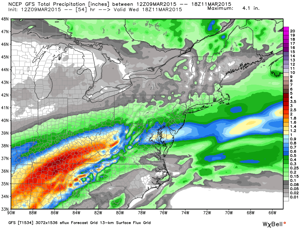
A low pressure disturbance will transfer to the coast well to our south tomorrow through Wednesday. It will bring light to moderate rainfall with it Tuesday afternoon through Wednesday morning. Current model guidance favors SNJ with more rainfall than NNJ. Expect in general, ~a tenth of an inch in NNJ, ~a half inch for CNJ and ~an inch in extreme SNJ. Temperatures should hold in the mid-to-upper 40s throughout the rainfall. Here’s the latest GFS showing total precipitation through 1PM Wednesday which is when it should wrap up by:
In English: It’s going to rain tomorrow into Wednesday. Rain could start as early as noon tomorrow and taper off as late as noon on Wednesday with the heaviest rainfall occurring during overnight hours. SNJ is favored for more rainfall than CNJ and NNJ. Be safe! JC


Jonathan Carr (JC) is the founder and sole operator of Weather NJ, New Jersey’s largest independent weather reporting agency. Since 2010, Jonathan has provided weather safety and forecasting services for New Jersey and immediate surrounding areas through the web, social media, and app spaces. Originally branded as Severe NJ Weather (before 2014), Weather NJ is proud to bring you accurate and responsible discussions ahead of high-stakes weather scenarios that impact the garden state. All Weather. All New Jersey.™