A cold front will move through the region late Saturday night/early Sunday and deliver another shot of cold air to the region. High temperatures on Sunday might only reach the 50s with overnight lows then dropping well into the 30s (40s for coastal areas). Here’s the latest GFS showing surface temperatures at 8AM Sunday morning:
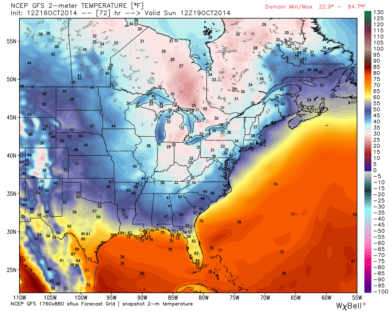
The frontal passage should be mostly dry with only a few isolated sprinkles here and there throughout the region. It’s about that time for temperatures to drop in accordance with seasonal averages anyway. This air mass might seem a little more relevant however, given the above average temperature anomalies we saw earlier this week. Hurricane Gonzalo will hit Bermuda pretty hard in the next 24-36 hours. The only effect for the east coast will be intensified surf/rip currents. The full weekend outlook will be posted tomorrow. Be safe! JC


Jonathan Carr (JC) is the founder and sole operator of Weather NJ, New Jersey’s largest independent weather reporting agency. Since 2010, Jonathan has provided weather safety and forecasting services for New Jersey and immediate surrounding areas through the web, social media, and app spaces. Originally branded as Severe NJ Weather (before 2014), Weather NJ is proud to bring you accurate and responsible discussions ahead of high-stakes weather scenarios that impact the garden state. All Weather. All New Jersey.™