
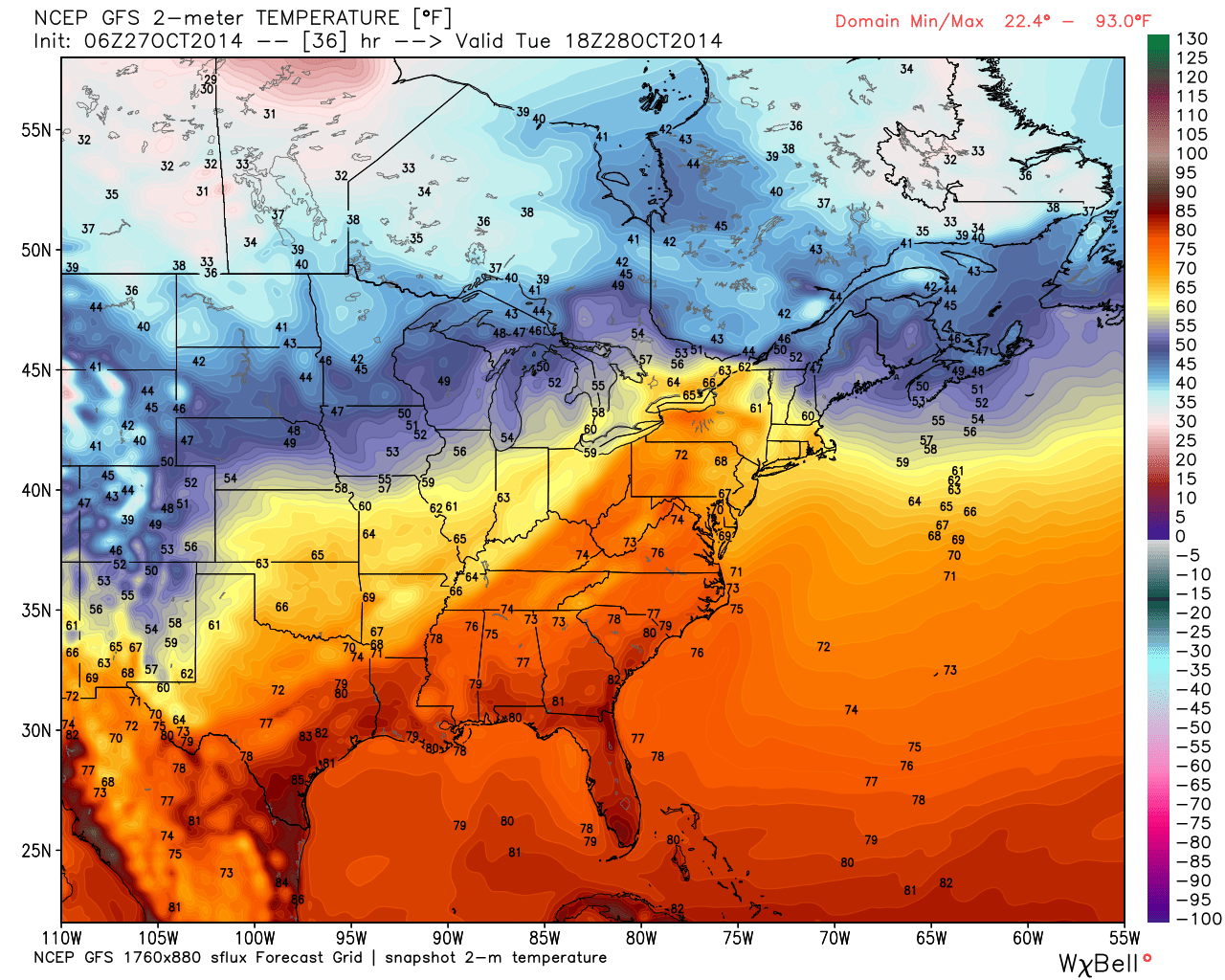
I don’t know about you but I’m enjoying every minute of the warmer Fall we’ve been having. As we further transition towards Winter, we’ll see more and more temperature fluctuations. Each cold spell will last a little bit longer as warmer periods equally shrink. The warmer trend (with shorter cold spells) should continue through early November but for now lets look at the short-term. This is the GFS model showing lower-level temperatures tomorrow afternoon (Oct 28). As you can see, temperatures will be above average for this time of year. Interior NJ might even surge into the 70s.
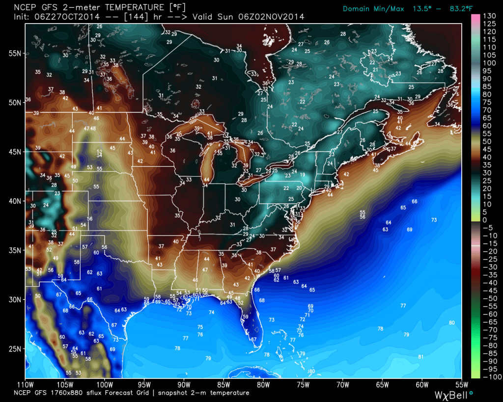
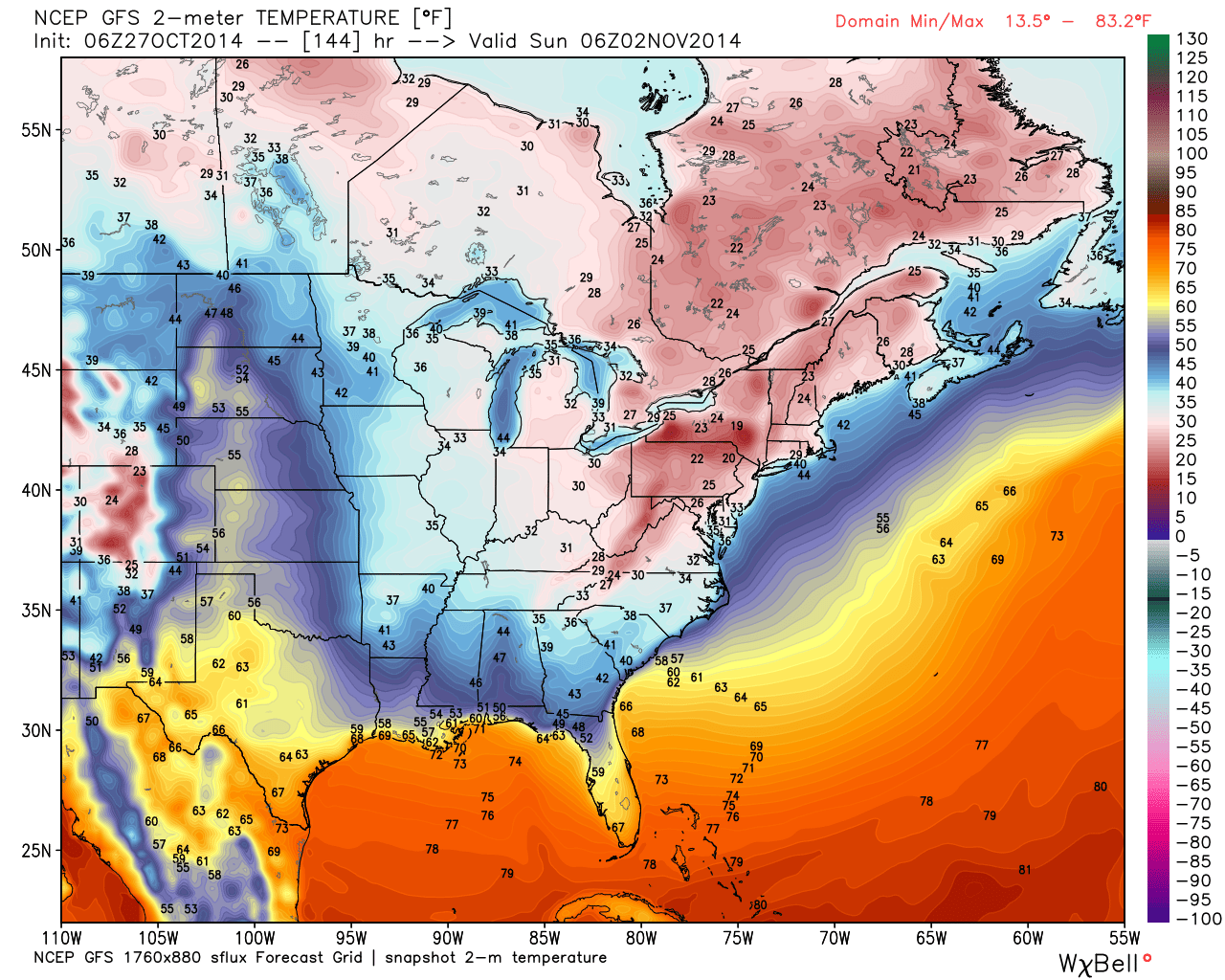
Now lets fast-forward to early Sunday morning. The same GFS model is indicating temperatures in the 20s for most of New Jersey. That’s a 40-50 degree difference in temperature between tomorrow and Sunday. A low pressure disturbance will be dipping down from Canada into NY State on Friday and then lifting out over Maine by Sunday. It’s mostly a miss to the north of New Jersey but back-end NW winds around strong cyclonic flow will be the driving force behind the temperature drop. While extremely unlikely, some tail end snow could be possible away from the ocean. We’ll see…
After the cold snap, we should moderate back to mild temperatures with again, longer-lasting cold shot interruptions through November. By December we should be ready to start tracking snow. Be safe! JC


Jonathan Carr (JC) is the founder and sole operator of Weather NJ, New Jersey’s largest independent weather reporting agency. Since 2010, Jonathan has provided weather safety and forecasting services for New Jersey and immediate surrounding areas through the web, social media, and app spaces. Originally branded as Severe NJ Weather (before 2014), Weather NJ is proud to bring you accurate and responsible discussions ahead of high-stakes weather scenarios that impact the garden state. All Weather. All New Jersey.™