

Dec 11: White Christmas Possibilities for Dec 24-25 2014
By 👤Weather NJ
We are at the point in the month of December where I think it is appropriate to begin the White Christmas speculation that will go full throttle over the next 2 weeks. Needless to say for New Jersey it really depends on where you are. If you are north of route 80 the odds of a white Christmas (either snow on the ground or actually falling and leaving an accumulation can run from 25 percent in southeastern areas of that zone to as high as 40 percent or more in the Northwest corner. As we go south to say route 195 the odds decrease to 10 to 25 percent from south to north and from east to west. South of route 195 it is probably under the 10 percent range thanks to the proximity of the warm ocean and given that we are so early in the winter season, for those areas it needs to be almost perfect for it to happen.
That being said let us examine what will be going on over the next 2 weeks and you may be happy to see that the awaited pattern change is about to take place. Of course it is important to remember that at this stage do not focus so much on the specifics. Rather focus on the overall trends that we will be seeing and we will worry about the specifics in the short range.
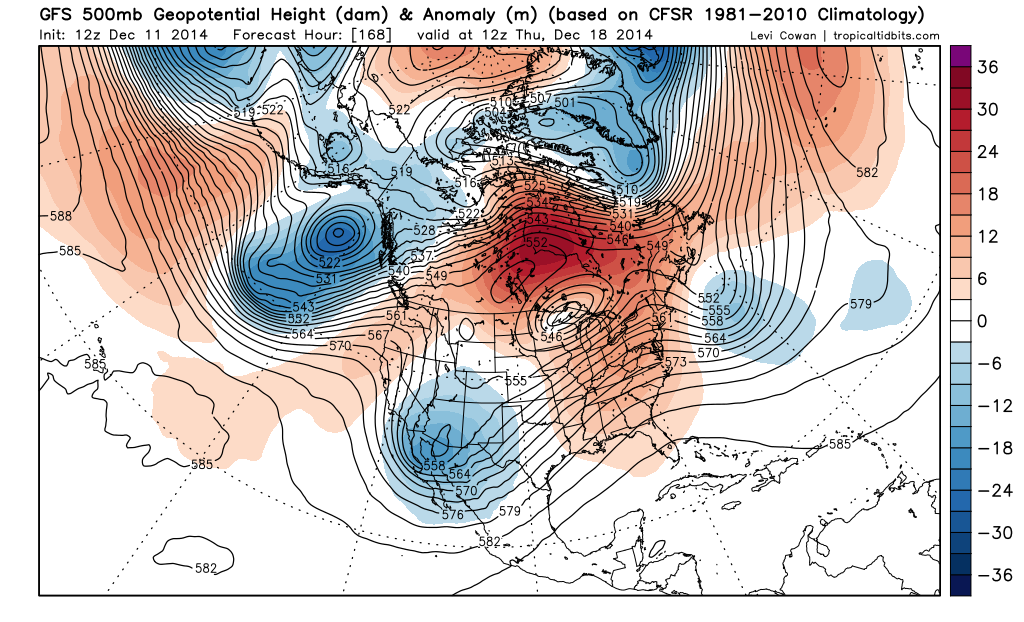
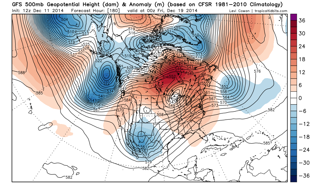
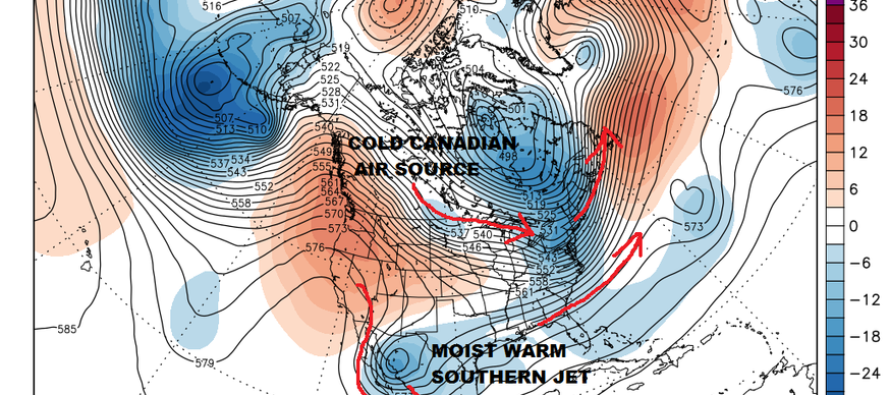
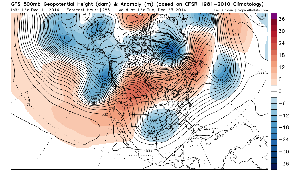
The first 2 maps above show us the jet stream pattern at 18,000 ft for December 18th and 19th. Notice a couple of things right off the bat. There is what we call a split flow developing or 2 distinct jet stream in play here. The one in the north being driven by a strong low pressure system over the Great Lakes which is the part of the jet that is controlling the delivery of cold air. The second jet stream is the one in the south being driven by the low in the Pacific and weather systems that are driving into California and then progress eastward in the southern branch. Both jets tend to merge together when they get to the east coast
Now the trick here is to get these 2 jets to interact in such a way where the northern jet brings down cold air and the southern jet brings up the warmer moist air. It is a very delicate balance at play because either jet dominating will result in either too much cold air and hence it will overwhelm the flow and keep things south. Or if the south is too strong it makes for a storm that tracks to the west and brings up warm air and mostly rain for the east coast and northeast.
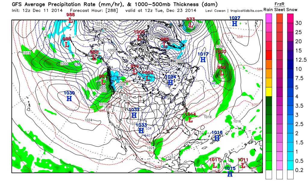
Now let’s take a look at what this all means at the surface. Indeed that Jet Stream pattern does produce a storm of the southeast coast of the United States and takes it northward just offshore. The delicate balance between the northern and the southern branches of the jet stream seem to be aligned in a somewhat favorable position for something to happen.
However it is important to remember that this going to change quite a bit over the next few days. If models begin to sense that one branch may be more important than the other they will adjust accordingly. Remember if the south is too strong it will be a track to our west and rain because the flow will be more southerly along the east coast. If the north is too strong then the jet will be flatter and more westerly which is not favorable for a low to develop at all or if it does it its too flat and weak and passes offshore
The imporant thing to focus on here is that the jet stream pattern is changing and that there will be a stream of cold air coming down from the north and at the same time there will be an active southern branch developing to bring along weather systems and some moisture. How they ultimately come together remains to be seen. However we can say that there is a possibility here that there could be some snow action for somebody and the white Christmas fantasy remains a possibility. Remember also that the whole southern hemisphere is in summertime and they spend their Christmas’s on the beaches of Brazil!
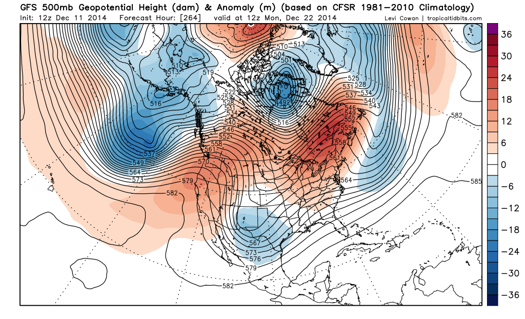
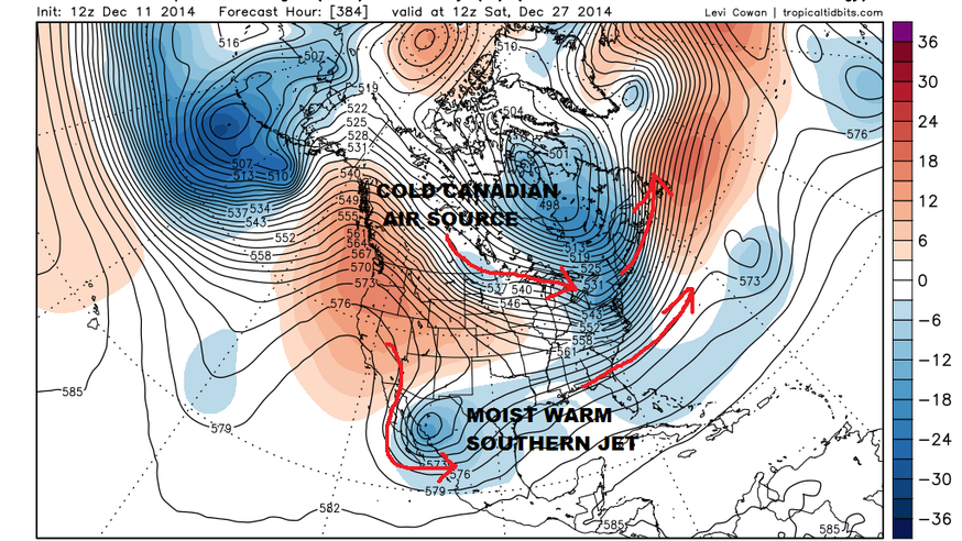
By the way if the long range is correct this is the pattern that shapes up to take hold the day after Christmas and probably is going to last into the beginning of January. Winter is coming!!!
In English: Meteorologist Joe Cioffi is sensing a winter storm setup in the week leading up to Christmas and will keep his finger on the pulse of jet stream interaction over the next few weeks. It’s looking cold and snowy to finish December.
Joe Cioffi has been a meteorologist in the New Jersey/New York area for the last 30 years on NJ 101.5 radio and WPIX TV in New York. You can follow him on facebook (facebook.com/meteorologistjoecioffi) and Twitter (@joecioffi) or visit his website at www.meteorologistjoecioffi.com.
By 👤Weather NJ


LOCAL FORECAST | INTERACTIVE RADAR | LATEST NJ WEATHER ALERTS | WEDDING FORECAST| PRIVACY POLICY
© Copyright 2026 Weather NJ LLC. All Rights Reserved.
Some information that can be found on our website is provided by a private weather station and is not an officially recognized station for weather reporting. Though we always strive to achieve accurate reporting for our own use, it is important that you do NOT depend on the data provided here for any purpose.
