

Aug 6: Rain Storm Update
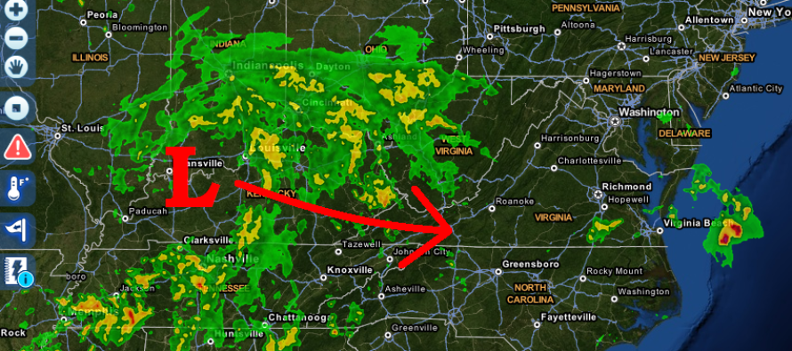
Widespread synoptic rainfall is already organizing around a low pressure disturbance moving into W. Kentucky. It should reach New Jersey as early as later this evening but should clear out before Saturday. This leaves just a single potential washout day for Friday but not for all.
Only SNJ and parts of CNJ should see rainfall from this system. There will be a very sharp precipitation cutoff on the northern side of this system as it slides by to our south. With that said, I would imagine this cut-off line to be anywhere between the Atlantic City Expressway and I-78. To the north of that, you might not see a single drop. To the south of that, expect between .25-1.25 inches of rain with extreme SNJ seeing the highest range of such. While the storm will be just off our coast on Saturday and Sunday, I believe that it will be too far out to sea to bring rain into the coast. I would, however, expect stiff winds out of the N as well as roughed-up surf.
In English: Expect rain later this evening through tomorrow evening/very early Saturday AM. Rain should at least reach the AC Expressway but could possibly push as far north as I-78 (absolute max). Most likely will push to about the ~I-195 latitude. Everything should clear for a dry Saturday and Sunday but not without some light-to-moderate wind out of the N and possibly dangerous surf conditions. Be safe! JC
Jonathan Carr (JC) is the founder and sole operator of Weather NJ, New Jersey’s largest independent weather reporting agency. Since 2010, Jonathan has provided weather safety and forecasting services for New Jersey and immediate surrounding areas through the web, social media, and app spaces. Originally branded as Severe NJ Weather (before 2014), Weather NJ is proud to bring you accurate and responsible discussions ahead of high-stakes weather scenarios that impact the garden state. All Weather. All New Jersey.™


LOCAL FORECAST | INTERACTIVE RADAR | LATEST NJ WEATHER ALERTS | WEDDING FORECAST| PRIVACY POLICY
© Copyright 2024 Weather NJ LLC. All Rights Reserved.
Some information that can be found on our website is provided by a private weather station and is not an officially recognized station for weather reporting. Though we always strive to achieve accurate reporting for our own use, it is important that you do NOT depend on the data provided here for any purpose.
