

Dec 11: Cold Temperatures Detected!
After next week’s ~Tuesday rain and ~Thursday-Friday coastal low potential, temperatures are expected to plunge below-average for next weekend. This, IMO will be a transient cold shot but the coldest and longest yet of meteorological winter (began Dec 1). I expect it to last from next Friday through Monday.
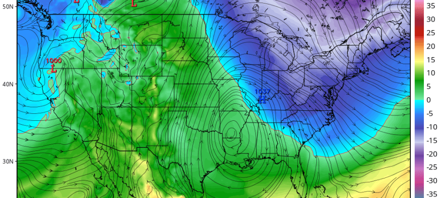
Here is some model guidance showing 850mb temperatures for Friday, Saturday and Sunday (all 18Z times):

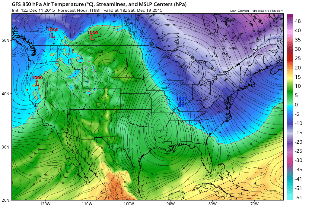
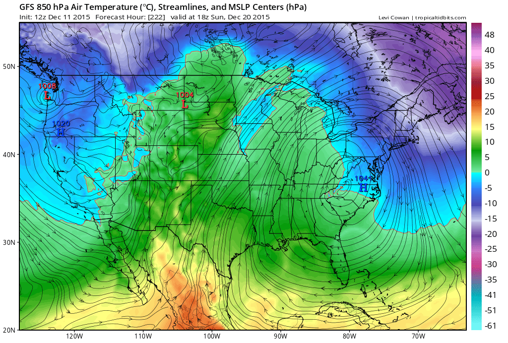
The main driver of this will be high pressure that slowly gravitates from Texas through the SE US. If you notice, Saturday’s temp profile indicates a transient +PNA/-AO/-NAO pattern (ridge for W. US/trough for E. US) which makes since given the current modeled teleconnections and current pattern across the Pacific, Arctic and sub-tropical regions. The cold will likely leave as fast as it comes in after next weekend but then set up another cold air mass invasion for Christmas Weekend. With that said, I think we should prepare for a roller coaster of temperatures fluctuating between “very mild for winter” and “cold enough for snow” through the end of December. The writing is on the wall.
Specific daily conditions will obviously have to be monitored in the shorter term. Let’s get through Tuesday’s rain, next Thursday-Friday’s coastal, and next weekends cold shot first before we get too crazy about the holidays.
In English: Warm weekend, rain on Tuesday, rain/possible snow for elevations next Thursday-Friday and then a very cold weekend. Be safe! JC
Model images retrieved from Tropical Tidbits.
Jonathan Carr (JC) is the founder and sole operator of Weather NJ, New Jersey’s largest independent weather reporting agency. Since 2010, Jonathan has provided weather safety discussion and forecasting services for New Jersey and surrounding areas through the web and social media. Originally branded as Severe NJ Weather (before 2014), Weather NJ is proud to bring you accurate and responsible forecast discussion ahead of high-stakes weather scenarios that impact this great garden state of ours. All Weather. All New Jersey.™ Be safe! JC


LOCAL FORECAST | INTERACTIVE RADAR | LATEST NJ WEATHER ALERTS | WEDDING FORECAST| PRIVACY POLICY
© Copyright 2026 Weather NJ LLC. All Rights Reserved.
Some information that can be found on our website is provided by a private weather station and is not an officially recognized station for weather reporting. Though we always strive to achieve accurate reporting for our own use, it is important that you do NOT depend on the data provided here for any purpose.
