

Dec 30: Weekend Storm Update
After reviewing the latest model guidance, there is a general consensus that low pressure will form in the southern US this weekend and take a track known as a Great Lakes Cutter (GLC)—possibly bringing snow, sleet, and/or freezing rain to start but quickly changing to all rain. Precipitation could start as early as Saturday evening and clear as late as M0nday morning. There’s still some wiggle room to trend colder or warmer but this is what it looks like right now. It all comes down to blocking high pressure to the north and the speed of the northern stream of energy. If the northern stream is slower it will cut further west. If faster, it could transfer to the coast in what’s called a miller-B storm. Regardless, we’re cold (below average temperatures) until Saturday and cold air moves in right behind this system for next week. Let’s look at the models:
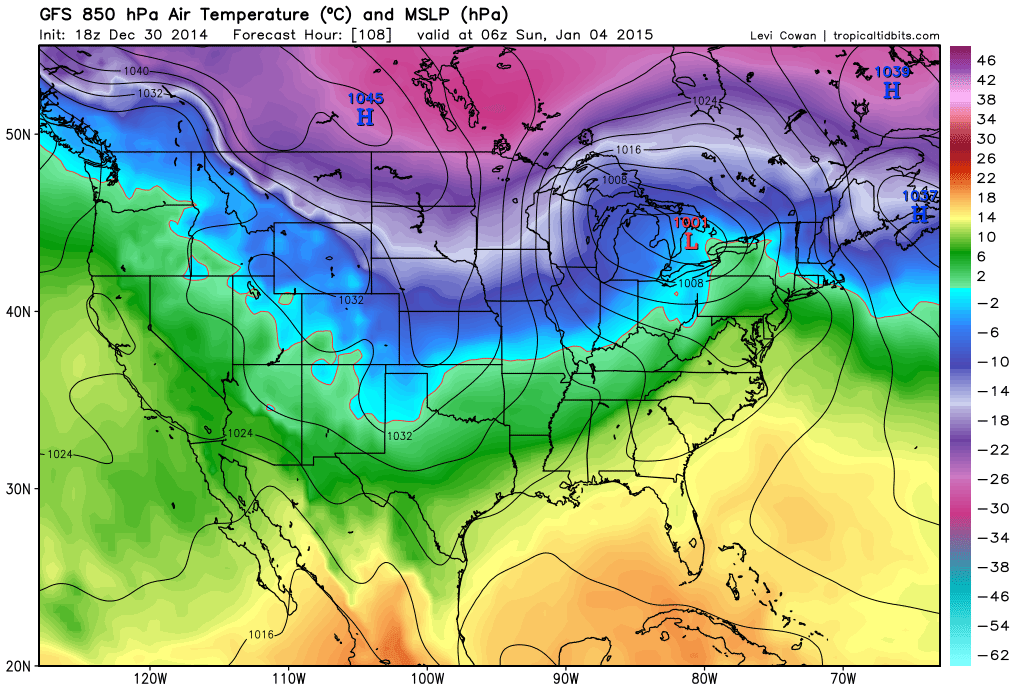
First up is the 18Z American GFS. As you can see the low tracks into the eastern Great Lakes placing New Jersey and most of the mid-Atlantic US in the warm sector. While some interior areas, especially higher elevations, might start as wintry precipitation, it would all go over to rain. Colder temperatures would return but only after the precipitation moves out.
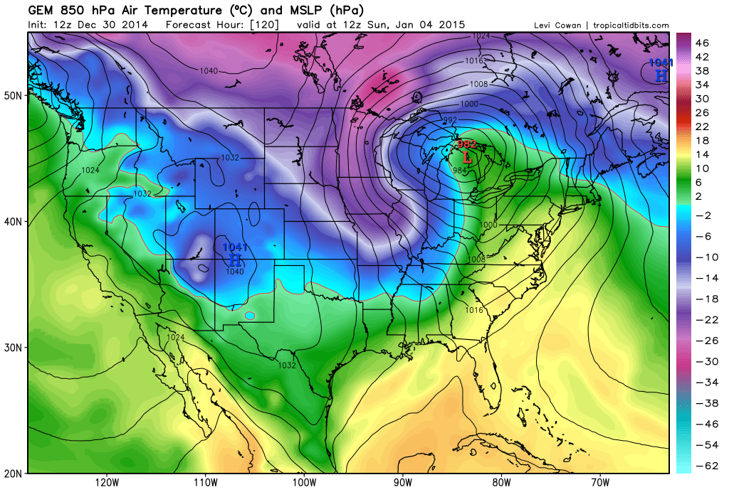
Next is the 12Z Canadian GEM which shows the warmest solution of all guidance. The low tracks into the central Great Lakes placing New Jersey in an even warmer sector than the GFS does. You can see the opposite energy force in action with colder temperatures being pulled down the western side of the cyclone. All in all not that much different—rain but warmer.
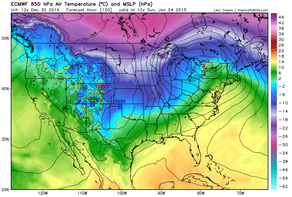
Last but not least is the 12Z European ECMWF which is closer to the GFS than Canadian. Regardless, it’s a Great Lakes cutter that possibly starts as wintry precipitation that quickly goes over to rain.
In English: Model guidance is pretty unanimous in a low pressure disturbance that could possibly start as snow, sleet, and/or freezing rain before changing over to all rain. The precipitation could start Saturday evening and should clear out by Monday morning. That window could narrow/shift a bit as we approach but for the most part, it’s starting to lock in. Let’s see where we’re at 24 hours from now despite drastic changes not expected. Be safe! JC
Model images courtesy of Tropical Tidbits.

Jonathan Carr (JC) is the founder and sole operator of Weather NJ, New Jersey’s largest independent weather reporting agency. Since 2010, Jonathan has provided weather safety discussion and forecasting services for New Jersey and surrounding areas through the web and social media. Originally branded as Severe NJ Weather (before 2014), Weather NJ is proud to bring you accurate and responsible forecast discussion ahead of high-stakes weather scenarios that impact this great garden state of ours. All Weather. All New Jersey.™ Be safe! JC


LOCAL FORECAST | INTERACTIVE RADAR | LATEST NJ WEATHER ALERTS | WEDDING FORECAST| PRIVACY POLICY
© Copyright 2025 Weather NJ LLC. All Rights Reserved.
Some information that can be found on our website is provided by a private weather station and is not an officially recognized station for weather reporting. Though we always strive to achieve accurate reporting for our own use, it is important that you do NOT depend on the data provided here for any purpose.
