

May 28: More Thunderstorms Expected
New Jersey is in for another warm and humid day with thunderstorm potential. Yesterday’s thunderstorms were primarily held NW of the turnpike. Everyone to the SE was subject to fizzle due to southerly flow and cooler stable air mass associated with stubborn high pressure in the Atlantic Ocean. Winds will be slightly more W/SW today than S/SW so any storm lines that push east could push further than yesterday and even reach the coast.
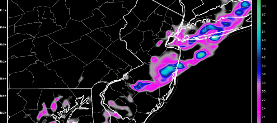
The fact that this week continues to be warm and stormy should be no surprise. With that said, I’ll slap on the classic “sunny and humid during the day + afternoon/evening showers and thunderstorms” possibility with only localized instances of severe criteria (wind gusts > 58mph and/or 1-inch or greater-sized hail). In general, everyone is subject to at least a few passing showers or average-strength thunderstorms and only in now-casting will we know where the strongest storms hit. Let’s look at the latest high-res NAM guidance, specifically simulated precipitation intensity:
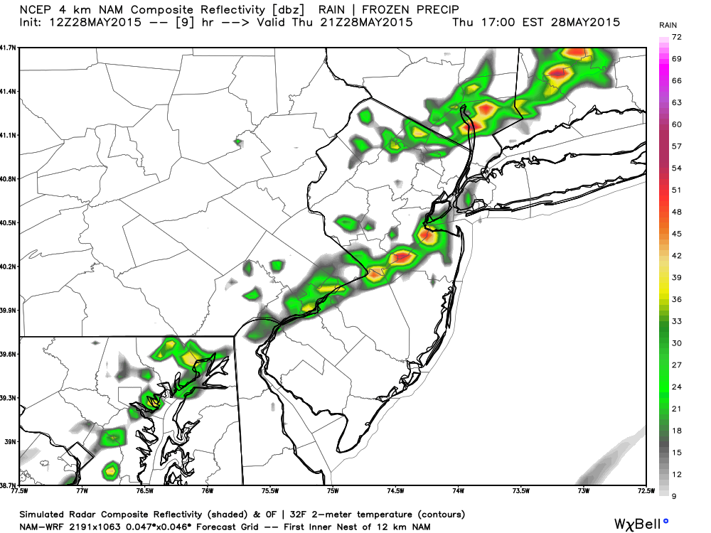
Between 4pm-5pm:
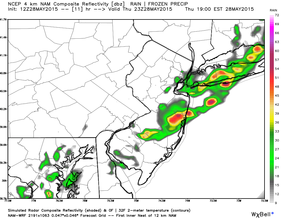
Between 6PM-7PM:
Between 8PM-9PM:
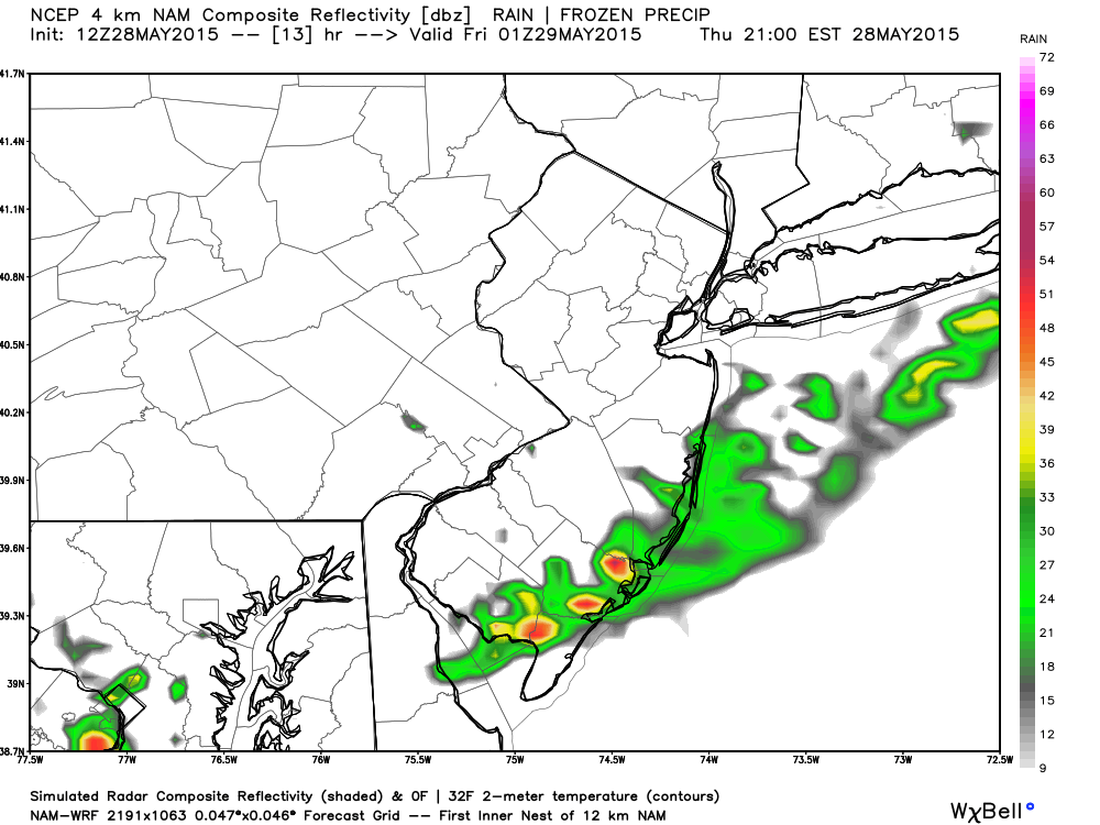
In English: Today will be warm and humid inland again with the coast a bit cooler. Stiff SW winds should persist. As you can see, showers and thunderstorms should generally start in NWNJ in the afternoon and push SE through evening hours—clearing the coast and Cape May by 10PM. Nothing crazy is expected, just run-of-the-mill warm weather storms in New Jersey. As per usual, these storms will likely weaken as they near the coast but it DOES seem like at least something will make it this time. I’ll be watching. Be safe! JC
Model images used with permission from WeatherBell Analytics.
Jonathan Carr (JC) is the founder and sole operator of Weather NJ, New Jersey’s largest independent weather reporting agency. Since 2010, Jonathan has provided weather safety and forecasting services for New Jersey and immediate surrounding areas through the web, social media, and app spaces. Originally branded as Severe NJ Weather (before 2014), Weather NJ is proud to bring you accurate and responsible discussions ahead of high-stakes weather scenarios that impact the garden state. All Weather. All New Jersey.™


LOCAL FORECAST | INTERACTIVE RADAR | LATEST NJ WEATHER ALERTS | WEDDING FORECAST| PRIVACY POLICY
© Copyright 2024 Weather NJ LLC. All Rights Reserved.
Some information that can be found on our website is provided by a private weather station and is not an officially recognized station for weather reporting. Though we always strive to achieve accurate reporting for our own use, it is important that you do NOT depend on the data provided here for any purpose.
