

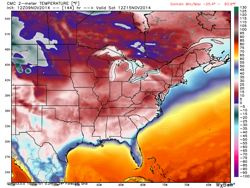
Nov 9: Dual Arctic Outbreaks Detected!
After well below-average temperatures flood the region later this week, another (even colder) arctic air mass is modeled to move in after the weekend. These arctic outbreaks are the direct result of the massive storm that just affected the Bearing Sea. Pressure sunk to 924mb in the center of this storm breaking the all time record for the Bearing Sea. This storm is in the process of spinning up into the polar regions and will result in arctic air spilling southward over the central and eastern US. This model image represents surface level temperatures in degrees Fahrenheit early this coming Saturday morning. This is the Canadian shown with the Euro in close agreement:
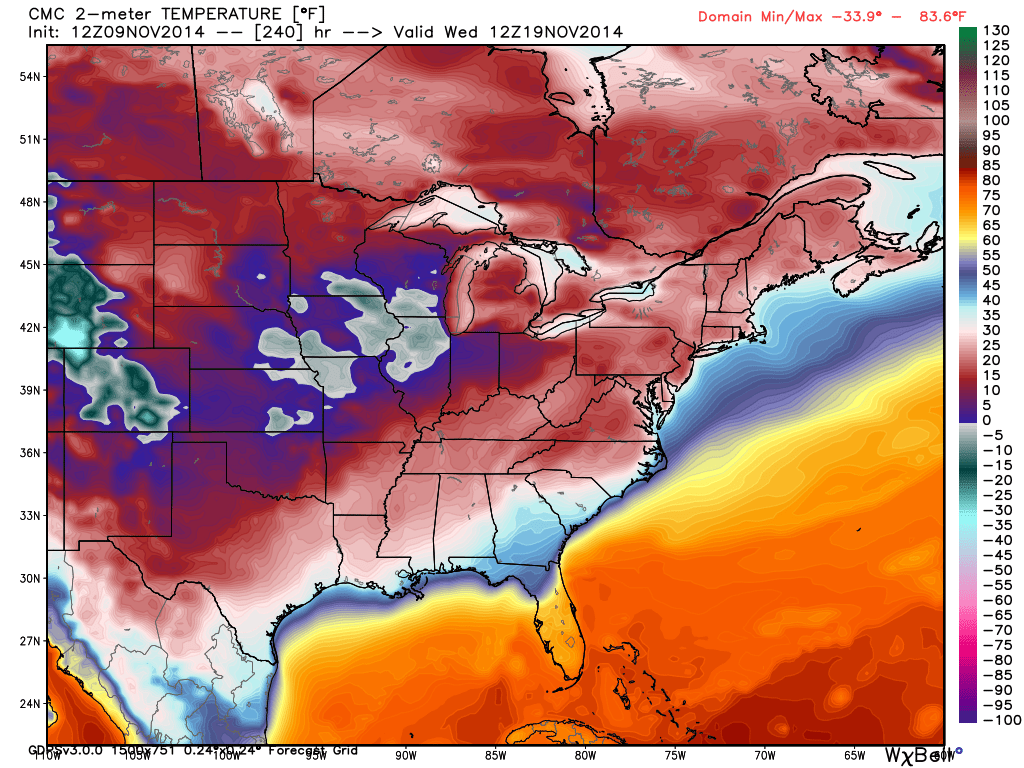
After that, temperature moderate slightly as a potential low pressure system swings through in the November ~16-17 period. Whether it be from lake affect or a coastal graze, we could very well see our first snow in that period. I’ll be monitoring that closely. Then by mid-week, even colder surface level temperatures are expected. This is the same Canadian model as above showing surface level temperatures for next Wednesday morning. Again, the Euro is in high agreement. Notice the single digit values entering the Ohio Valley and below-freezing temperatures in the northern Central US:
Before the cold shows up later this week, temperatures should feel average to slightly above-average to start the week. It might not be until ~Thursday-Friday before the cold frontal boundary moves through. The first wave will like result in statewide highs in the low-to-mid 40s followed by overnight lows in the 20s. The second wave next week…highs in the 30s followed by lows in the upper teens/lower 20s.
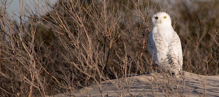
Snowy Owl image taken by Steven Moore in Holgate, NJ (S. Long Beach Island). Even though the most likely reason for snowy owl presence in New Jersey is prey related, they have been natural forecasters of approaching arctic frontal boundaries in recent years. With such cold air on the way, please make sure you’re prepared to dress accordingly. Be safe! JC
Jonathan Carr (JC) is the founder and sole operator of Weather NJ, New Jersey’s largest independent weather reporting agency. Since 2010, Jonathan has provided weather safety and forecasting services for New Jersey and immediate surrounding areas through the web, social media, and app spaces. Originally branded as Severe NJ Weather (before 2014), Weather NJ is proud to bring you accurate and responsible discussions ahead of high-stakes weather scenarios that impact the garden state. All Weather. All New Jersey.™


LOCAL FORECAST | INTERACTIVE RADAR | LATEST NJ WEATHER ALERTS | WEDDING FORECAST| PRIVACY POLICY
© Copyright 2024 Weather NJ LLC. All Rights Reserved.
Some information that can be found on our website is provided by a private weather station and is not an officially recognized station for weather reporting. Though we always strive to achieve accurate reporting for our own use, it is important that you do NOT depend on the data provided here for any purpose.
